With Cristobal likely headed east, Houston to feel the heat

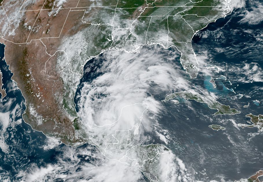
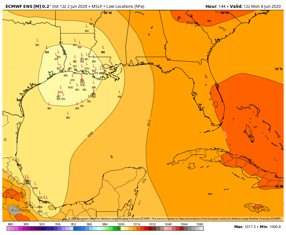
Good morning. We’re approaching the longest day of the year—June 20—but we’ve already reached the earliest sunrise of the calendar year for Houston. From June 3 to June 17, sunrise will occur at 6:20 am CT before it starts to get later. Our sunsets will continue to get later until July 2. (Why is this? Well, it’s a bit complicated). Weather-wise, we’re looking at a lot of sunshine in the week ahead as long as Tropical Storm Cristobal stays east of Houston, which is looking increasingly likely.

100-degree temperatures are coming to West Texas today. They may reach East Texas next week. (Pivotal Weather)

Thursday

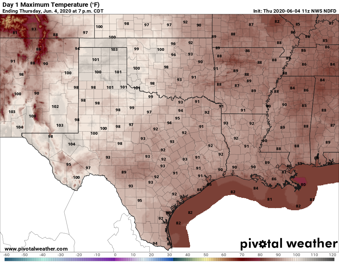
We should see partly sunny skies today, which will allow high temperatures to nudge up to 90 degrees or slightly above. Some showers and thunderstorms will be possible today, but they’re not going to be as organized as we saw on Wednesday. Some models are hinting at the best chance of rain between Houston and Beaumont, but even then it’s a really scattered shot at showers. Most of us will just be dry and hot, with light winds out of the southeast.

Friday

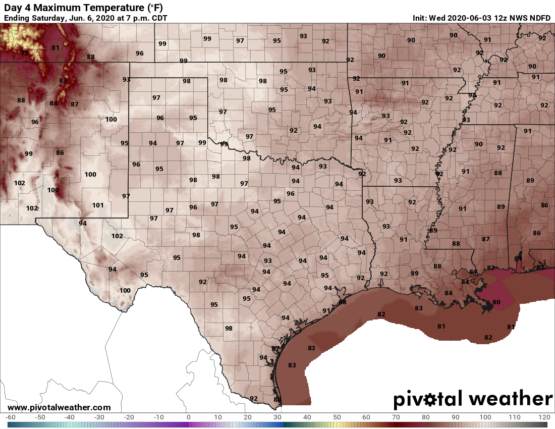
Expect a similar day to Thursday, although perhaps a touch warmer. We expect to see high pressure building in from the west—the same high pressure that will probably help steer Cristobal east of the region—and this will set the region on a warming trend into the weekend and likely beyond.

See full post

Showers possible today, Houston heating up, and a Cristobal update

Good morning. Houston is seeing warm and humid conditions this week, as one would expect in June. However, we still have a ways to go in terms of summertime heat, and the region should reach the mid-90s by Saturday. The question remains about what happens after that, and it almost entirely depends on what happens with Tropical Storm Cristobal. At the moment, it still appears as though the storm and the bulk of its effects will probably stay east of Houston, but we’re far from being able to make a definitive call on that.

Wednesday

Today should produce the region’s best chance of showers and thunderstorms until at least Sunday. A combination of daytime heating, ample moisture in the atmosphere, and only moderate high pressure should allow for some storms to fire up this afternoon before fading this evening. High resolution models offer a mixed bag of solutions, bit given our recent pattern I’m fairly bullish on at least some moderately strong storms firing up closer to the coast and pushing inland later today. Areal coverage of these storms will probably be in the 30 to 50 percent range, so not everyone is going to get wet. Otherwise, expect partly sunny skies with highs of about 90 degrees.

Expect high temperatures to push into the mid-90s by Saturday. (Pivotal Weather)

Thursday, Friday, and Saturday

As high pressure settles into the area we should see a warming trend, with partly to mostly sunny skies through Saturday, and highs rising into the mid-90s. Under such a pattern we normally would expect only slight afternoon rain chances along the sea breeze.

See full post

Cristobal forms in the Gulf—models trending toward Louisiana

Tropical Storm Cristobal formed earlier today, but Matt and I wanted to wait until after the 12z model runs came in before posting an update. Now that these forecasts are in (I promise I’m only going to do this once, but I can’t help myself) we’re going to look into our …

C R I S T O B A L   C R Y S T A L    B A L L

(If you hate that pun please direct your ire to a former colleague of mine). On to the forecast!

Tropical Storm Cristobal as it formed Tuesday. (NOAA)

Anyway, the big picture story with Cristobal remains the same: It’s going to wobble around the Southern Gulf of Mexico for the next three or four days. In the process, it is going to drench parts of Mexico and Central America already hard hit by Tropical Storm Amanda’s crossing of the area this past weekend. And then some kind of system—still hard to say what, because we don’t know how much the center of Cristobal will interact with the Mexican coast—is going to get pulled north by Friday or Saturday.

The trend today has been a continued shift in the models bringing the center of Cristobal not into Texas, but Louisiana. This is evident in all of the major global models, including the European and GFS ensembles. Overall confidence is still very low, given that we’re not quite sure what sort of system is going to eject out of the Southern Gulf of Mexico later this week. But the models seem to be finding a more pronounced weakness in the high pressure over the southern United States allowing Cristobal to take a more northern path. Things could easily shift back toward Texas, but we wanted to confirm that that model this trend is legitimate in both operational and ensemble forecasts.

European model ensemble forecast for Cristobal’s center of circulation on Monday morning. (Weather Bell)

The global models seem to be less bullish on hurricane development as well, as a lot of the ensembles are now predicting a tropical storm, or a loosely organized storm moving toward the Gulf coast. Again lots of uncertainty here. But in this kind of scenario we would expect most of the rain and winds to be on the “wet” or right side of the storm. Effectively, this means that if Cristobal were to make landfall at the border between Texas and Louisiana, Houston may not see much of an impact.

The bottom line is that many different scenarios are still in play, but for Texas the trends are good. We all need to keep watching, however, and especially closely if you live in Louisiana or points immediately east of there.

Depression nearly stationary in Southern Gulf, watching for late-week impacts

Good morning. The Houston region is looking ahead to a warm, mostly sunny week with scattered afternoon showers. Our forecast takes a sharp turn in uncertainty toward the weekend when a tropical depression in the Central Gulf of Mexico likely begins to move toward Texas or Louisiana. We’ll discuss that extensively below.

Also, I’d like to remind readers that to receive timely updates to this site you can subscribe for email updates using the “Subscribe via e-mail” form on the right-hand-side of this page, or follow us on Facebook, Twitter, and Instagram.

Tuesday

Any clouds this morning should clear out later today, leading to mostly sunny skies with light winds. As high pressure builds over the area we may see the atmosphere squeeze out a few isolated showers this afternoon, but we expect they will be brief, with most people staying dry. If you are heading to the march to support George Floyd’s family this afternoon, the biggest weather consideration will be heat. With mostly sunny skies, temperatures will reach about 90 degrees. Lows tonight will be in the low 70s.

High temperature forecast for Tuesday. (Pivotal Weather)

Wednesday

Expect similar conditions on Wednesday, with the possibility of scattered showers, partly to mostly sunny skies, and highs of around 90 degrees.

Thursday through Saturday

The second half of the week will see warmer weather as high pressure continues to build over the area. We are likely to see high temperatures in the low- to mid-90s, with mostly sunny skies, and only slight rain chances during the afternoon hours. Nights will be warm and muggy, in the 70s.

See full post