As Laura pulls away, we may see some fleeing showers later today and Friday

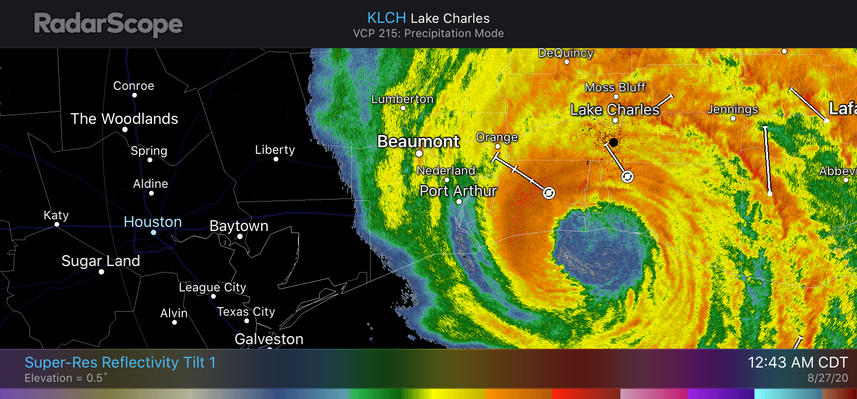
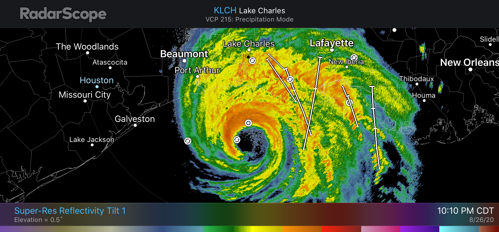
Well, it’s over for the coast. After making landfall early Thursday morning at Cameron, Louisiana, Hurricane Laura has continued to move northward at a fast clip, about 15 mph. At 7 am CT the center was located near Fort Polk, Louisiana, with maximum sustained winds of 100 mph. Sometime later today or this evening Matt will be along to provide a roundup of its many, many damages. Some of the first-light images this morning show about what you would expect.

Now, for a change, we’ll actually do a forecast for Houston rather than focusing exclusively on the tropics. If you’re new to the site, most of the time, we provide a once-a-day forecast on weekday mornings. (Because, hey, sometimes there’s only so much you can write about Houston’s weather when it’s hot, sunny, and humid). As ever, if inclement weather threatens, we’re here 24/7. Since that is no longer the case, we’ll return to our regular programming.

Thursday

As Laura pulls away from the Gulf coast Houston is seeing a dry, northwesterly flow. This has made dewpoints a few degrees lower this morning across the region, at the surface. We’re going to see some clouds today, but despite this, thanks to the drier flow, it’s still going to get plenty hot. Look for low to mid-90s near the coast, and upper 90s inland. For coastal areas, after astronomical high tides occur this morning, we expect any residual high water to recede. Rain chances will remain near zero until late this afternoon or the overnight hours, but even then will remain quite low.

Friday

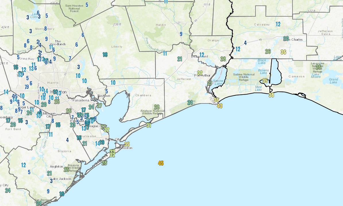
This day offers the best chance of rain, as Laura pulls away and the onshore flow resumes. The following map of precipitable water shows the center of Laura on Friday shortly afternoon, and the trailing remnants of moisture that may produce some showers and thunderstorms over Houston. I’d rate rain chances at 40 to 50 percent, better to the east than west, and accumulations don’t look overly impressive.

Precipitable water forecast for 1pm CT Friday. (Weather Bell)

Skies will be partly to mostly sunny, on Friday but the increased moisture should help limit temperatures into the mid-90s.

Saturday and Sunday

Our weekend forecast calls for mostly sunny skies, with highs in the mid-90s. We think there will be enough residual moisture along the coast to generate at least some scattered showers. But I don’t think we’re going to get the kinds of widespread showers the region sort of needs after a mostly quite dry August. (In this sense, while Laura’s more eastward track saved Houston from any significant winds, it also kept a decent shot of rainfall away). In any case, most outdoor activities should be fine, just have a plan to deal with a passing shower.

Next week and beyond

The first week of September looks fairly hot and sunny—standard fare for this part of the year. As for rain, there will be some, but probably not much. Some of the models are starting to flirt with a cool front reaching Houston by around September 10, but there are so many “mirage” fronts at this time of year I’m not buying it for now.

Tropics

Beyond Laura we’re seeing the potential for more activity, but there are no imminent threats to the Gulf or Caribbean so let’s just all breathe a sigh of relief. We’ve got another four or five weeks to get through and then we’re really into fall.

Laura roars like a lion into Louisiana, but acts as a lamb in Houston

POSTED AT 1 AM CT THURSDAY: At midnight, central time, the northern eyewall of Hurricane Laura came ashore over Cameron Parish, Louisiana. This is about 35 miles east of the state’s border with Texas, and a bit further east than forecasters anticipated. This places the storm’s core of strongest winds solidly over the western half of Louisiana, and should spare much of the Beaumont region from the very worst of Laura. Meanwhile, a devastating storm surge is moving into southern Louisiana and has inundated some locations for dozens of miles inland.

Laura had 150 mph winds at landfall, the hurricane center reported. This makes it a high-end Category 4 hurricane, tying the storm for the fifth most powerful continental U.S. landfalling hurricane since 1900.

The worst of the storm’s winds are only now moving onshore and the hurricane center justifiably urged those who have not evacuated from Southwestern Louisiana to, “Treat these imminent extreme winds as if a tornado was approaching and move immediately to the safe room in your shelter. Take action now to protect your life!”

Local effects

A landfall in Cameron places the storm’s center more than 130 miles from Houston, and because this is further than anticipated we are seeing very limited impacts here in the metro area. There is some moderate surge along the coast and in Galveston Bay, and a few areas have recorded wind gusts near 40 mph. As a result of these lower-than-expected winds, Houston has so far experienced no power outages tonight—a welcome change from our earlier expectations. We do not anticipate winds increasing significantly overnight. Rain chances are quite low as well. This is it, folks.

Laura’s rains only extend about as far west as Winnie tonight, and they’re unlikely to get closer. (RadarScope)

Houston will probably be mostly cloudy, and quite warm on Thursday with a drier flow from the north on Laura’s backside. Rain chances may increase on Friday as the tail of Laura brings some moisture into the area before lifting entirely away. We’ll have a complete forecast for Houston in the morning—whenever I wake up.

Some late night thoughts about Laura, and hurricanes in general

I have come to the conclusion that hurricanes are fascinating and horrible. But mostly, horrible.

Three years ago, at this very hour, those first, tremendous rain bands from Hurricane Harvey were pushing through Houston. It was a Saturday night. The storm had come ashore the day before, and Houston had seen a few bouts of heavy rainfall on Friday night. Most of the day Saturday was reasonably sedate. And then, BOOM. Ten inches of rain on the west side and then the first band moves over to the east side of Houston. And then it. Just. Stopped. Twelve inches of rain in two hours at one gauge near my home. Like for many of you, that was the longest and worst night of my life. Rising waters. Flooded homes. No idea if it would ever end.

Radar image of Tropical Storm Harvey at 9pm CT August 26, 2017. (Space City Weather/Intellicast)

And now tonight we are watching another devastating hurricane, Laura. This one is a completely different animal from Harvey. Though inland flooding from rainfall is not a concern this is a monstrously intense storm, stronger than anything ever recorded in that part of the Gulf of Mexico, pushing a wall of water toward Louisiana and lashing the state with 150-mph winds. I have never experienced that. I never want to. You run from that hell. And you run fast.

I feel immense relief tonight that Laura is not barreling down on the west end of Galveston Island, bringing 130- or even 140-mph wind gusts across broad swaths of the Houston community and leaving a path of devastation. At the same time, I have something akin to survivor’s guilt knowing that I will sleep comfortably in my bed late tonight. I’ll hear some wind. Maybe some rain. But these will only be distant echoes of the horrors unfolding a couple of hundred miles away, on the beastly right side of Laura. So many will lose so much tonight. Some will pay the ultimate price. Others will see their lives and livelihoods destroyed. So hurricanes are horrible.

Houston came pretty close to feeling Laura’s wrath. Many people closely watched the radar today, anxious to see whether Laura would in fact turn fully to the northwest, and then the north, as forecast. This gives you some insight the difficulty in forecasting a storm like Laura. As recently as Monday morning—less than three days ago—Laura was still a tropical storm more than 1,500 miles from Houston. The trick was figuring out when that turn to the northwest would occur, and getting it right to within dozens of miles. Because if Laura had waited a few more hours to turn, we all have an idea of what might have happened here.

Hurricane Laura is about 50 miles south of Cameron, Louisiana, at 10:10 pm CT. (RadarScope)

Hopefully this will inspire a younger generation to become interested in meteorology. The reason I got into weather science is because, quite selfishly, I wanted to know what was going to happen. I got caught unawares by Tropical Storm Allison way back in 2001, surrounded by rising waters beneath sheets of torrential rainfall. Never again, I vowed. But forecasting is hard work. Especially as Matt and I have, improbably, found ourselves with a voice in the community. A lot of people, and my goodness there are a lot of you kind souls, in this area now look to us for guidance. That’s a lot of pressure not to screw up. We do sometimes, but we try our damnedest not to, all day and pretty late into the night. But we want to make sure you’re never caught unawares, either. Anyway, it’s now been 11 days since we first started talking about the systems that would become Marco and Laura. It is good to be finally seeing them head toward the exits. We’re exhausted—mentally and emotionally.

We’ll be back with one more post tonight to wrap up conditions for the greater Houston area (they’re not going to be serious at all), and assess some of the preliminary effects of Laura on Louisiana and southeast Texas. That probably will be posted around 2 am CT.

Laura on the precipice of category 5 intensity as it approaches the Louisiana coast

POSTED AT 8:20 PM CT WEDNESDAY: Hurricane Laura has made its turn to the north in earnest late this afternoon and evening, and is likely heading for landfall on the Louisiana coast, possibly near Calcasieu Pass, south of Lake Charles.

Hurricane Laura is approaching the Louisiana coast this evening, about 95 miles south of Lake Charles and southeast of Port Arthur. (Weathernerds.org)

Wherever it makes landfall doesn’t mean much now short of who sees the absolute worst of the strongest hurricane ever recorded in this part of the Gulf of Mexico.

It’s going to be a hellish night for folks in extreme southeast Texas and southwest Louisiana. Nothing seems to be slowing Laura down, which is par for the course for a storm that somehow dodged nearly every conceivable hurdle imaginable in the Caribbean and brought us to this point. While Laura is still expected to come ashore “past peak,” it will still likely be the worst hurricane on record for this particular portion of the Louisiana coast. Conditions will now begin to rapidly deteriorate in far southeast Texas and Louisiana, progressing up to landfall around midnight. There’s really not much else to say at this point except godspeed to folks in the path.

Houston area

See our earlier afternoon post for a breakdown of what we expect in the Houston area and elsewhere. Most of these impacts are unchanged and may even be forecast too high.

Wind gusts as of 8 PM are not that bad in Houston. We may only see slightly stronger gusts overnight. (NOAA)

The highest wind gust as of 8 PM in the Houston area is about 25 mph at Hobby Airport. Galveston is gusting to around 30-35 mph. We do expect these gusts will increase a bit overnight, but with the storm now on a mostly north-northwest heading, we’ll see how far west the 30 to 40 mph gusts can make it.

There is surge still happening though, and the Bluewater Highway in Brazoria County is now closed from Surfside to San Luis Pass because of water and debris.

Surge levels look to be about 3 to 4 feet so far at San Luis Pass up through Galveston.

There are not many showers around Houston at the moment, and we will likely have a quiet evening. Rain could commence at times overnight, and it will likely fall east of I-45 and along the coast as Laura lifts inland. Our best chance of heavier rain in Houston may come in Laura’s “tail” wake on Friday. We’ll update you more on that tomorrow.

Eric will have our next post no later than 11 PM CT tonight.