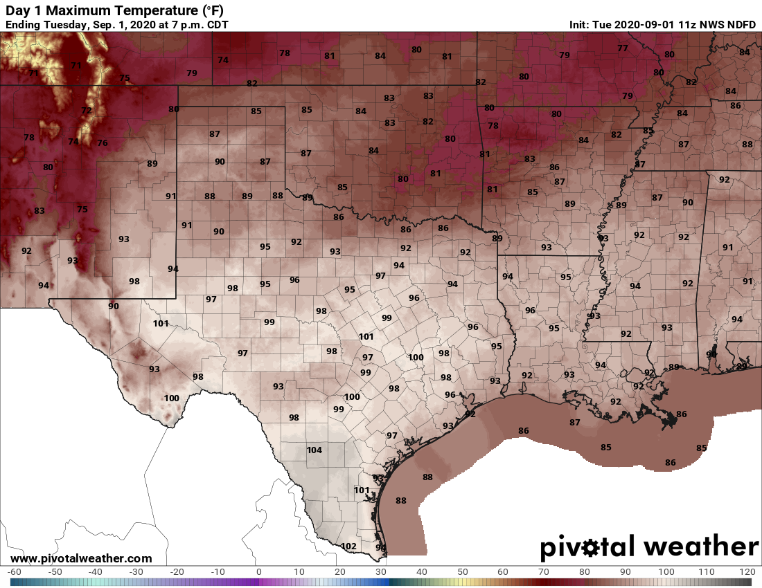
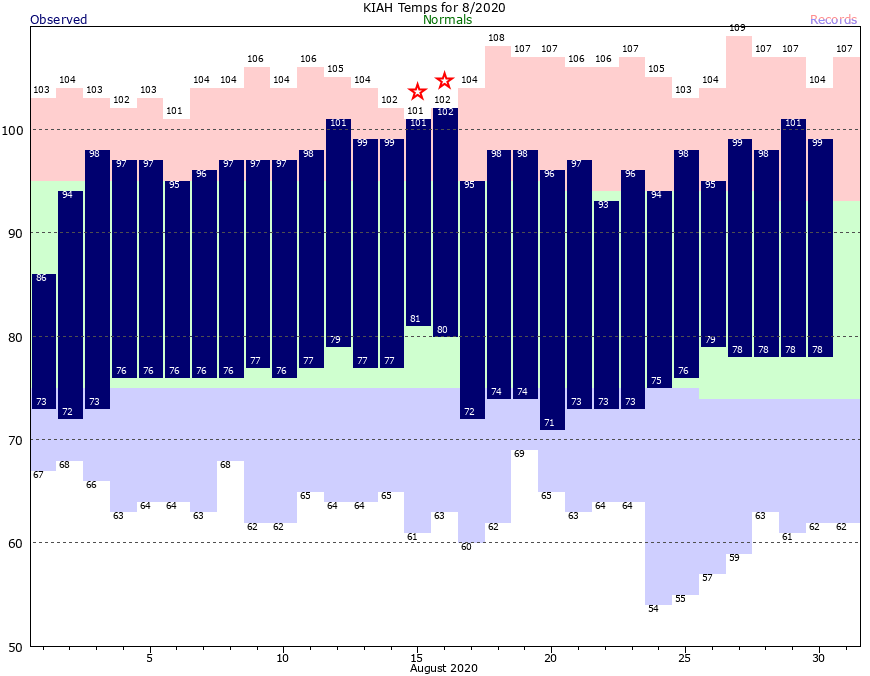
Good morning. The main story of our weather continues to be heat—Houston’s high temperatures for most of the last week have reached 99 degrees or above—but after today our hottest weather and extreme heat indices should be in the rear view mirror. We expect to see a few more clouds today, and then better rain chances starting tomorrow should help to temper our peak daytime heating just a bit.
Wednesday
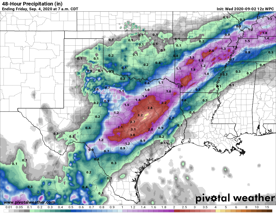
A large complex of storms that has produced several inches of rainfall over North Texas should continue to sag southward this morning. But most likely these storms will stall out to the northwest of our area—the rains will probably reach a line from Sealy to Conroe before dying out. Areas northwest and along this line may see some additional on and off rainfall through this evening. Otherwise it should be a partly to mostly sunny day for most of the metro area, with high temperatures in the mid- to upper-90s. Winds will again blow from the south, gusting perhaps to 20 mph due to a tight pressure gradient.
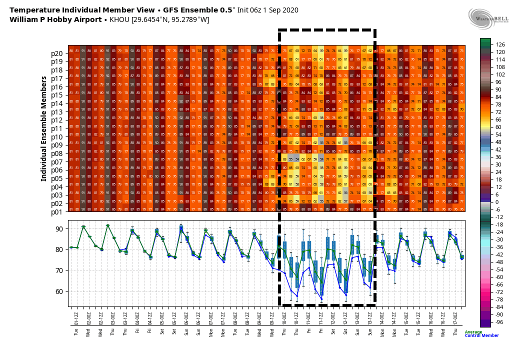
Thursday
As more moisture moves into the atmosphere we’re likely to see more clouds on Thursday, and this should help to moderate temperatures slightly. At least some scattered showers will be possible as highs get into the low- to mid-90s. Nighttime lows will remain sticky, in the upper 70s.
Friday
A bit more of a disturbed atmosphere on Friday, in conjunction with ample moisture in the atmosphere, should lead to more widespread showers on Friday. Accumulations will likely vary widely across the region. Highs will depend upon the extent of rainfall at your location.
Saturday, Sunday, and Labor Day
The weekend weather looks fairly standard for this time of year, with partly to mostly sunny skies and highs in the low- to mid-90s most likely. We’ll have some decent rain chances—perhaps 30 percent?–each day along the sea breeze.
Next week
We’re still watching the potential for a fairly robust cool front to arrive in Houston later on Tuesday or Wednesday of next week. If it makes it, this front will provide a nice shot of drier and cooler air, but it remains too close to call or guarantee a week out.
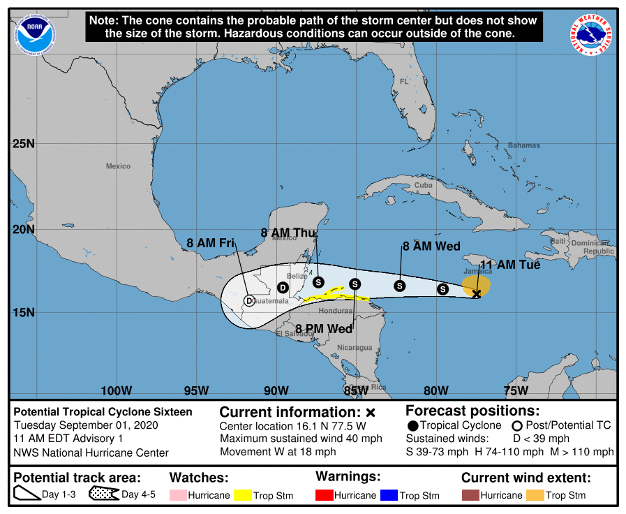
Laura wrap-up
As some of you may know, for my day job I write for a publication called Ars Technica. On Tuesday, we published a feature on Hurricane Laura, and the very close call on whether the region enacted a more widespread evacuation. And it was very close.