Earlier this summer, I wrote one of our first ‘weather why’ pieces on the heat index. Now that Eric has written the obituary for Summer 2016 (RIP), we can discuss the heat index’s winter cousin—the wind chill. Since regional wind chill temperatures could fall into the upper teens tonight, it’s important to understand how wind chill works.
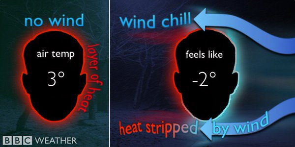
What is wind chill?
Wind chill describes how cold the air feels against your skin, not the actual air temperature. Our bodies radiate heat out at all times, which is why we wear layers to trap our body heat in the cold. Without any layers to trap that heat, it radiates into the surrounding air. However, if the air is calm, that heat will hang out near your body, creating a thin, warm insulating layer near your skin.
October ended as an usually hot and dry month. Eric covered this a bit yesterday, but weather data from Houston’s Bush Intercontinental Airport shows that 25 out of 31 days were warmer than average, with a measly 0.14 inches of rain recorded for the month. By the end of October, the heat and lack of rainfall produced drought conditions in the eastern third of Texas.
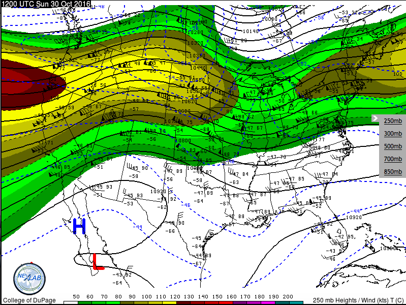
The jet stream
Figuring out why our weather has been so warm starts with analyzing the jet stream. The image below is an upper-air map, showing the state of the atmosphere at 250mb (about 30,000 feet above the ground, or a just above the peak of Mount Everest).
250 mb map showing the location of the jet stream on 30 October, 2016 (courtesy of The College of Dupage)
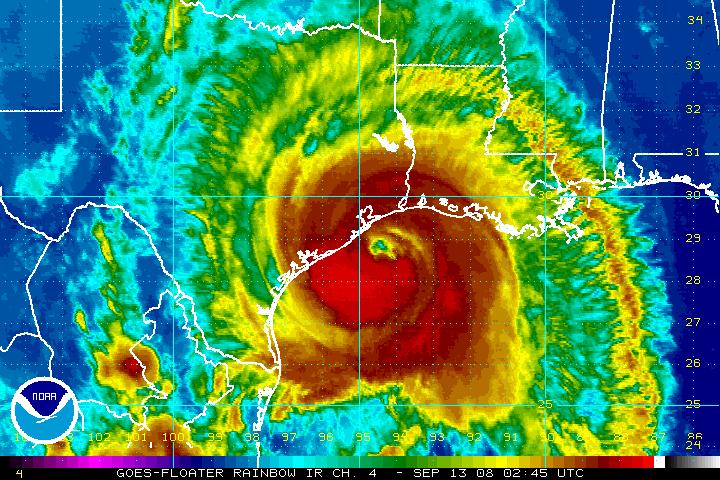
With talk of invests, depressions, tropical storms, and hurricanes (oh my!), readers have asked about some of the science and processes involved with hurricanes. One question we received this week asked us to look at a hurricane’s structure, and where the worst weather occurs.
Infrared satellite imagery of Hurricane Ike before landfall, September 2008 (courtesy NOAA)
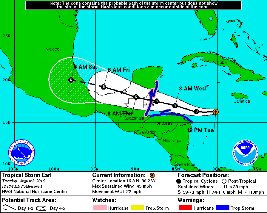
It’s been nearly eight years since the last significant tropical system (Ike) impacted the greater Houston region. So understandably, when NOAA’s National Hurricane Center began tracking the tropical wave that became Hurricane Earl, the region became a little jumpy. Was it, after a record-breaking “hurricane drought” in the Gulf of Mexico, our turn again?
In the end, Earl came nowhere near Houston, instead making landfall as a Category 1 hurricane in Belize. Nevertheless we thought it worth discussing the factors that control the path a hurricane takes, so that the next time a system threatens the Gulf of Mexico we’ll all have a little more knowledge, and perhaps be less susceptible to any hype.
First advisory issued for Tropical Storm Earl on August 2nd, 2016 (Courtesy NWS)
The graphic above is a version of the one we’re all familiar with—it shows the location of then Tropical Storm Earl at the time of the advisory, its projected track and intensity, the forecast cone, and any watches or warnings. Arguably, the most important information in this graphic is the track of the storm, because it (obviously) tells us where the storm is headed, and who will be potentially impacted.
What controls where a hurricane goes?
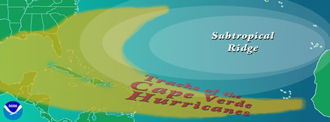
There are two main forces that control where a hurricane goes—the environment, and something called “beta drift”. The environment around a hurricane is the main force behind the direction the storm goes, “steering” it in one direction or another. The primary environmental steering for storms that form in the deep Atlantic tropics—these are the systems that move off Africa and spin into tropical lows—consists of the east-to-west moving trade winds, which drive storms across the Atlantic and toward the Caribbean and the Gulf of Mexico.
Diagram showing typical tracks of North Atlantic hurricanes (courtesy NOAA)