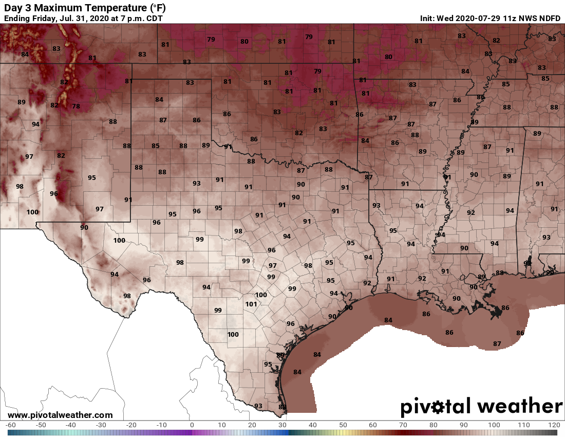
Good morning. After several wetter days for the region, rain chances will slacken some to end the work week before returning again Friday night. As we head into August this weekend, high temperatures will likely remain mostly in the low 90s, which is fairly “pleasant” for what is typically the hottest time of the year in Houston.
Thursday
Some drier air is mixing into the atmosphere this morning, and this should help to limit shower and thunderstorm activity later today across the region. Rain chances are likely around 20 percent for most locations. Skies should become partly to mostly sunny this afternoon, and this will allow highs to warm into the low or mid-90s for the region. Winds, generally, will be light, coming from the south. Skies should turn partly to mostly cloudy tonight, leading to warm and humid conditions, with lows struggling to fall below 80 degrees for much of the region.
Friday
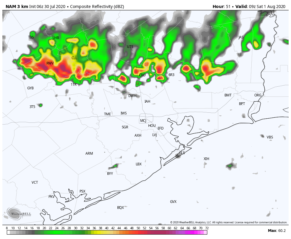
Conditions will be similar on Friday, with partly to mostly sunny skies leading to another warm day with highs in the low- to mid-90s. Later in the day a dying cool front will approach the region from the northwest. This may ultimately bring some drier air into the northern half of the metro area, but initially it may lead to some storms over areas north of Interstate 10—particularly Austin, Waller, Washington, Grimes, and Montgomery counties. Some models indicate a line of storms moving into these areas between midnight Friday and Saturday morning. We’ll continue to track this to see if it’s likely to come to fruition.