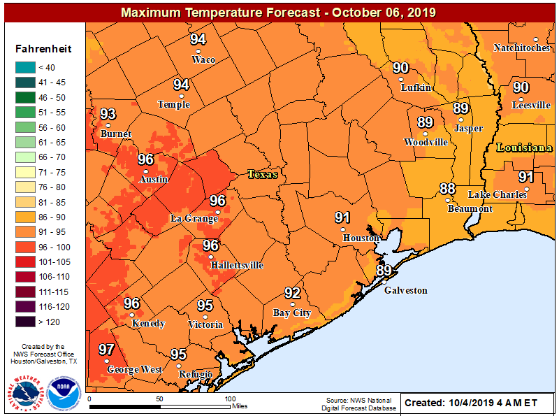
After a dreadful September that entailed a devastating tropical storm, 100-degree heat, and unending humidity, the season’s first fall front dragged into Houston on Monday. It’s not super strong, but after nearly five months of summer-like weather it will be strong enough. And with the promise of more cool fronts on the way, we are well and truly entering fall.
Monday
The first six days of October have produced an average temperature of 82.6 degrees, which is 7.7 degrees warmer than normal. Today’s high temperature may not even reach 82.6 degrees as a mix of drier and cooler air move into Houston. As the front blows in, winds could gust up as high as 20mph this afternoon.
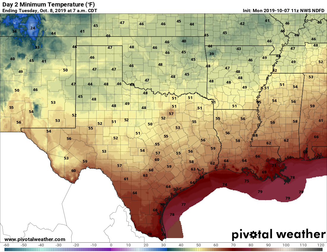
Tonight should be especially sublime as drier air at sunset will push low temperatures into the 60s this evening—a wonderful time for a walk or whatever outdoors. Low temperatures by Tuesday morning should drop into the upper-50s for inland areas, and low 60s for most of the rest of Houston. It’s all nice enough that we’re declaring today to be our annual Fall Day holiday.
Tuesday
This should be a great early fall day, with sunny skies, highs in the low- to mid-80s, and overnight lows a couple a degrees warmer than Monday night.
Wednesday and Thursday
Warmer conditions return to Houston as the onshore flow resumes. Highs will creep back into the upper 80s, and unfortunately nighttime temperatures are going back into the 70s. Skies should be mostly sunny.