Monday marked the first time in more than three weeks that the high temperature in Houston did not reach at least 90 degrees, but now we’ll put our brief flirtation with somewhat cooler behind us as high pressure begins to build over the area today. Perhaps the biggest question about the forecast from now through the end of the work week is whether highs in the days ahead will reach the mid- or upper-90s.
Also, be on the lookout later today for a tropical update from Matt. There is nothing imminent, but we want to keep readers apprised of what we’re thinking and seeing as we look ahead over the next week or two in the Atlantic Ocean, Caribbean Sea, and Gulf of Mexico. When we get into July, we probably will begin posting these on a weekly basis, and then probably more frequently during the peak periods of August and early September.
Tuesday
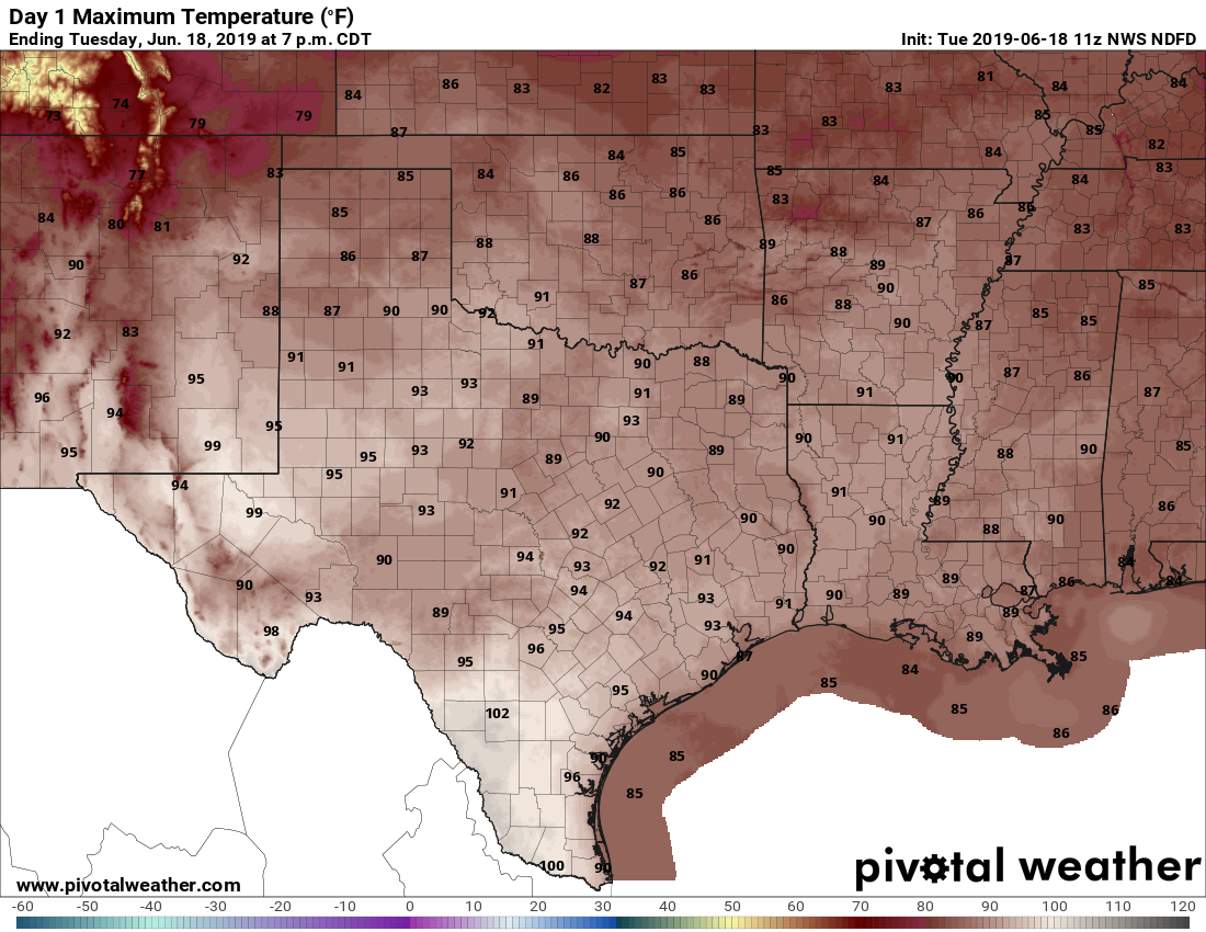
There isn’t much movement in the atmosphere today, which means that despite a fairly moist atmosphere any shower development should be scattered at best. High resolution models are indicating the best chances for rain may come down near Matagorda Bay, or to the northeast of the Houston metro area. In any case, for the most part we should see a mostly sunny day with highs in the low- to mid-90s.