This is the final day of our 2021 fundraiser, and it will be a fine one

Today marks the last day of our 2021 fundraiser, during which we are raising money to support the site next year, further app development, and more. You may either buy merchandise, donate, or both. The response this year has exceeded our expectations, and your support is humbling to both Matt and myself. We would like to offer sincere thank you to everyone, and we do mean everyone, who pitched in for this year’s fundraiser. We’re in great shape heading into 2022 and promise to be here every step of the way.

Weather-wise, the forecast calls for a slow warming trend this week after a chilly start. One noticeable change will be a transition to more sunny skies. Matt promised you lots of clouds this weekend, and very little sunshine was to be found. But now, the sunshine is back, and we’ll see a week of partly to mostly sunny days. Rain chances won’t return until toward the end of the week.

It is a cold morning across the entirety of Texas at sunrise on Monday. (Weather Bell)

Monday

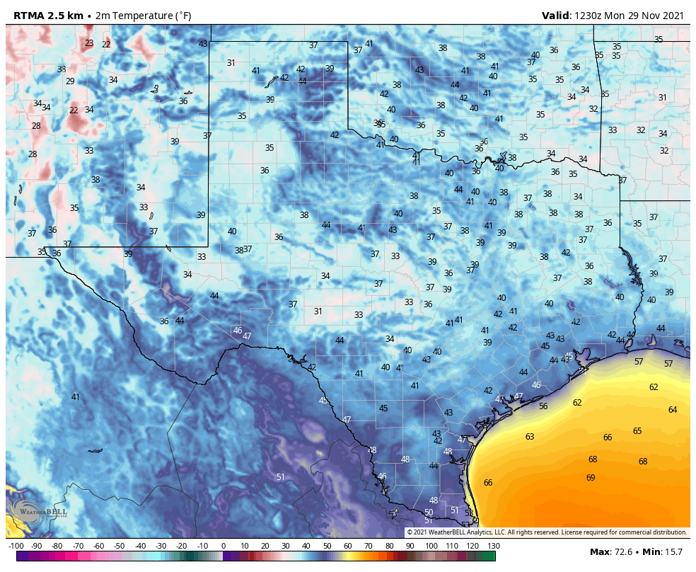
As temperatures drop into the 40s this morning near dewpoints, some patchy fog has developed in some areas. This will burn off quickly as the sun rises, and temperatures go up. Highs today will reach 70 degrees, with light northerly winds, beneath sunny skies. Lows tonight should once again drop into the 40s for all but coastal areas, with some patchy fog possible again.

Tuesday

This should be another fine fall day, with mostly sunny skies and highs in the low 70s. Winds will shift to come from the southeast on Tuesday, and this will kick off a slow warming trend that probably will last into the weekend. Overnight lows for most areas on Tuesday night should still drop into the 50s.

Wednesday and Thursday

These should be a pair of warmer days, with high temperatures in the mid- to upper-70s across the area and partly to mostly sunny skies. Dewpoints should remain about 60 degrees, so the air will neither feel dry nor overly humid. Overnight temperatures will continue to creep up, with lows on Friday morning probably not dropping below 60 degrees in Houston.

Friday, Saturday, and Sunday

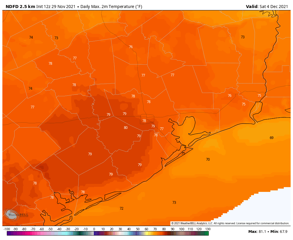
If you have plans for this weekend, I’m afraid you may have to wait a day or two before confidence increases in the forecast. I’m pretty sure that Friday will see a continued warming trend, with partly sunny skies and highs around 80 degrees. By Friday night, or so, with several days of an onshore flow, moisture levels will be high enough to support some kind of rain. But overall chances are probably fairly low.

Some parts of Houston could hit 80 degrees by Friday. (Weather Bell)

As for the weekend, some kind of mild front—originating from the Pacific Ocean, rather than Canada or to the north—will probably move through. My best guess in terms of timing is Saturday night, but that’s just a hunch. So at this point I’d say to expect some slight rain chances on Saturday and perhaps Sunday morning, with the airmass turning somewhat drier by the second half of the weekend. Highs, for the most part, should be in the 70s, with lows in the 50s. We’ll try to get some more clarity for you, soon.
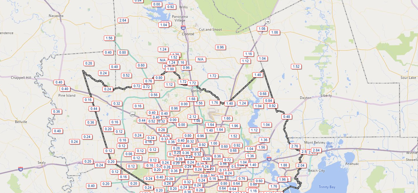
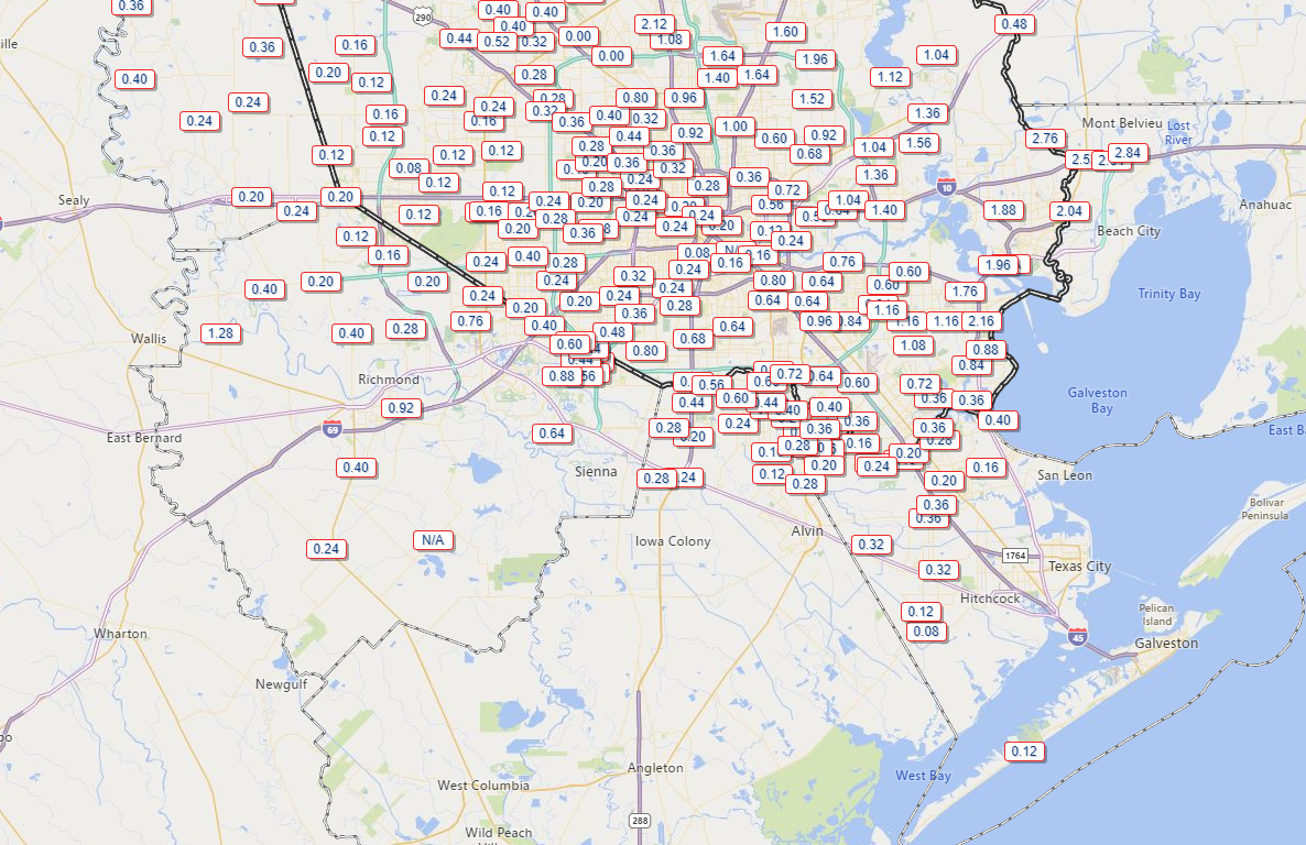
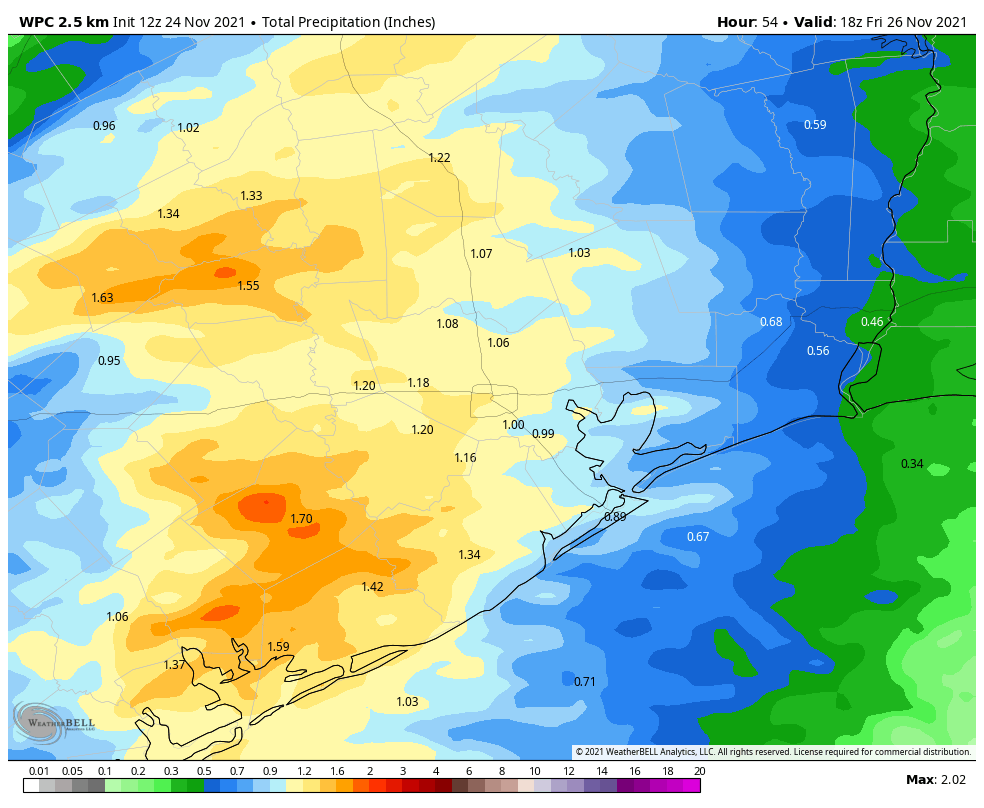
Thanksgiving review

This is pretty shameless, I admit. And a good general rule of thumb for forecasters is to never get too confident about this job, because the unpredictability of weather can be pretty darn humbling. But in our very first outlook for Thanksgiving, 10 days before the holiday, here’s what we wrote:

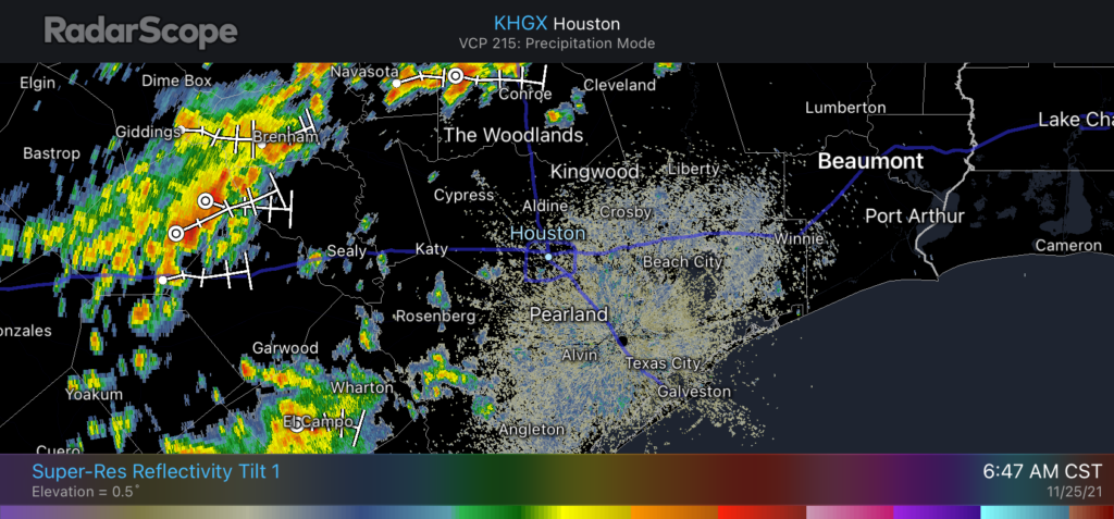
So my best guess is that Thanksgiving starts out fairly warm, but may cool down later with a wet frontal passage.

What goes around comes around, of course, so all this really means is that Space City Weather’s 10-day outlook for Christmas probably will be about as worthless as a lump of coal in your stocking.

Black Friday deals on clouds for Houston this weekend

Alright, this weekend won’t be that bad, but you will notice a lot of high clouds streaming across throughout the day today, rain developing tomorrow, and lingering clouds on Sunday.

First, some quick housekeeping. Our annual site fundraiser is in the final days! We are so incredibly grateful for everyone’s support. Thank you so much.

I hope everyone had a happy Thanksgiving. Yesterday’s rain was a bit weird in that it was widespread, but some areas saw quite a bit and others saw mostly minor amounts.

Rain totals across the region varied with some areas seeing little and others seeing quite a bit. (Harris County Flood Control)

Places like Mont Belvieu saw nearly 3 inches of rain. The Woodlands got 1 to 2 inches of rain. Sugar Land saw nearly an inch. Downtown Houston and most of western Harris County? About a quarter-inch. Same story for most of Galveston County and the Island. At least we salvaged the latter part of the day in most places.

Today

With all of Thanksgiving’s mess cleared out, we transition today to fair weather. Expect sun filtered through periods of high cloudiness today. Temperatures are starting the day in the 40s for most with a few pockets of 30s here and there.

It’s a chilly start to Black Friday across the area. (NOAA)

With the clouds around, we will likely stay in the 50s in most spots today for high temperatures.

Saturday

Clouds will thicken up some tonight. This should prevent temperatures from falling quite so far, and we should expect generally 40s to low-50s on Saturday morning. A disturbance will be approaching from the west through the morning and afternoon, and it will allow rain to begin to break out from west to east through the day. This will be a mostly light to moderate rain, though perhaps it will be briefly heavy at times south of I-10. Temperatures will warm until the rain starts, and then they’ll drop a few degrees. Look for mostly 50s, and areas west of Houston could fall back into the 40s by late afternoon. Rain will end from west to east on Saturday night.

NOAA’s rainfall forecast for tomorrow into Sunday is a bit aggressive, but totals up to an inch or so will be possible with the steadiest, heaviest rain. (Weather Bell)

Rain totals should be a quarter to three-quarters of an inch for most, with a few higher amounts possible.

Sunday

Look for clouds to linger, but the rain should be done. Some sun is possible, which would allow us to crack 60 degrees in many spots after beginning the day in the upper-40s to low-50s.

Next week

The week should start off lovely with sunshine on Monday, Tuesday, and Wednesday. Temperatures will add a few degrees each day, and we should see 70s by Wednesday. The late part of next week could even see temperatures approach 80 degrees depending on the timing of our next cold front. There are hints in the models today that we could briefly see some pretty chilly air next weekend with 30s for lows possible over a wide area. Not a major freeze or anything like that, but chilly! We’ll watch that next week to see how it evolves. Enjoy the weekend!

Storms incoming on Thanksgiving

Good morning, and let me wish you a very Happy Thanksgiving. We’re writing a short post this morning to update you on the incoming storms and resulting weather through the weekend.

Radar at 6:47 am CT shows storms approaching from the west. (RadarScope)

A cold front remains on track to cross the greater Houston region today, with associated storms having already passed through College Station and now approaching The Woodlands. These storms, which are moving from northwest to southeast, will push into the central part of Houston from 9 am to Noon, and should reach the coast just before or during the early afternoon. Most of the region should see 1 to 2 inches of rain, with some higher isolated totals. The heaviest rains will probably come south of Houston, in places such as Matagorda and southern Brazoria County.

After the front

Fortunately, we expect rains to clear out fairly quickly, with storms ending for areas on the inland side of Highway 59/Interstate 69 by around Noon or 1 pm, and coastal areas by mid- to late-afternoon. Northerly winds will follow, blowing out of the north at about 15 mph and gusting to 20 or 25 mph. For many locations, temperatures will have dropped into the 50s by sunset. Overnight lows will bottom out in the 40s in Houston’s urban areas, with some 30s possible further inland. Friday should be partly sunny and cool, with highs in the low 60s.

Forecast lows for Friday morning. (Weather Bell)

A mixed weekend

After another chilly night Saturday will be mostly cloudy, with temperatures maxing out at around 60 degrees. Rising air due to a low-pressure system will support the development of rain showers on Saturday, likely during the afternoon hours, and this probably will persist with an-and-off light to moderate rain through the overnight hours. Accumulations will be on the order of 1 inch or less for most areas, but it could put a damper on outdoor plans for Saturday and Saturday night.

Another front arrives early on Sunday, and this should end rain chances. This should also bring clearing skies on Sunday, allowing highs to get into the mid-60s. Sunday will be your better day for outdoor activities this weekend. Next week looks clear and cool before a warming trend heading into next weekend.

Enjoy the holiday, everyone!

Fundraiser

Only a few more days left as we sell merchandise and accept donations to support Space City Weather. For those who have already contributed, we’re so appreciative.

Ten things I’m thankful for on the eve of a stormy Thanksgiving

Before we get to the forecast for the remainder of this week, I want to offer a few words on some of the things I’m most thankful for as we head into the Thanksgiving holiday.

  • Matt Lanza: the best damn partner one could ever ask for to operate the site
  • That first fall cold front
  • My family, who (almost) always understand when I need to “post an update” to the site
  • Tacos, fajitas, and margaritas
  • September 24: The date after which we can breathe a little easier about hurricanes
  • Houston’s parks and trees
  • Astronauts, flight controllers, and the people who build spaceships
  • Rock and roll, jazz, and Steve Earle
  • Our long-time sponsor, Reliant
  • Most importantly: our readers, who always have a kind word and genuine appreciation for our efforts

Alright, let’s get to the forecast. We’re still looking at a warm Wednesday, followed by a messy Thanksgiving as a fairly strong front blows through the area. Read on for the details.

Conditions on Wednesday will be warm, and increasingly humid. (Weather Bell)

Wednesday

Temperatures are generally in the low 60s this morning, and we’re going to rise near 80 degrees this afternoon with a mix of sunshine and clouds. Winds will be noticeable, out of the south, gusting up to 20 mph. This southerly flow will be helping to amp up atmospheric moisture levels, and dewpoints will be on the rise this afternoon and tonight. Temperatures will not fall much below 70 degrees tonight, and some light showers will be possible after midnight, mainly to the west and north of Houston.

NAM model forecast for winds shows the front’s forecast position at 2pm CT on Thanksgiving. (Weather Bell)

Thursday

As we have been saying for awhile, a robust cold front will move through Houston on Thanksgiving. Rain chances will start to pick up after sunrise on Thursday, and peak with the passage of the front. While the conditions favor showers and thunderstorms, the ingredients do not appear to line up for severe weather, so the main threat should be briefly heavy rainfall. Rains will probably be heaviest just ahead of the front, which should reach north and west areas—such as Katy, Tomball, and The Woodlands — between 10 am and Noon, the downtown area from Noon to 2 pm, and push off the coast during the afternoon hours. Overall rainfall accumulations still look to be 1 to 2 inches of rainfall for most areas, with isolated higher amounts. Rain chances should end shortly after the front’s passage.

Temperature wise, it will be a sticky morning in the low 70s, with temperatures dropping in the wake of the front into the 60s, and down to around 50 overnight in Houston. Winds may gust out of the north up to about 20 mph Thursday night. (Despite the holiday we’ll have a post tomorrow updating all of this.)

NOAA rain accumulation forecast for now through Thursday. (Weather Bell)

Friday

This day looks clear and cool, with mostly sunny skies and highs around 60 degrees. Friday night should see lows in the upper 40s in Houston, with cooler conditions inland and a bit warmer near the coast.

Saturday and Sunday

Unlike weekends over the last month or so, this one won’t be spotless. Saturday should be a cloudy and cool day, with highs of around 60 degrees. Due to a southwesterly flow later on Saturday, we probably will see some rain showers develop on Saturday afternoon or evening, and persist on and off into Sunday morning. Right now accumulations will be probably be on the order of 0.25 to 1 inch for most areas, with the greater likelihood of rain along the coast. Showers should end on Sunday morning and we may see some clearing skies during the afternoon hours. Highs will be in the 60s, with lows dropping into the 40s.

Next week

This fall-like weather will persist at least into the middle of next week, with highs in the 60s and 70s, and lows in the 40s and 50s. We’ll see a moderate warming trend before another front, perhaps on Friday or Saturday of next week.

Fundraiser

A few days remain in our annual fundraiser, during which you can purchase merchandise or simply donate to support Space City Weather for 2022. Thank you!