Pretty decent rain chances today and Friday before hot and sunny weather sets in for awhile

Good morning. Houston will enter a classic summertime pattern next week in which high pressure dominates. This will bring sunny skies and plenty of heat as we get deeper into June. But before this happens we’ll have a puncher’s chance of seeing some much needed rain today and Friday as a weak front sags into the region.

Thursday

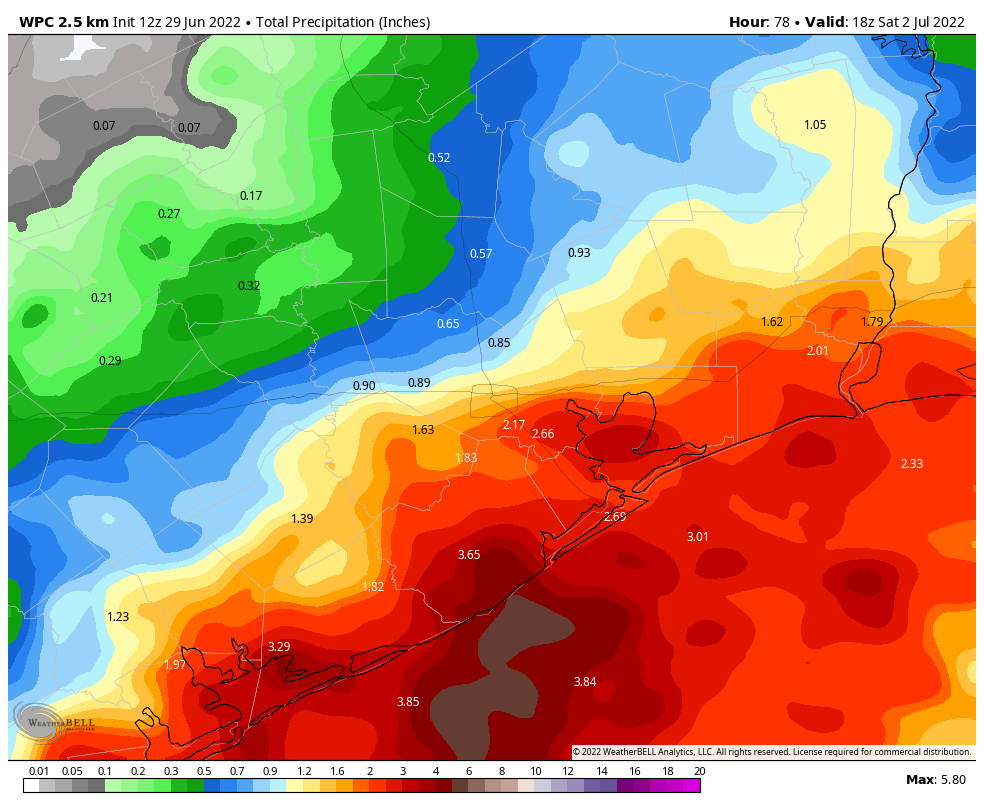
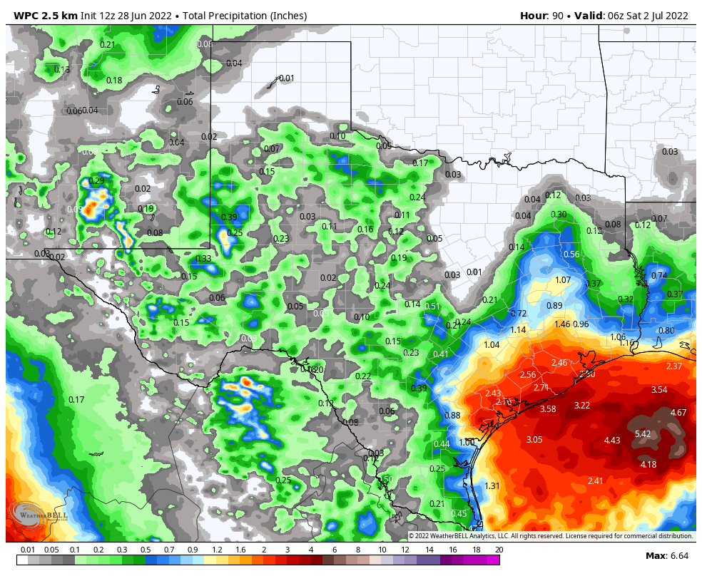
Today’s rain chances will be driven by an advancing cold front—please understand this is a cold front in a meteorological sense, in that it is a boundary ahead of an advancing mass of air, but as we’re in June the “cold” air behind the front is not particularly cold—colliding with the sea breeze. The potential for rainfall today is probably greatest along and south of Interstate 10, where these boundaries will meet. I think there’s about a 50 percent chance of showers and thunderstorms today for coastal areas, whereas chances are probably in the 30 percent range north of Interstate 10. These will be the kind of storms where some locations will see downpours while a few streets over there will just be menacing looking clouds and a few drops. A lucky few areas may pick up 1 to 2 inches of rain, but most of the region that receives rain will see a tenth of an inch or two. Otherwise expect partly sunny skies today, with winds turning northwest, and highs in the low 90s.

Friday

Rain will be possible again on Friday as an upper-level system passing through meets the sea breeze, although I’d put chances at a little bit lower than Thursday. It will be the same kind of situation, with passing downpours. Highs on Friday should reach about 90 degrees, or a bit higher, with partly to mostly sunny skies.

NOAA rain accumulation forecast for now through Friday. (Weather Bell)

Saturday and Sunday

The weekend looks sunny and warm, with highs in the low 90s. We can’t entirely rule out a passing shower on Saturday, but the chances are very low. Winds will be fairly light on Saturday, but should start to blow in a more pronounced manner out of the south on Sunday, perhaps gusting up to 20 mph.

Next week

As high pressure settles in next week, we should mostly see days with highs in the low- to mid-90s, partly to mostly sunny skies, and southerly winds at 5 to 15 mph with higher gusts. After this Friday, there likely won’t be meaningful rain chances for at least a week. Maybe that starts to change by next weekend? But only maybe. It’s summer, baby.

NOAA rainfall forecast for now through Sunday in Florida. (Weather Bell)

Tropics

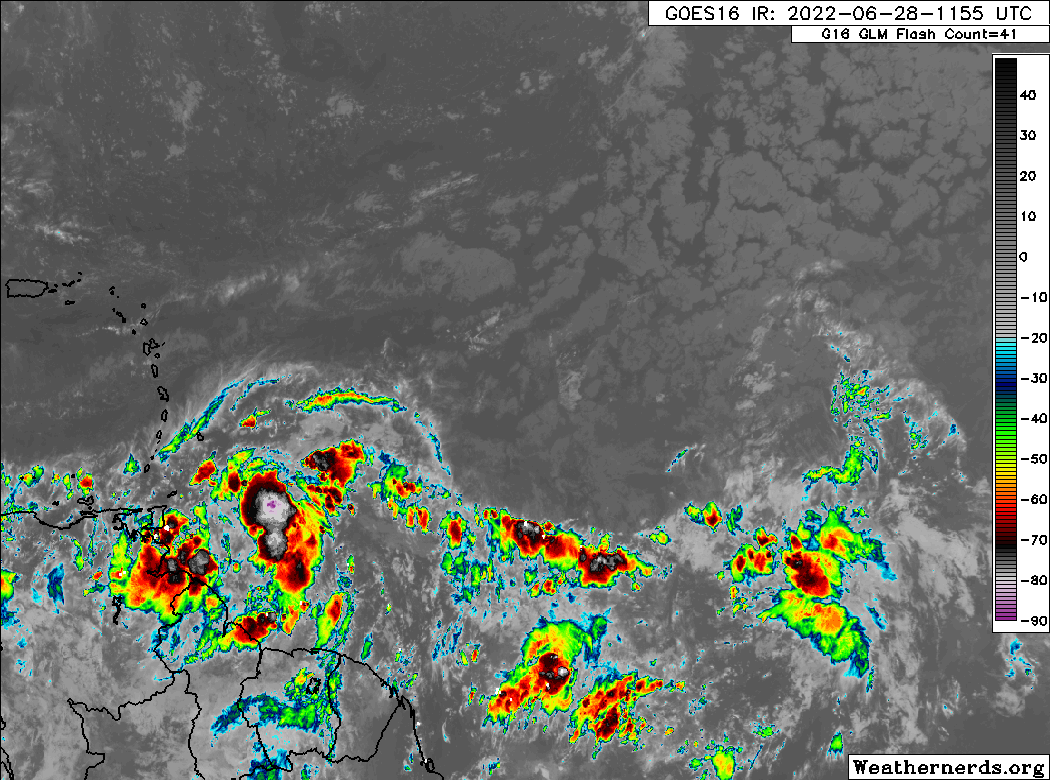
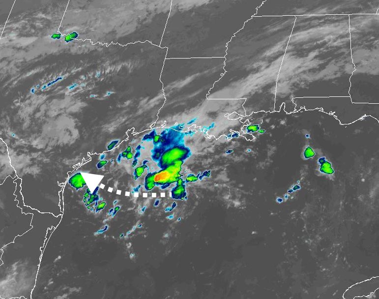
Invest 91L looks to be close to becoming a tropical depression, or even Tropical Storm Alex, later today as it moves into the southern Gulf of Mexico. There doesn’t appear to be a whole lot of potential for development, but the storm should bring a lot of rain to the Florida peninsula from Friday afternoon through Sunday afternoon.

The Atlantic hurricane season begins today, but the real action typically starts in two months

Good morning. It’s June 1, which marks the official beginning of the Atlantic hurricane season. If you need a refresher on the basics of hurricanes, I spoke with Lisa Gray at City Cast Houston to answer all of her questions about these storms. Despite the likely formation of a tropical system near the Yucatan Peninsula this week, there are no imminent threats to Texas. And as regular readers will be aware, prime time for the Atlantic hurricane season really doesn’t kick off until late July or early August.

Most Atlantic hurricanes form during August and September. (Phil Klotzbach/Colorado State University)

Wednesday

Some scattered showers streamed in from the Gulf of Mexico early on Wednesday morning, and you probably have about a 20 percent chance of seeing a shower through this afternoon. Any rain that pops up could be briefly heavy, but should dissipate quickly as these showers move from south to north. Otherwise, expect partly sunny skies today with high temperatures of about 90 degrees. Winds will be out of the southeast at about 10 mph, with modestly higher gusts. Lows tonight should drop into the mid-70s.

Thursday

A weak (and dying) front will approach the region on Thursday, and probably the most noticeable effect will be an increased chance of rain, up to about 30 or perhaps even 40 percent. Some high resolution models are showing the potential for afternoon thunderstorms along Interstate 10 and down to the coast, where there will be ample moisture. We’ll see about that. Otherwise expect highs in the low 90s, with partly sunny skies. Lows Thursday night will again drop into the mid-70s for most.

Friday

As the “front” pushes down toward the coast, rain chances will probably be in the 20 to 30 percent range. There won’t be much drier air with the front, and highs will likely still get into the low 90s with partly sunny skies. Winds should briefly shift to come out of the north. Lows Friday night will be the coolest of the week.

Saturday morning should be somewhat “coolish” in the wake of Friday front. Sort of. (Weather Bell)

Saturday, Sunday, and beyond

The weekend will see mostly sunny skies and highs generally in the low-90s. We can’t entirely rule out a brief, passing shower, but I’d put rain chances at about 10 percent. High pressure starts to take control of our weather through at least the early part of next week, so look for mostly sunny skies, highs in the low- to mid-90s, and basically no rain. Pretty soon I’ll probably be quoting Blind Melon lyrics here.

Tropics

The primary area of interest is a low pressure system likely to move into the Caribbean Sea and develop into Tropical Storm Alex later this week. It will almost certainly bring heavy rainfall to the Florida peninsula and the Bahamas this weekend. The other system (yellow) is moving out to sea.

Summer is really here, Houston. Let’s set expectations accordingly for heat, drought, and hurricanes

After our brief fling with the remnants of spring last week, we are now approaching June and the end of “Early summer,” as I described in an earlier post. This brings us to “Mid summer,” which I define as the period of time when highs run from 90 to 95 degrees, and nights are sultry, but you know it could still get worse. Now that we’re here, I wanted to set some expectations for those of you who are relatively new to Houston, or just have forgotten what to expect.

Heat

The next four months will be hot, with the heat generally peaking from late July through early September. Houston can reach 100 degrees, but due to the region’s proximity to the Gulf of Mexico and our high humidity, most summertime days remain in the mid-90s. (It’s not a dry heat, it’s a wet heat). On average, Houston sees about six 100-degree days during a given year. Summertime temperatures will vary from the low-80s to upper-90s based upon the extent of cloud cover, and whether it rains during the afternoon hours. One thing we won’t have much relief from, at all, is muggy nights with lows ranging from the low 70s to about 80 degrees. Our first real “fall” front typically does not arrive before mid- to late-September.

Drought

This is not something we’ve had to worry about for awhile in Houston—our last significant, prolonged drought came in 2011—but if you’ve lived through a drought you know the desperation of waiting to see even a small amount of rain fall from the sky. We are not predicting that Houston will see a drought this summer, but it’s certainly possible. About two thirds of Texas is presently in a “severe” drought, with nearly half of the state in an “extreme” drought. This is not a good posture for us heading into the hottest months of the year.

Hurricane season

Although hurricane season begins on June 1 and ends of November 30, it’s a little bit more complicated than that for Texas. While we can certainly experience tropical storms and even hurricanes in June and early July, typically the season really does not get going for us until late July. And then, historically, weather patterns generally push storms away from Texas by the end of September. So for most years, we really only worry a lot about tropical weather during an eight- or nine-week period from late July through late September.

Still, you should be making your preparations for hurricane season now. That means understanding your vulnerabilities to storm surge (see an interactive map, by hurricane category), your vulnerability to inland flooding (see interactive map), and your tolerance to losing power for one, two, or more weeks (if you’re considering a whole-home generator, here’s what the process is like). Our partner, Reliant, has some good storm preparation resources as well. Now is the time to decide under what circumstances you would evacuate, where you would go, and what you would bring in the event of a hurricane.

Hurricane season can be a stressful time, and it’s one of the main reasons that Space City Weather exists. If you want to track every tropical wave, there are certainly places to do that on the Internet. But the vast majority of these systems will not have any meaningful impact on Texas. Matt and I view our job as helping you to separate the important weather stuff from the noise. (And there is a lot of noise out there). Anyway, we will be with you every step of the way this summer.

Tuesday

Today will see partly to mostly sunny skies, with highs in the low 90s. Like on Memorial Day, there is a 10 to 15 percent chance of a brief, passing shower. Winds will be out of the south or southeast, at about 10 mph, with higher gusts during the afternoon hours. Low temperatures tonight will again only fall into the upper 70s for most areas.

Wednesday

A similar day to Tuesday, although I would bump rain chances up to maybe 20 percent. Any showers will again likely be driven by the sea breeze, with shower chances peaking during the afternoon and early evening hours. Lows will again be sticky on Wednesday night.

Low temperature forecast for Friday morning. (Weather Bell)

Thursday and Friday

A dying front will push into the region on Thursday, and this will primarily serve to elevate rain chances to perhaps 30 percent for both days. Showers will be pretty spotty, but a few areas could briefly see a downpour. Highs will be around 90 degrees both days, with a smidgen of drier air helping to push overnight lows down to around 70 degrees for far inland areas, and perhaps the low 70s for Houston itself.

Saturday and Sunday

As high pressure builds back into the region this weekend, we’ll see mostly sunny skies and temperatures in the low- to possibly mid-90s. Winds should generally be out of the south at about 10 mph. This hot and sunny trend should persist into the early part of next week.

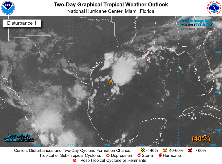
Tropical outlook as of 7am CT on Tuesday morning. (National Hurricane Center)

Tropics

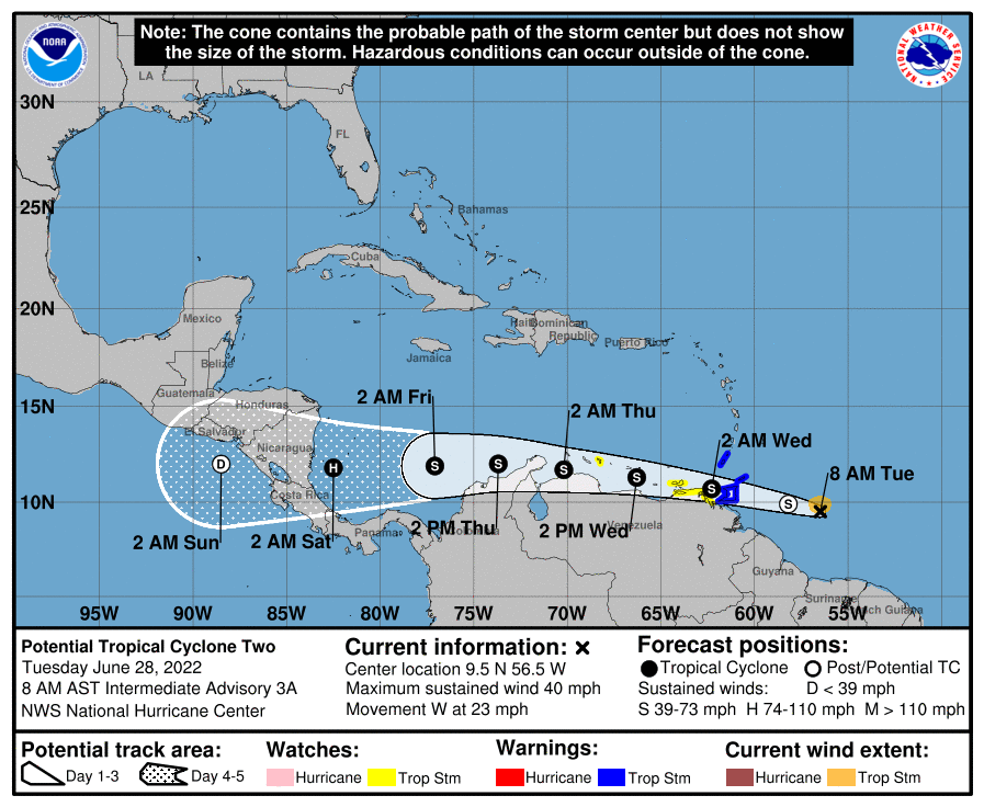
Hurricane Agatha, the first storm in the Eastern Pacific basin this year, made landfall in Mexico, and is bringing heavy rains to the southern part of that country. The remains of Agatha will likely reemerge into the southern Gulf of Mexico or northern Caribbean Sea later this week, possibly regenerating into a tropical storm. If it does so, it would take on the name “Alex.” This system poses no threat to Texas, but it could definitely make for a wet weekend in the southern half of Florida this weekend, with perhaps 5 to 10 inches of rainfall.

A quiet, hot Memorial Day weekend for Houston this year

Houston has occasionally endured some painful Memorial Day weekend weather. This year will not be one of them. We expect sunshine, with highs in the upper-80s to low-90s each day and lows mainly in the 70s. Today should be the hottest day of the next several, but the humidity will increase this weekend.

Mid-90s for highs today should be the hottest of the next several, though the humidity will pick up through the weekend. (NWS Houston)

Yes, there is a small chance for a pop-up shower, especially Monday, but consider yourself lucky, should you see one. Wear sunscreen, stay hydrated, and enjoy the weekend if you can. Feel free to unplug the weather button for a few days. We will be doing just that ourselves.

Rest of next week

After the holiday on Monday, we see onshore flow and at least a chance for a few afternoon showers each day, typical summer weather. As of now, there’s nothing out there that looks particularly concerning or bothersome, so we’ll turn it down a notch until Tuesday and come back at you refreshed and ready to tackle early summer!

While this weekend is reserved to honor those who gave the ultimate sacrifice, we do also want to express our gratitude to all men and women who have helped defend our nation over the years. Thank you for your service.