This month has started out with significantly warmer than normal weather. So far we have experienced four 80-degree days, and the average temperature has run about 10 degrees above normal. Cooler weather has been the exception in December, rather than the norm. And this pattern seems likely to continue through at least the first two-thirds of the month. So is there any chance of a colder turn toward Christmas, the remainder of the holidays, and New Years?
The pattern for the middle third of the month is pretty set. We’re going to warm back into the 80s to end this work week, a strong-ish front will cool things down for the weekend, and then we’ll be back into at least the upper 70s for most of next week. So eight or even nine of the next 10 days will see warmer than normal weather. So what of the last 10 days of the month?
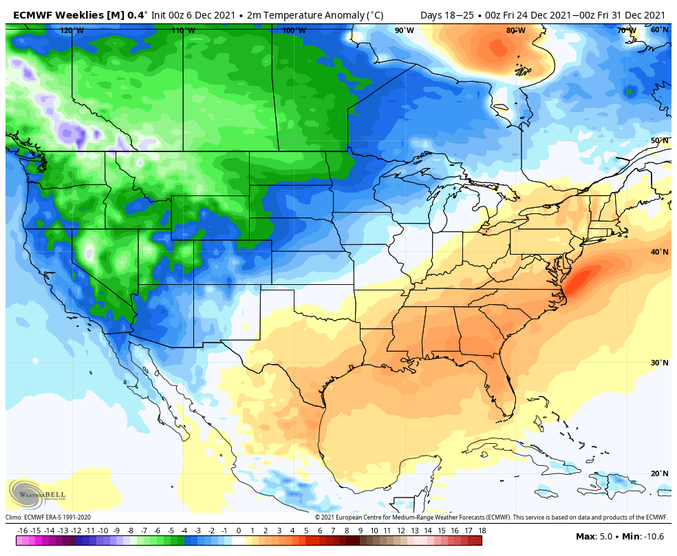
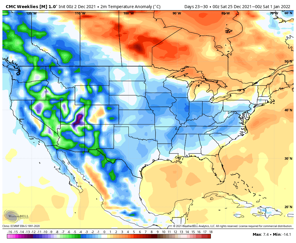
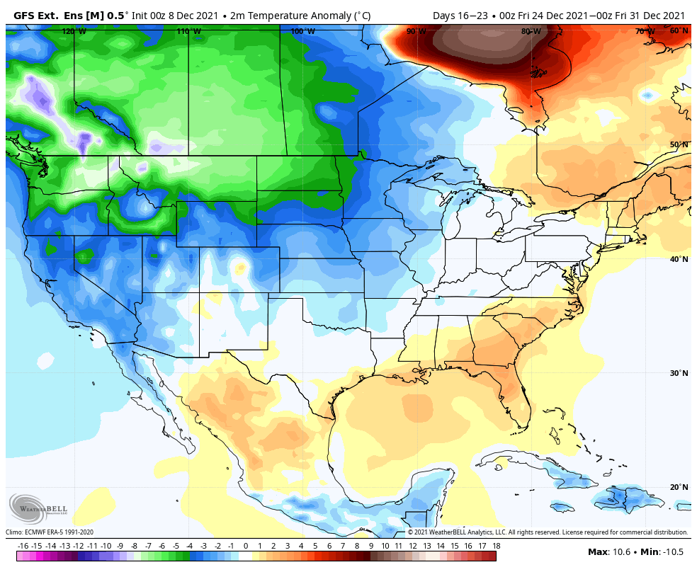
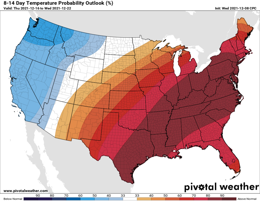
This extended period lies beyond the ability of our existing models for precision forecasting. However, it does look as though some sort of front may arrive around Dec. 20. After that the “weekly” models from all of our sources suggest somewhat more normal weather to end the month. That is, instead of days in the 70s and 80s, and nights in the 50s and 60s, we can more probably expect days in the 60s and nights in the 40s or 50s. At this point—and it really is way too early to say this with any confidence, but here goes anyways—I’m seeing little signal for a freeze before the end of the year. But we shall see.
The bottom line: The first two-thirds of December are going to be quite a bit warmer than normal, but the last part of the month should feel more seasonal. Probably. We think. I mean, it has to feel like Christmas sometime, right?
Thursday
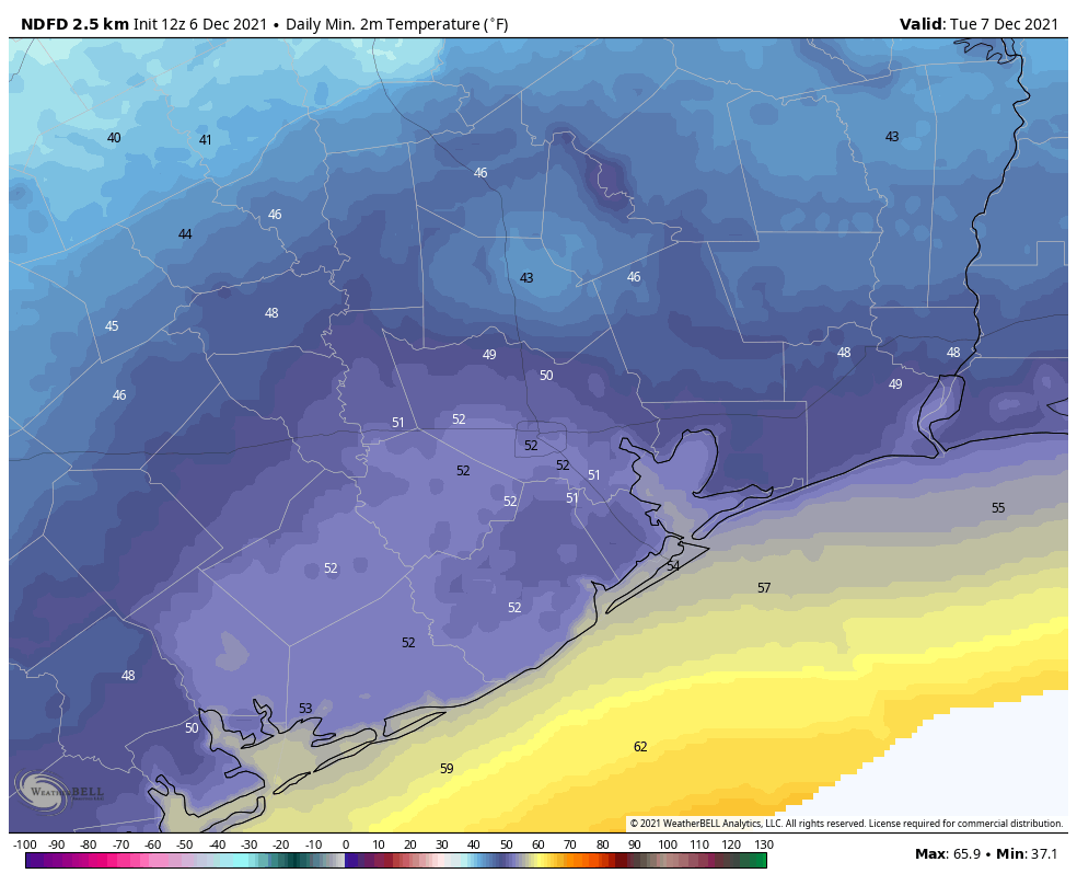
There is some patchy fog west of Houston this morning, but this should burn off within a few hours. After it does, skies will remain partly to mostly cloudy, as temperatures rise into the low 80s. Some very light showers or drizzle will be possible throughout the day, but chances are less than 20 percent. Temperatures across much of the region are unlikely to fall below 70 degrees, a very sticky night for December.
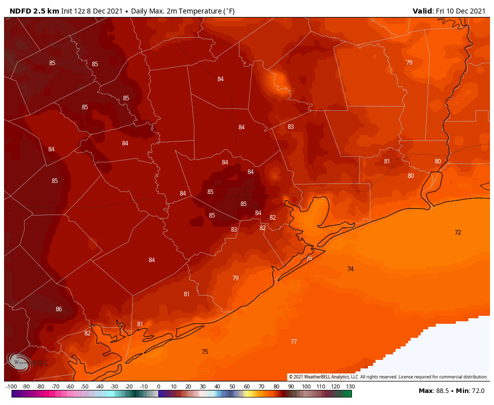
Friday
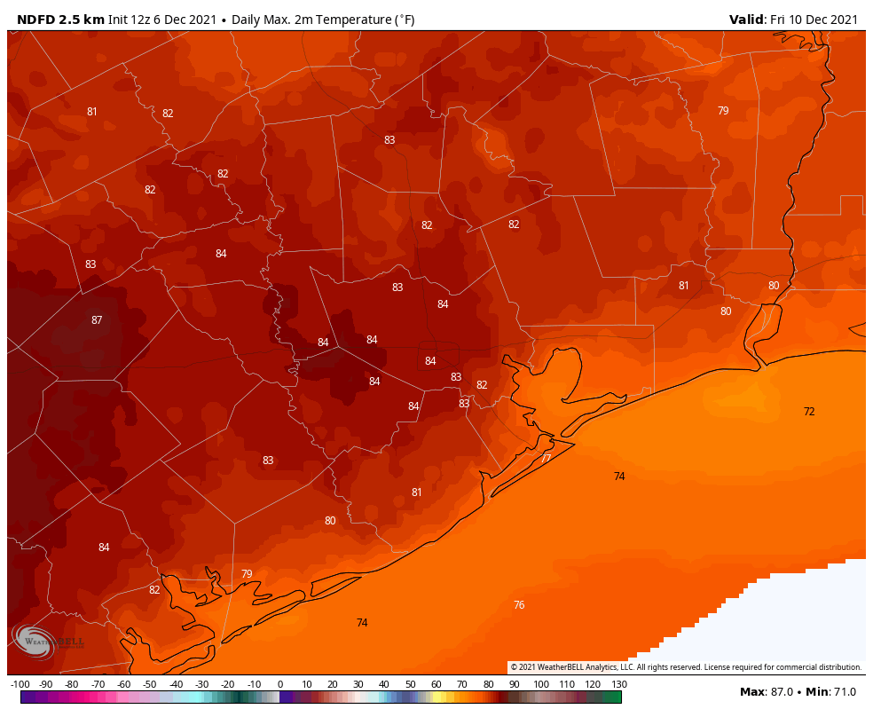
This will be another warm and mostly cloudy day, with high temperatures in the low to possibly mid-80s. This will also be another day during which light showers are possible throughout the day, but accumulations should not be anything to write home about. Expect another warm night ahead of the frontal passage.
Saturday
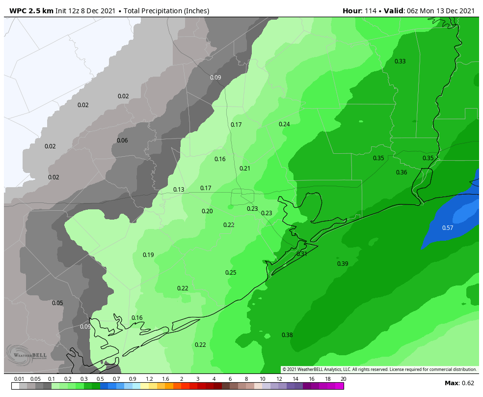
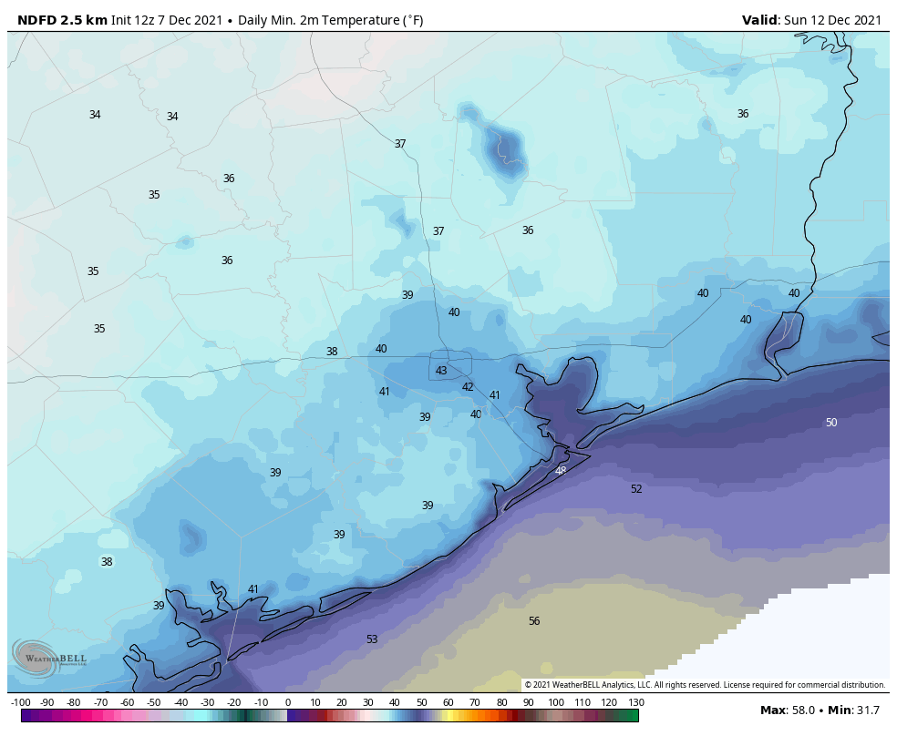
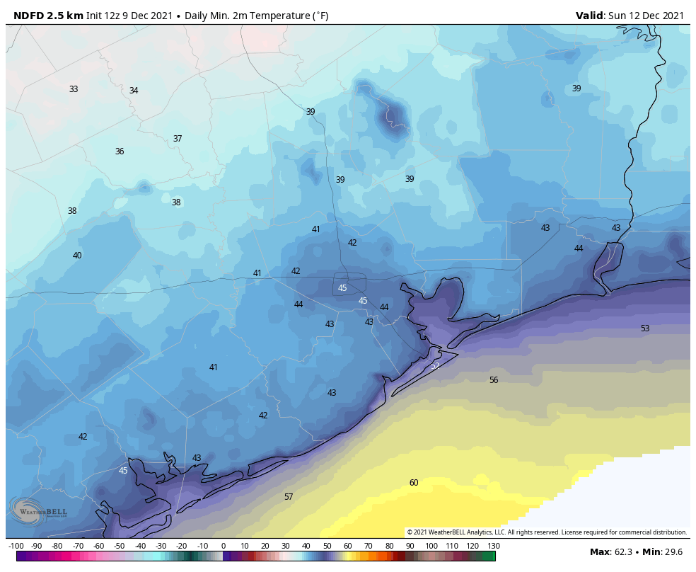
At some point a ragged line of showers and thunderstorms will progress through the region ahead of the front. This line probably arrives in areas northwest of Houston an hour or two after midnight, reaches the city a few hours later, and arrives at the coast just before sunrise. Accumulations should measure a few tenths of an inch of rain for most. A significantly drier air mass will move in an hour or two behind the rain, and with dewpoints falling into the 30s, the air will indeed feel much drier. Highs should drop into the 50s during the afternoon hours with wind gusts reaching 30 mph. Winds start to die down a bit during the evening, with lows dropping into the 40s for most of Houston.
Sunday
A truly winter-like day with mostly sunny skies, highs in the low- to mid-60s, and another chilly night in the 40s and 50s.
Next week
As mentioned above, we’ll see a warming trend next week, with high temperatures recovering into at least the mid- to upper 70s by Tuesday, and onward.