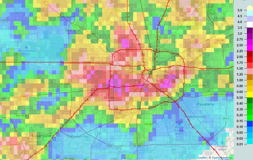
Some areas along the Southwest Freeway and Loop 610 saw very heavy rainfall on Monday, with storms briefly producing about 1.5 inches in 15 minutes. While overall totals for much of this area were only 2 to 4 inches, the intensity of this rainfall nonetheless produced significant street flooding. This is a testament to the power of rainfall rates, which are just as important as rainfall totals. A rate of 2 inches per hour, or more, will quickly back up streets. A healthy chance of rain will remain until the weekend, when high pressure should yield more sunny skies across the region.
Tuesday
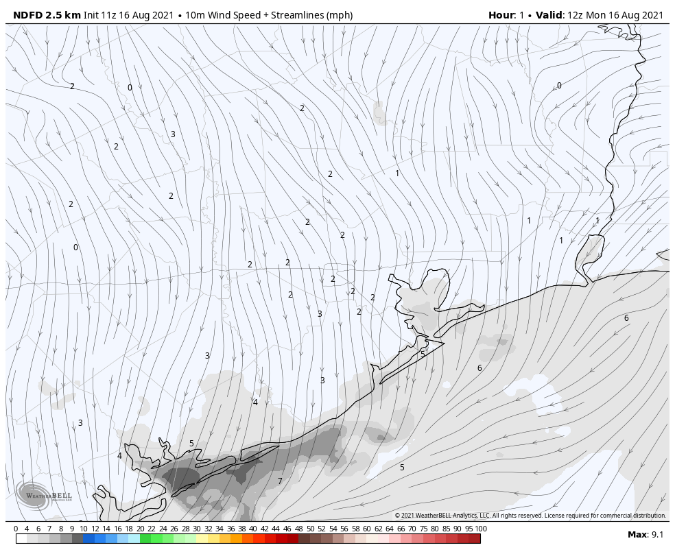
Skies should be partly to mostly sunny, with highs pushing into the mid-90s. High resolution models indicate that storms should again form in the metro area this afternoon and evening, before waning around sunset. I suspect about 40 percent of our region will see showers, with storms likely not as intense as on Monday. Winds will be light, out of the southeast at 5 to 10 mph.
Wednesday
Slightly higher moisture levels and more of an impetus for rising air should lead to better rain chances on Wednesday, with perhaps 60 percent or more of the area seeing showers or thunderstorms during the afternoon and evening hours. Highs will probably slot into the low 90s, with partly sunny skies.
Thursday and Friday
These should be mostly sunny days with highs in the mid-90s. Afternoon shower chances will remain, with perhaps one-third to one-half of the area receiving some rainfall each day.
Saturday, Sunday, and beyond
As high pressure establishes itself more firmly, rain chances will fall back to about 20 percent for this weekend. As rain chances fall, temperatures will go up, and I expect a hot weekend with highs pushing into the upper 90s for inland locations. This hot and sunny trend likely continues into next week with August-like weather for our region. The good news? August is now more than half over, my friends.
Tropics
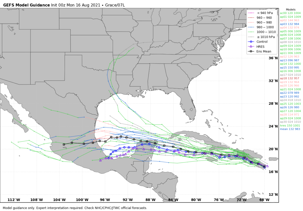
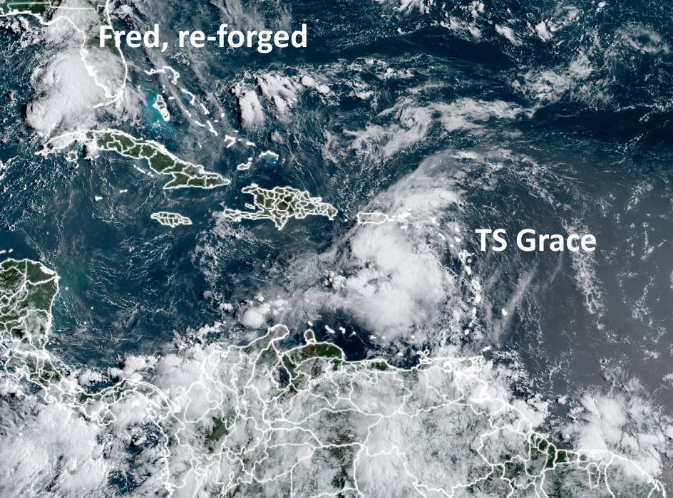
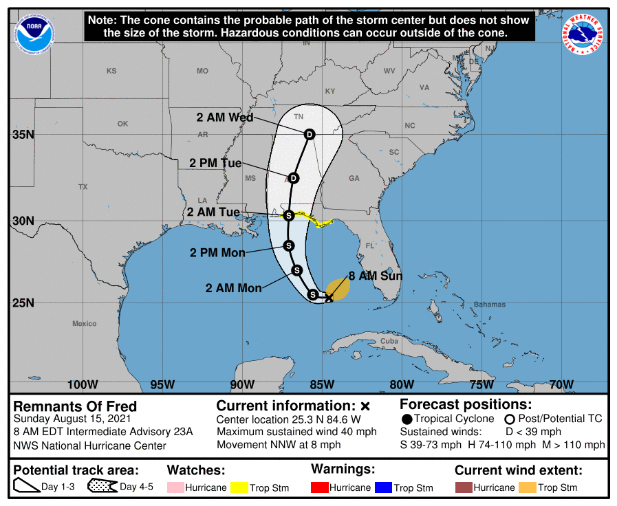
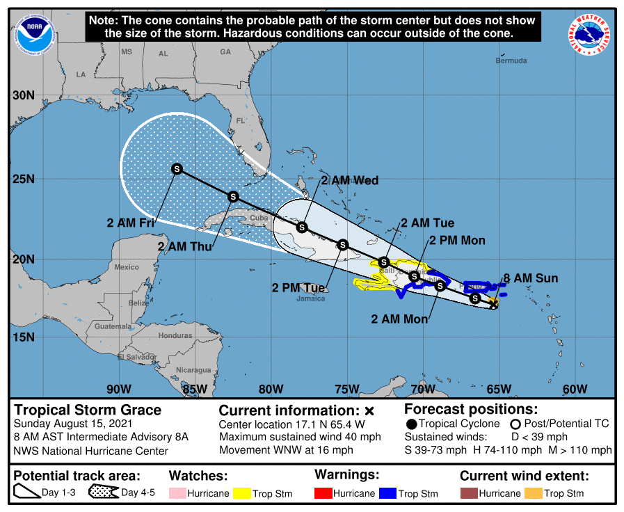
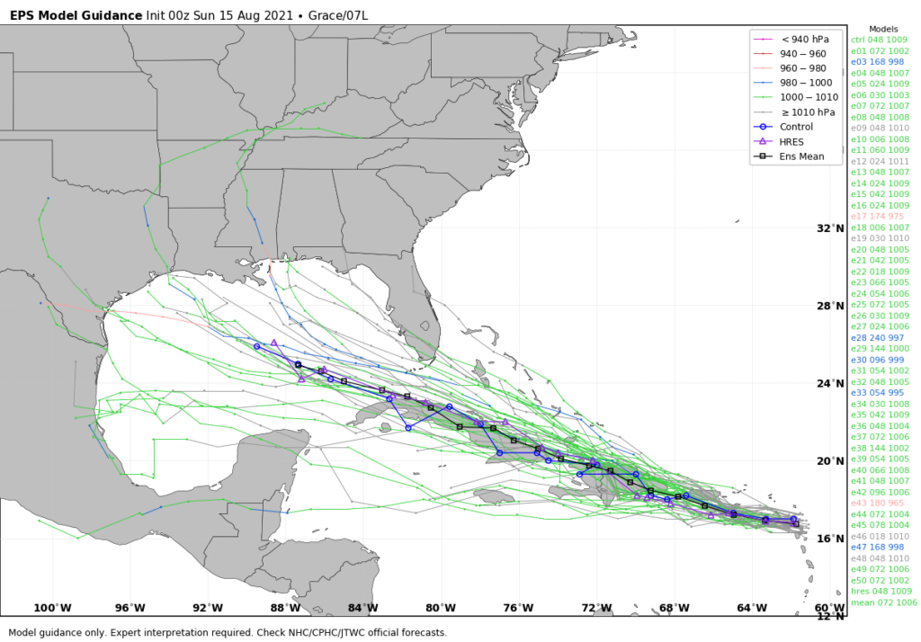
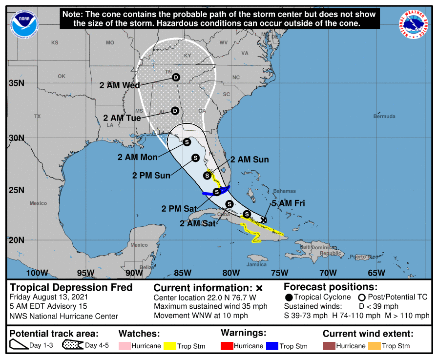
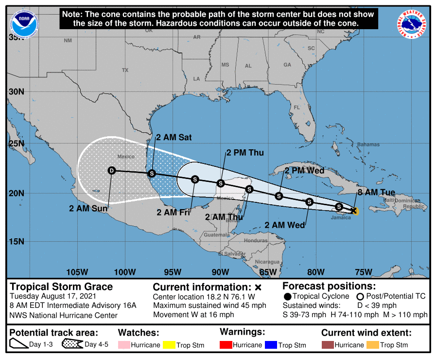
There are three named storms active in the tropics this morning. Tropical Depression Fred has moved inland into the Southeast United States. Tropical Storm Henri is swirling around Bermuda, and will stay away from the United States. And then there’s Tropical Storm Grace, which is nearing Jamaica. Confidence is now high that this system will continue traveling due west, across the Yucatan Peninsula, into the Southern Gulf of Mexico, and ultimately into Mexico. It is not a threat to Texas.
After these three storms we may see a bit of a lull in activity—but no promises as we’re in the middle of August.