After the rains ended and skies cleared on Tuesday, the air still seemed hazy across some parts of the Houston area. This was due to a large dust storm, or haboob, that created a huge dust cloud over west Texas, and some of these particles were lofted about 1 mile high in the air and carried all the way across the state. Here’s a satellite view of the phenomenon that developed on Monday, and spread into the Houston region on Tuesday.
Wednesday
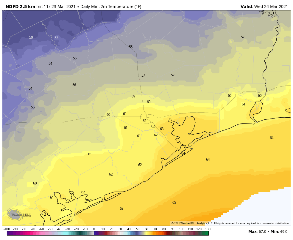
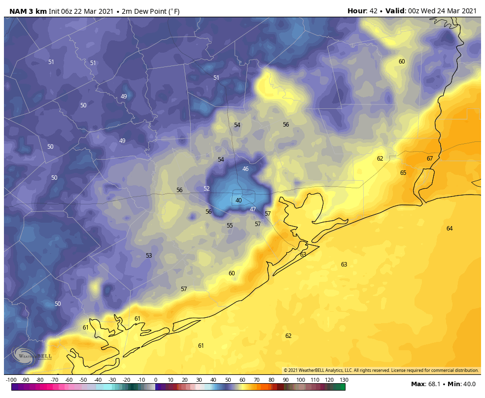
Winds have turned easterly today, and that will bring more humidity back into the area, as well as a chance of showers and thunderstorms. We’ll see this in the form of scattered to very scattered showers later this morning and during the afternoon hours. Highs will climb to about 80 degrees under mostly cloudy skies, with lows tonight only dropping into the mid- to upper-60s.
Thursday
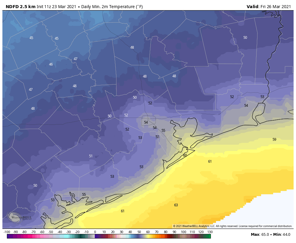
A cold front will approach and move through Houston on Thursday morning, likely pushing off the coast by around noon. This front will generate some more scattered showers and thunderstorms, but right now the system appears unlikely to be particularly organized as it moves through the region. Highs will get into the upper 70s with sunny skies after the front’s passage. Lows Thursday night will drop into the 50s with ample dry air.
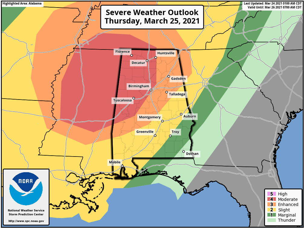
Please note that if you are traveling eastward on Thursday, the setup is once again favorable for severe weather, including the potential for long-track tornadoes. The worst storms are likely over Mississippi and Alabama.
Friday
A lovely spring day, with clear skies and highs in the upper 70s. Lows Friday night will be about 10 degrees warmer that Thursday night, as the onshore flow reestablishes itself.
Saturday and Sunday
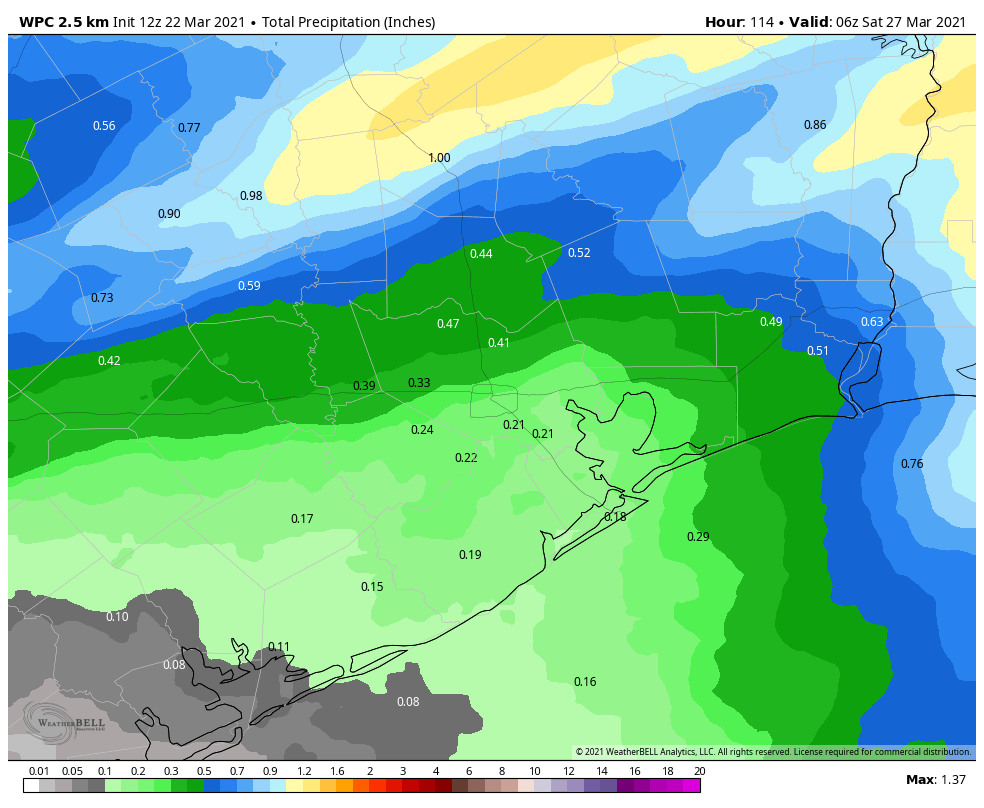
The weekend forecast is still a bit of a mess. We can be confident that Saturday will be warmer, with high temperatures in the low 80s, and more humidity. Skies will be partly sunny with a slight chance of rain. Saturday night should be warmer too, with some parts of Houston not falling below 70 degrees.
As for Sunday, a cold front will approach the area but my not quite reach Houston; may stall over the city, or may make it all the way to the coast. For now, I’d bet it stalls north of Houston, leading to partly sunny skies and highs of around 80 degrees on Sunday. But that is very much subject to change.
Next week
The models do seem a little more confident in the passage of a stronger cool front by Tuesday or Wednesday of next week, and this may also bring some chances for more widespread showers. But would I bet my house on this? Definitely not. I might bet Matt’s, however.