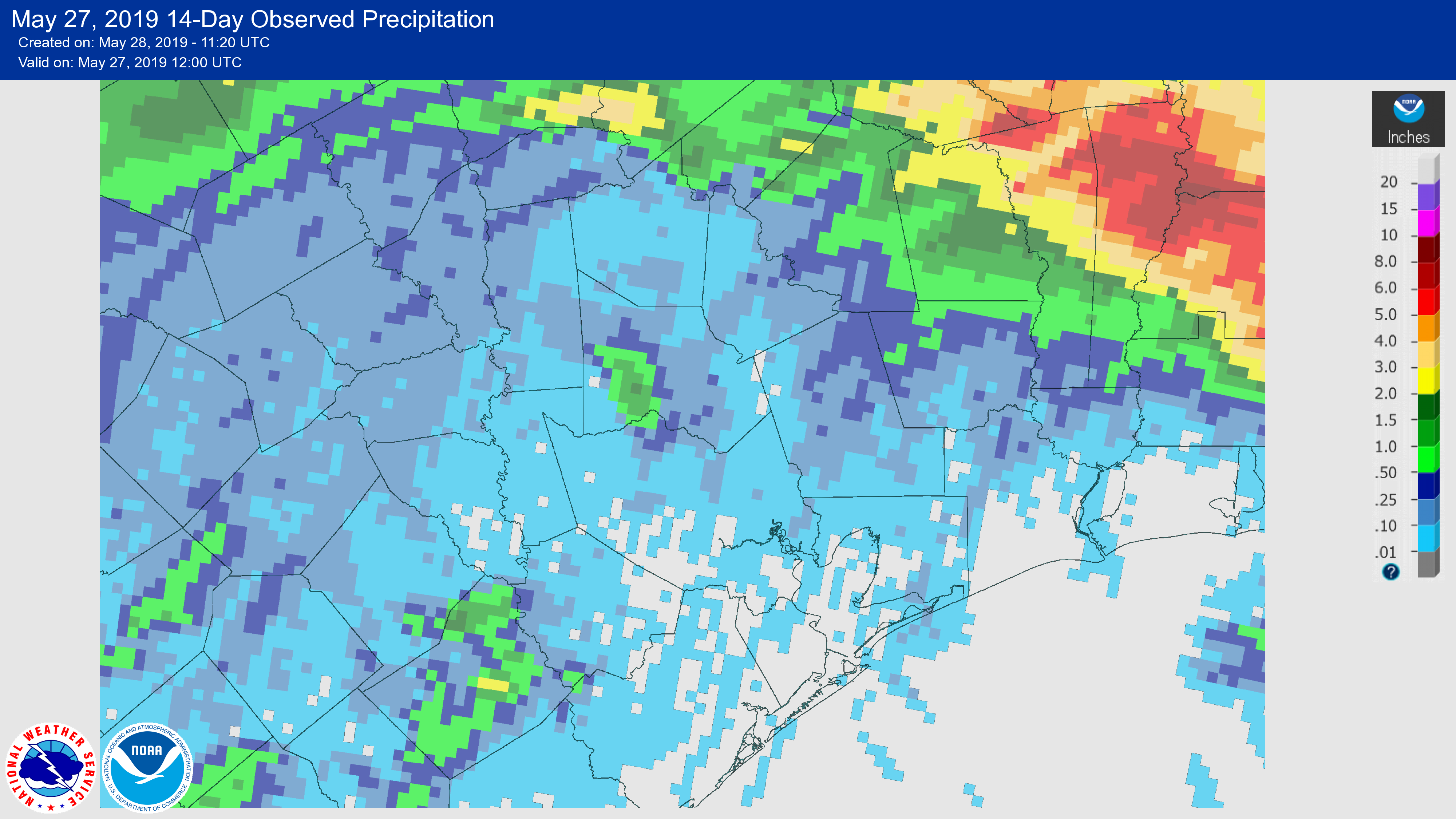
There’s a lyric in a Steve Earle song called The Rain Came Down that reminds me of Houston’s weather every time I hear it: “It’ll wash you away and there ain’t never enough.” Such was the case for Houston during the month of May, with heavy rainfall and significant flooding during the first two weeks of the month followed by almost nothing since then. The map below shows rain totals over the last two weeks for the greater Houston area.
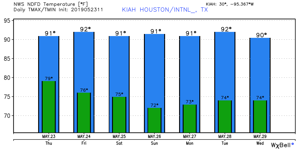
The schism in May rainfall also represents the transition from spring storm season to summer, as high pressure more or less clamped down and temperatures shot up—seven of the last nine days have had high temperatures of 90 degrees or above. We may see a bit of a reprieve from high pressure this week, but as we get deeper into June we can expect more of it.
Tuesday and Wednesday
Conditions for the next couple of days won’t change much temperature-wise for Houston. We probably will see high temperatures of around 90 degrees, with a mix of partly sunny mornings, and mostly sunny afternoons. We can’t entirely rule out a few showers streaming in from the coast, but chances probably will only be 10 to 20 percent for both days.