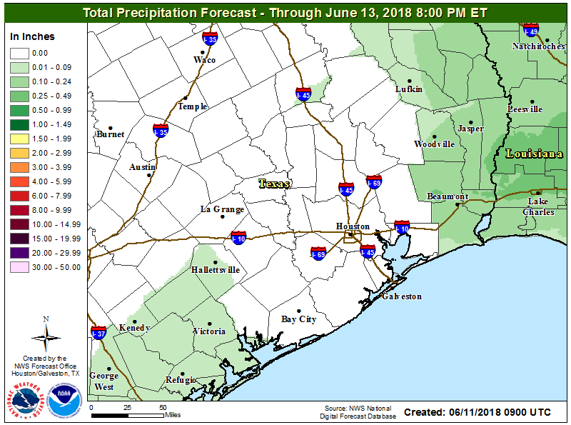
Cooler and significantly wetter weather remains on tap for the weekend—at this point Sunday looks like the wettest day—but with a disorganized tropical system moving into Mexico we don’t see any signal yet for widespread, significant flooding. So we’re watchful, but not overly concerned at this point. If you’ve been following along with Matt’s updates this week, you pretty much know what to expect.
Thursday and Friday
Houston endured highs of 97 degrees on Tuesday and Wednesday of this week, and that trend should pretty much continue to end the work week. Warm days will be punctuated with isolated to scattered showers, some of which can be intense as we saw with some storms near Tomball on Wednesday evening. But for the most part, conditions will just be hot and partly to mostly sunny.
Tropical disturbance
We continue to think the tropical disturbance now moving over the Yucatan Peninsula, which will move westward into the Bay of Campeche and likely into northern Mexico, will not develop. That means that the primary threat from the system remains tropical moisture, which should spread into Texas this weekend.
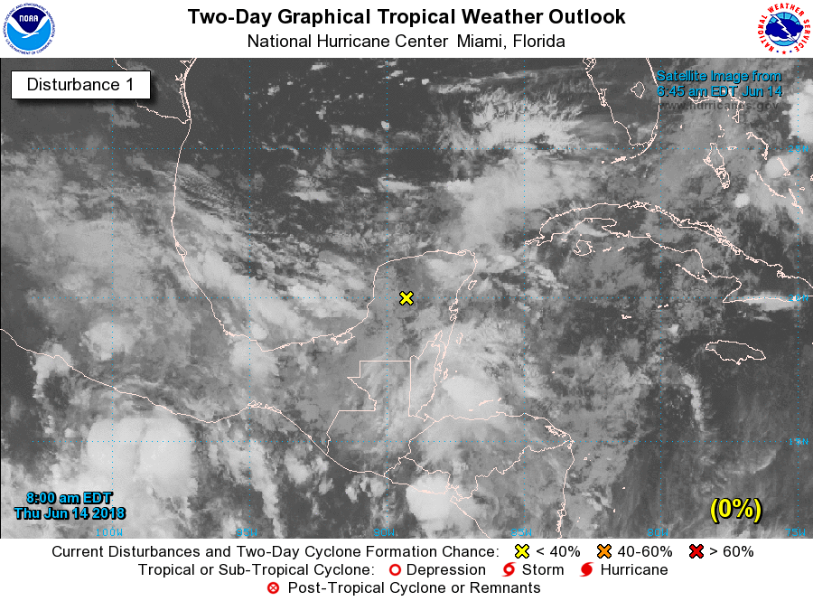
The key question is where the greatest amount of moisture will surge inland, and unfortunately we can’t say this with any precision. Will it be Houston? Beaumont? Victoria? We just can’t tell you yet. With that in mind, here’s our best stab at forecast conditions for this weekend.