Houston has had a moderate first half of July, with an average high temperature below 93 degrees, and overall temperatures slightly below normal for this time of year. That is now about to change, as we shift into the mid- and upper-90s, virtually no chance of rain, and full-on summer. We hope you like it hot, because hot is what you’re going to get.
Monday
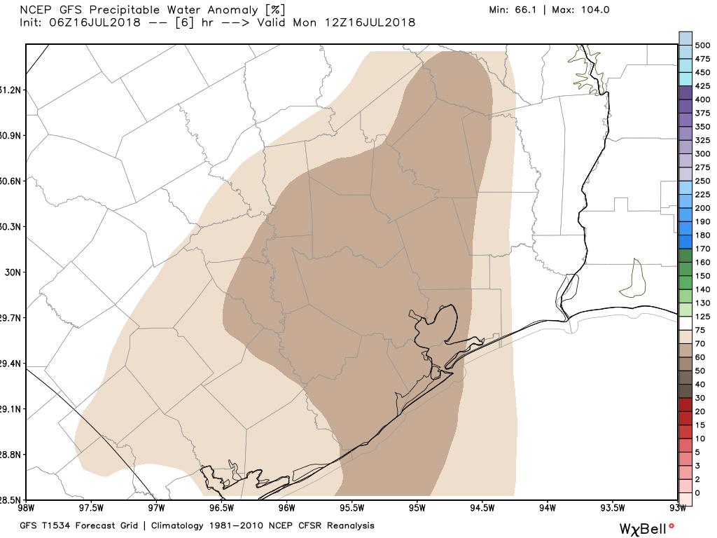
Remember all those clouds and healthy rain chances last week? Yeah, they’re pretty much gone. During most of last week the amount of moisture in the atmosphere, typically measured as precipitable water, was quite high as we saw values 50 to 100 percent above normal for this time of year. But this morning the tables have turned, with precipitable water values only about 50 to 70 percent of normal levels.
Precipitable water forecast for 7am CT on Monday morning. (Weather Bell)
So rain chances are going to go way down today, and go pretty much away for quite a while. Skies today should be partly sunny with highs in the mid-90s. What you probably will notice is a fine, yellow haze. That’s the Saharan dust that will be with us for the next few days. It will at least make for some pretty sunsets.
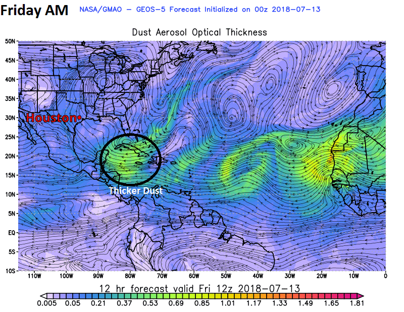
Our old friend SAL, the Saharan Air Layer (dust from the Sahara Desert in Africa) will be making a return visit to Texas this weekend, at least in higher quantities than we’ve seen this week. It will bring some grimy air quality by Sunday, as well as some potentially interesting sunrises and sunsets.
Model data from NASA shows thicker Saharan dust arriving in Houston on Sunday and Monday. (NASA)
You can see from the animation we’ve put together with NASA data that the brightest colors, or thickest dust arrives on Sunday afternoon, and it should be with us through about Tuesday. Dust has been with us to some extent much of this week, but it will be much more noticeable by later Sunday. So if you are an allergy sufferer (raises hand) or have respiratory ailments, worsening air quality on Sunday and Monday may cause you some discomfort. Air quality should improve after Tuesday. If interested, you can check the Texas air quality outlook here.
Today through Sunday
We’ve had a bit of a late start to thunderstorm activity over Houston the last two days, waiting until 3 PM or later in most cases. Yesterday’s storms were particularly frisky, with parts of Houston’s Inner Loop and West Houston seeing 1-2″ of rain. The Woodlands took home the trophy on Thursday with nearly 3″ of rain in spots.
@NWSHouston An evening thunderstorm dumped 2.44 inches in 64 minutes up in the back of The Woodlands/Alden Bridge. Sorry this photo looks similar to others I have posted but its the only angle from our house where I can take a picture safely. #houwxpic.twitter.com/No9GdzlI5u
I’m guessing we will see further hit or miss storms develop today through Sunday. Storm chances will generally diminish each day through the weekend compared to where they have been. Still, a few showers or storms should pop up each morning near the coast (you may have had rain in La Marque or Texas City already this morning, for example), advancing inland during the afternoon. Like yesterday, the handful of places that do see rain could see a fair bit of it in short order, so just be aware of that this weekend.
For most of the area, the majority of the weekend just looks partly to mostly sunny and hot. The last few days saw high temperatures exceed weather model guidance. We’ve hit the mid-90s, despite forecasts generally in the lower 90s. There’s a good chance we’ll do that again this weekend. We’ll call it generally low- to mid-90s for most of the area through Sunday. Overnight lows will be in the middle or upper-70s with humidity.
We’ve discussed the wet start to the month of July in Houston, and this has had the dual effect of keeping our lawns green as well as holding temperatures down a degree or so below normal for most of the area. Most evidence suggests the second half of the month will be considerably warmer and drier, so let’s enjoy the rain chances while they last.
Thursday
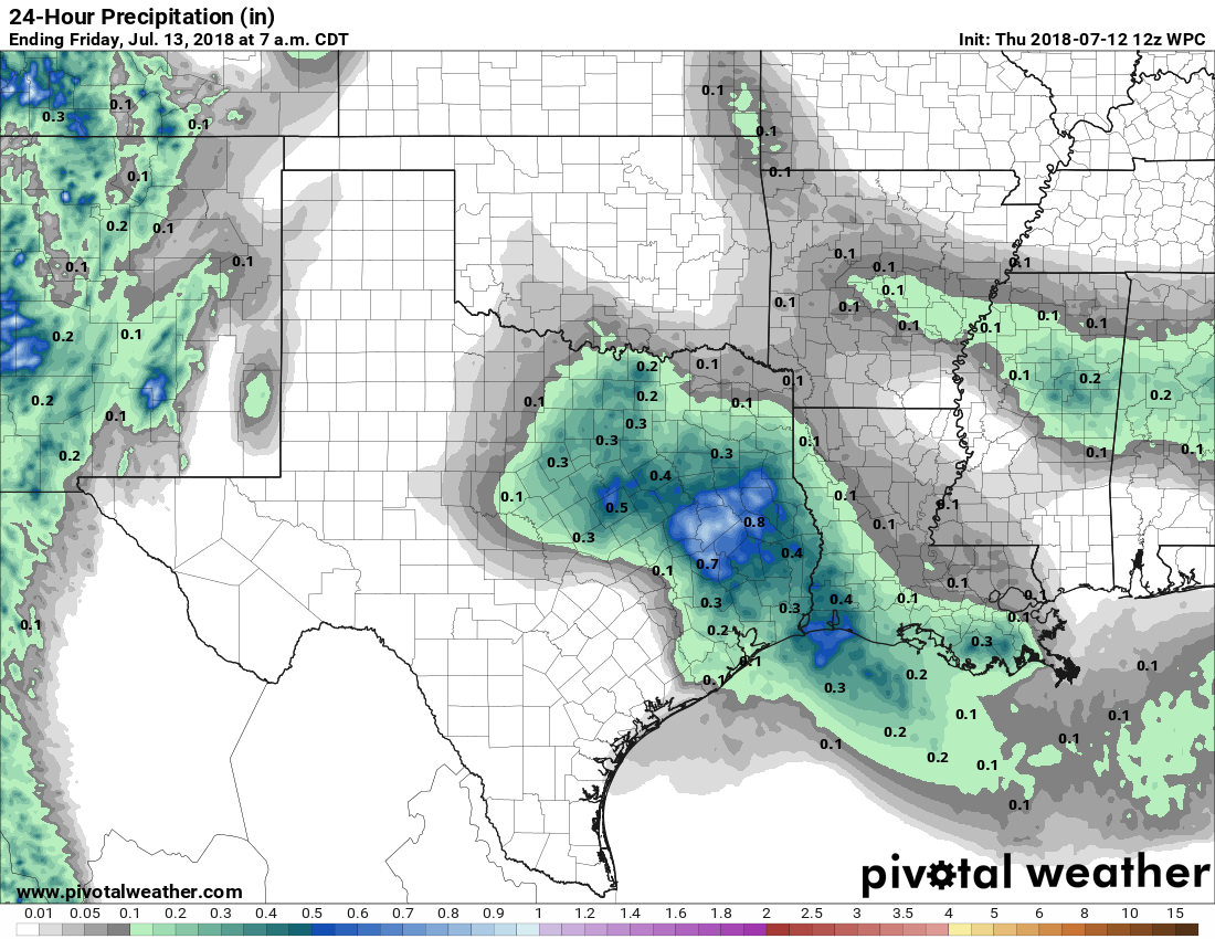
With high pressure kept at bay, and moisture levels pretty high, the region will probably see more widespread showers and thunderstorms today than we saw Wednesday. Probably about half of Houston will see rain, with accumulations of a few tenths of an inch. Partly to mostly cloudy skies this afternoon should limit high temperatures in the low 90s.
Thursday is probably the region’s best chance for widespread showers in quite awhile. (Pivotal Weather)
Friday and Saturday
These two days have the potential for more showers, but rain chances are probably only about 30 percent each day, as conditions won’t be quite as favorable for rain. As a result I think we can expect partly sunny skies, with highs in the low- to possibly mid-90s, and a few showers popping up during the day. Any rain is likely to be brief.
Tuesday offered a preview for what we can expect the rest of the work week in Houston—some sunshine, some clouds, and some scattered showers and thunderstorms. Where the heaviest storms set up, downpours will occur, but we don’t expect to see the longer-lived showers that affected Houston last week around the July 4th holiday.
Wednesday
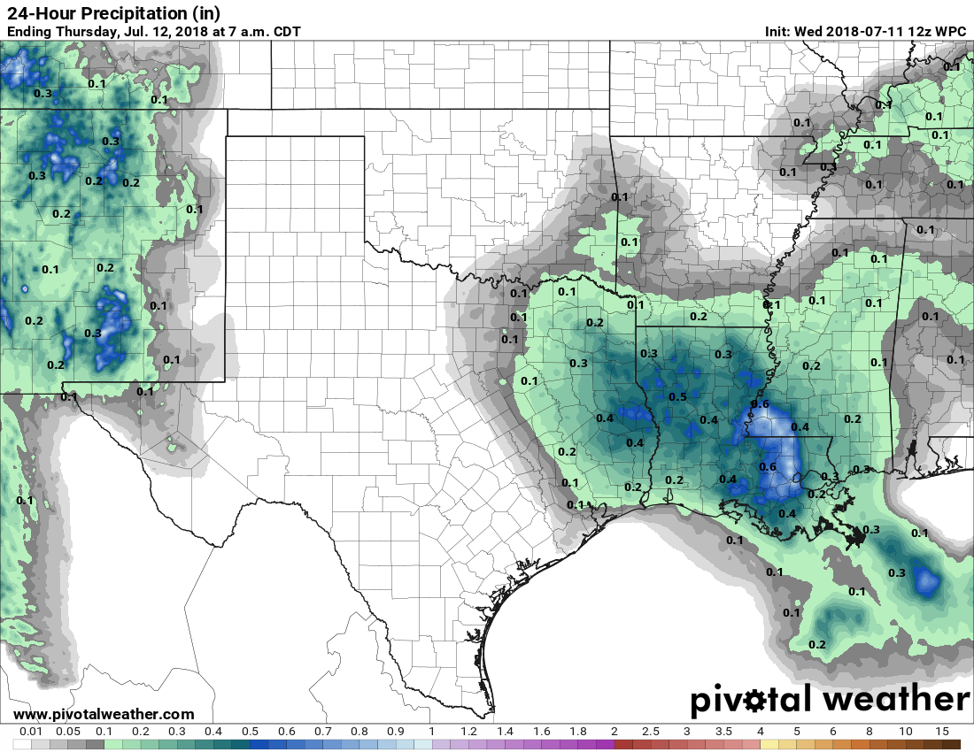
Partly sunny skies, with highs in the low 90s. Rain chances will be best on the eastern half of the city, where conditions are slightly more favorable for storms to develop. Still, there’s probably only about a 20 to 30 percent chance you get wet today.
Rain chances will be best today to the east of Houston. (Pivotal Weather)
Thursday and Friday
The story is similar to end the work week, with highs in the low 90s, a mix of sunshine and clouds, and scattered showers across the area. Again, there’s nothing we need to be too concerned about, but you probably should be prepared for the possibility of brief, heavy showers.