We’ve now reached August, and for Texas the next eight weeks represent the peak of hurricane season. The good news is that several key indicators, including sea surface temperatures and wind shear, both favor below normal activity for the next two months. Specifically, seas are cooler than normal in the tropical Atlantic where tropical storms and hurricanes most commonly form and then move westward toward the Caribbean Sea and Atlantic Ocean. Additionally, wind shear is forecast to be higher in these regions over the next two months.
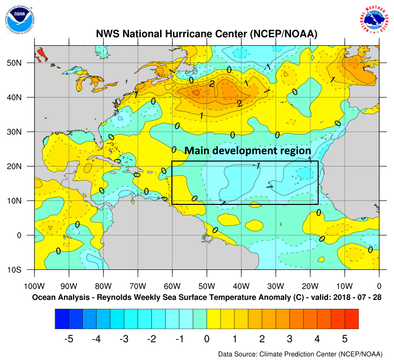
The only caveat is that seas in the Gulf of Mexico are expected to remain near or above normal. This suggests the greatest threat this year to the Gulf coast will come from a storm that forms relatively near to the shore, and then move inland. We will, of course, be on the lookout for such systems as they don’t provide much warning. For the next week or so, at least, the tropics appear very likely to remain quiet.
Thursday and Friday
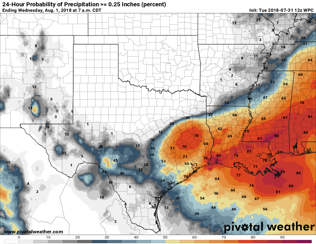
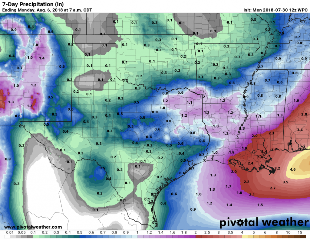
After a relatively cool start on Thursday morning, with lows down to around 70 degrees for the northern half of the metro area, there’s not much to say about the weather for the next two days. Highs are likely in the mid-90s, with mostly sunny skies, and lows in the mid- to upper-70s.