Houston has had some nice, chilly nights in March, but I think we all realize that summer is coming. Long, hot days. Shorter, humid nights. As y’all know, Reliant has sponsored our site for this year, and for their electricity customers they’re offering a free energy assessment ahead of the dog days of summer.
As part of this online “Home Energy Snapshot,” you’ll get personalized advice on how to make your home more efficient. Benefit from energy savings that you may not be aware are possible prior to an energy checkup. With your home energy snapshot, you’ll receive the following information:
- A report of your home’s average electricity usage over the last year
- A Home Efficiency Rating, based on comparisons with similar homes
- Tips to improve your home’s energy efficiency
- A baseline to measure your home’s efficiency progress

In-Home Consultation
If your Home Efficiency Rating indicates inefficiencies in electricity use, Reliant may recommend scheduling an In-Home Consultation. At your request, a Reliant Home Energy Consultant will visit your home for free, review your Home Energy Snapshot with you and thoroughly examine your home. The goal is to identify any issues that need to be addressed and provide vital statistics on your home’s major systems. Before the consultant leaves, he or she will provide you with recommendations tailored to improving your home’s efficiency and exclusive discounts on home services from Reliant and its affiliates.
During this visit, the following factors are evaluated:
- Home characteristics: Age, size, type and number of stories
- Heating and cooling system: Fuel source, system size an SEER rating
- Appliances: Energy Efficiency and 5 Star Rating
- Thermostat(s): Type(s) and automation
- Air Return System: Location, flow, etc.
- Insulation type: Location, depth and R-value
- Ductwork: Design, connections, sizes, performance, seals, type and R-value
- Attic Ventilation: Types and amounts
- Windows: Seals and caulking
- Lighting : Interior and exterior lighting
Within 48 hours of your In-Home Consultation, your Home Energy Consultant will send you the “Big Picture,” a detailed report that includes all the factors assessed during your consultation, plus specific actions you can take.
Virtual Consultation
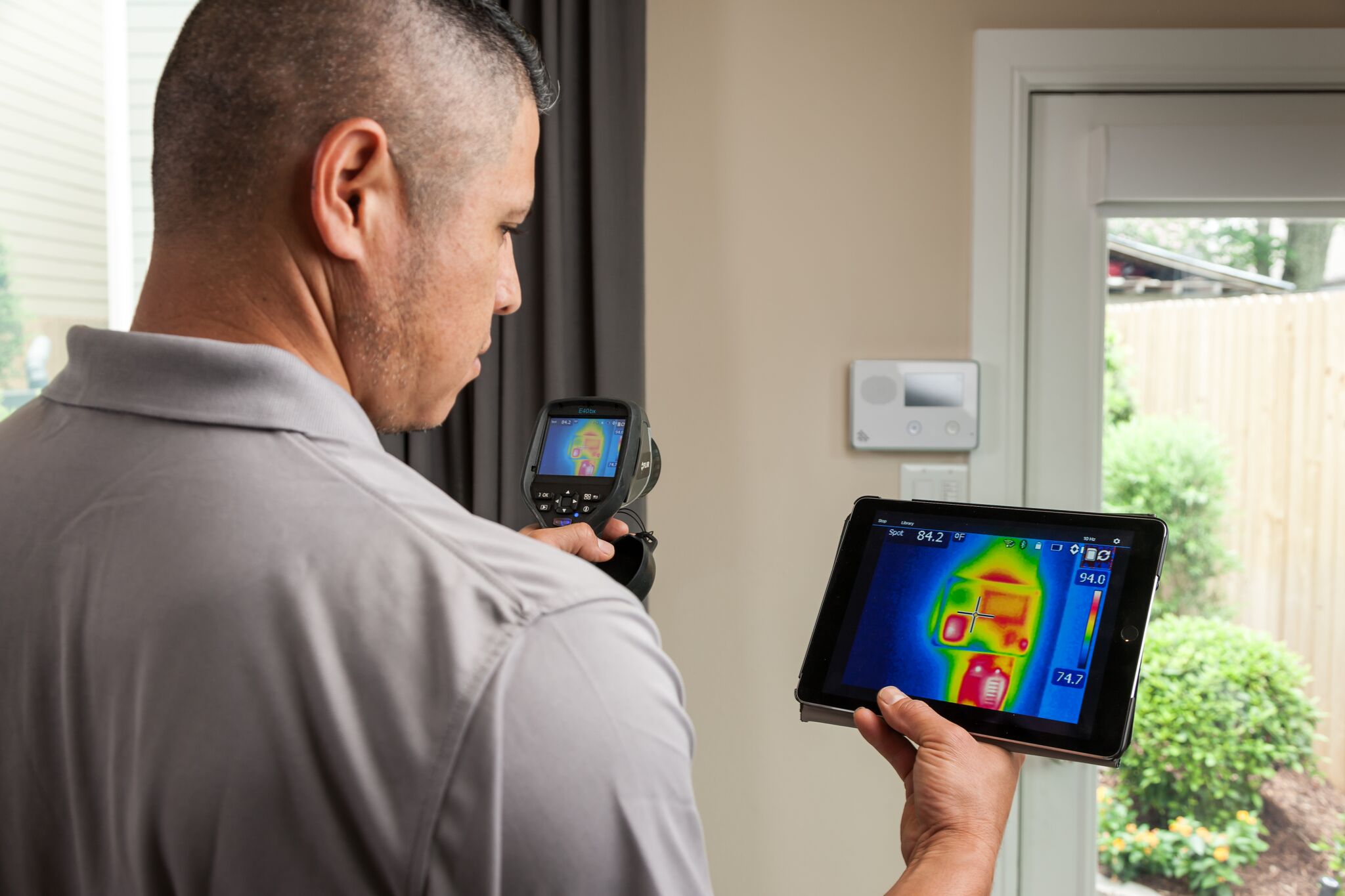
Reliant can even help customers in rural areas with the new Reliant Virtual In-home Consultation. Customers receive an infrared thermometer in the mail, and then at a scheduled time, Reliant’s energy consultant will Skype or FaceTime with you to take a virtual tour of your home. Using the thermometer, customers can take temperatures to give an idea of how well their A/C system is working and receive a full report with results.
To schedule a consultation, call 1-855-887-2190. With Reliant, you can request a free In-Home Consultation once per year.