Hello fellow marathon runners and volunteers. In 12 days, it will be all over but the recovery. And now that the big training runs are over, all that we can do is trust our preparation, and hope for good—cold—weather on the big day. To that end, for the rest of this week, I’ll be providing afternoon updates on what we can expect for Sunday, Jan. 14th.
Of course any weather forecast beyond about seven days out is going to have a lot of uncertainty, and anything beyond 10 days is even more problematic. But that does not mean such forecasts have zero value. The best way to look at weather this far out is to study the ensemble forecasts of the main global models. These are the 50 or so lower resolution runs of a given model, with slightly different initial conditions. By looking at the spread in output from these models, we can gauge the probability of cold, normal, or warm weather for 12 days from now. Looking at the 12z runs of the European and North American models, here’s what I have for you.
Starting with the European model I have broken down the possibilities for start line temperatures into four different categories:
Warm: 3 degrees F or more warmer than normal
Normal: +3 to -3 degrees within normal (average high is 65, low is 47 degrees)
Cold: -3 to -10 degrees below normal
Very cold: -10 degrees or more below normal
In looking at each individual ensemble member of the European model, here are the Houston temperature anomaly outputs sorted by category:
Warm: 5
Normal: 4
Cold: 33
Very cold: 8
Too obtain probabilities, just multiply those numbers by two. So, roughly, according to the European model this afternoon, there is a 20 percent chance of warm or near-normal weather for the marathon, and an 80 percent chance of cold or very cold weather.
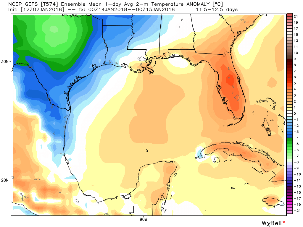
Looking at the GFS model, the we can see the mean of the ensemble members for January 14th is about 2 Celsius degrees (4 degrees Fahrenheit) below normal. But this model isn’t as cold as the European model.
This is a much better forecast for the 2018 run than what we saw in 2017 (warm and very humid), but it is far from locked in. There are also some concerns.
The models are suggesting that some kind of fairly strong cold front moves through the region toward the end of next week, and this could bring with it some decent precipitation. If that front is late, we could still be warm for the marathon. Or the front could drag through on a Friday or Saturday, leaving behind some cold rain for the marathon itself. That, obviously, wouldn’t be ideal either. All that said, I’d still rather be looking at probable cold weather more than just about anything.
More tomorrow.