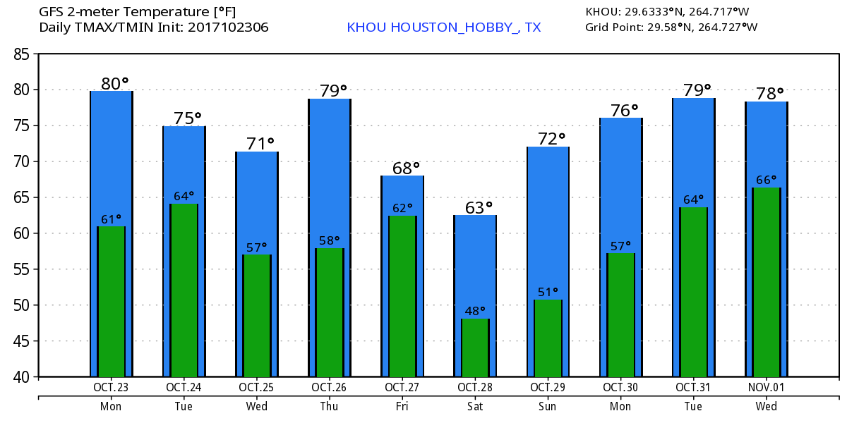
Some warmth returns to Houston briefly on Thursday before a cool front sweeps into the region on Friday, bringing the coldest weather since February. While the greater Houston area is unlikely to freeze, inland areas have a decent chance of seeing overnight lows on Saturday and Sunday morning fall into the 30s. Let us hope the Dodgers’ bats go as cold this weekend.
Thursday
As a southerly flow resumes this morning, humidity will return to Houston, and highs will climb into the lower 80s under sunny skies. There could be some gusty southerly winds later this morning, especially closer to the coast. Lows tonight will be in the 60s.
Friday
A strong cold front will approach the northwestern areas of Houston on Friday morning, likely pushing into the city around 9 or 10 am (give or take), and off the coast by or before noon. Some scattered showers and thunderstorms may accompany the frontal passage, but we’re not expecting any kind of significant rain accumulations, and rains should end during the afternoon hours. Highs should reach around 70 degrees on Friday before a steep dropoff in temperatures during the evening hours.