Good morning. Inland areas are seeing some drier air this morning, but if you’re closer to the coast, sorry, it’s still muggy.
TODAY and THURSDAY
A weak cool front has edged into the Houston area and largely stalled out. If we take a look at the GFS model forecast for relative humidity at 6 a.m. CT today we can get a good sense of where this boundary has gotten hung up.
The stalled front, which will probably move back inland tonight, means we have a couple of more partly sunny, muggy and warm days in the 80s. Lows won’t go below the mid-60s. And with the increasing moisture levels there’s a slight chance for some light rain.
Monday was a warm one. Houston’s official weather station, at Bush Intercontinental Airport, came within 1 degree of tying its all time record by reaching 87 degrees. Hobby Airport hits 88 degrees, and broke its all-time record. Hope you stayed cool.
TODAY
We’ll be a little cooler today because the humidity is coming up some, so highs probably will only reach the middle 80s under partly sunny skies. It will still be warm for mid-March, and we won’t cool down that much as we drop into the mid-60s tonight.
WEDNESDAY and THURSDAY
A weak cool front will approach the area tonight but likely not push all the way through. This will keep temperatures on Wednesday and Thursday to around 80 degrees, and allow for the slight possibility of showers and thunderstorms. Lows will still be pretty warm, in the low 60s.
FRIDAY and SATURDAY
There’s a stronger cold front coming to Houston but it’s not clear when it will arrive. This system will bring a good chance of rain to the region, but when the rain comes is dependent upon the timing of that front. So we could see some widespread showers beginning Friday during the day, or perhaps not well into the night. All the same, accumulations should not be more than 0.5 to 1 inch.
At some point Saturday, during the morning or afternoon depending on the timing of the front, we’ll begin to see some clearing as the front moves off the coast. Morning lows should be around 50 degrees and highs near 70.
SUNDAY and MONDAY
The beginning of next week looks great, with a couple of sunny, 70-degree days. Something to look forward to!
It sure doesn’t feel too much like summer out there this morning, with lows in the upper 50s, but just you wait my friends.
TODAY
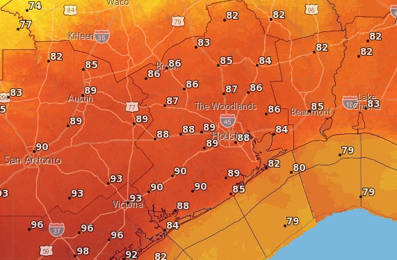
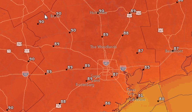
As discussed in detail yesterday the region will see a large amount of warm air moving into the region from the south-southwest, and this could allow us to reach or even break the all-time record high for today of 88 degrees, set in 2008. Temperatures are more likely to be quite a bit higher further inland, and especially to the southwest, than along the coast, which will still feel the Gulf’s influence today.
Anyway, expect abnormally warm temperatures in the mid- to upper-80s later today with partly to mostly sunny skies. Pretty amazing beach weather for this time of year if you’re on Spring Break. Lows tonight will only go down into the low 60s.
Some of you have lamented the early demise of winter this year—Houston hasn’t had a low temperature below 47 degrees this month—and I don’t have any better news this week. Temperatures are going to warm up into the upper 80s on Monday and Tuesday, possibly reaching 90 degrees on Monday in some locations. Here’s a quick discussion of why:
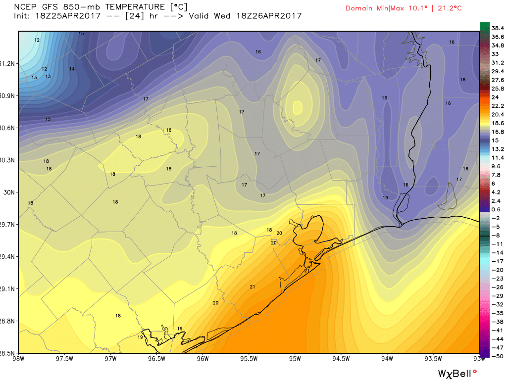
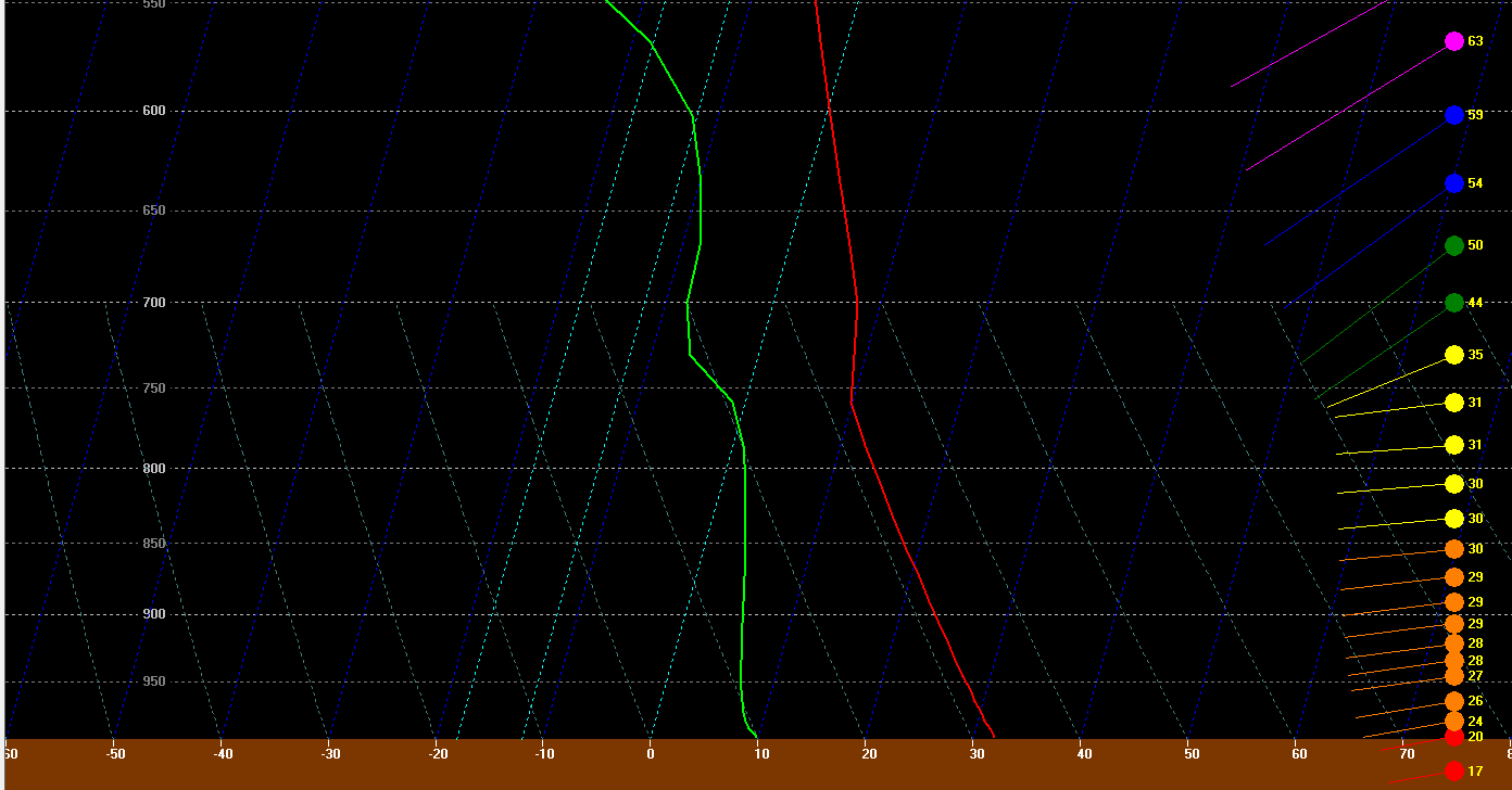
An area of low pressure over Nebraska will direct winds over Texas to flow from the southwest later on Sunday and through Monday. In the chart below winds (blue hues depict a stronger flow) are shown about 3,000 feet above the surface of the Earth.