Storms possible early Wednesday, and flooding potentially this weekend

Good morning. Before we move on to the potential for inclement weather later tonight, and again later this week, I wanted to note for the record that there was in fact a tornado in Houston on Sunday evening. The National Weather Service confirmed the touchdown of an EF-0 tornado, with 70-mph winds, in League City. It’s track went for 1.4 miles.

TODAY

It’s a warm and muggy morning, with temperatures only falling into the low 70s out there, and we’re going to see a very warm day in the upper 80s under partly sunny skies. Areas in northern Texas and Oklahoma are likely to see strong storms later today, and quite possibly a number of tornadoes. However I do not believe any of these storms will move into the Houston area today.
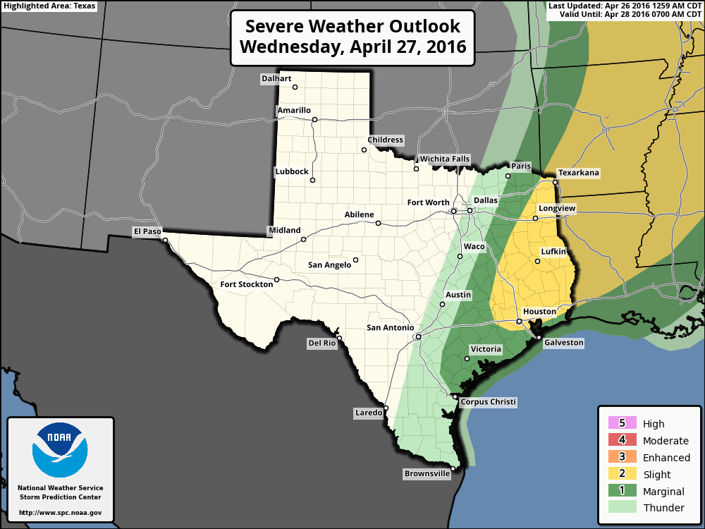
WEDNESDAY

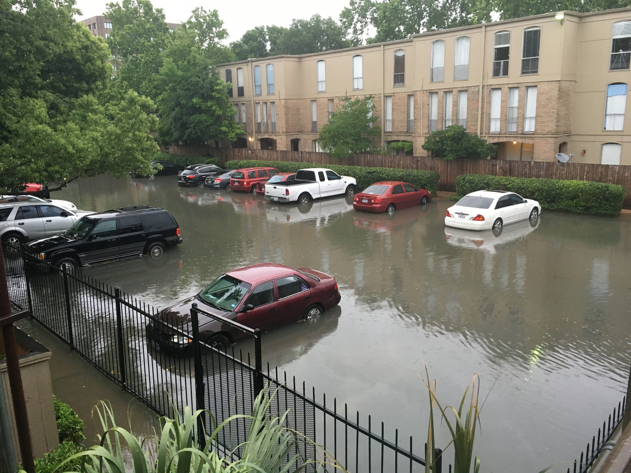
Some of the energy from the system over northern Texas should sag southward into the greater Houston area by early Wednesday, or mid-Wednesday morning, however. The best chances for storms should come north of Interstate 10, and the primary threats are wind and hail, with tornadoes a lesser possibility. As for timing, for the metro area I expect any line of storms that does develop to move through between about 6am and noon. We are probably looking at widespread rain totals of 0.5 to 2 inches of rain, with greater accumulations to the north. Isolated areas could see higher rain totals. While these storms have the potential to produce a flooding threat, and I’m not ruling that out, I don’t feel as though most areas will see high enough rain totals. (We will be watching it closely all the same).Some lingering showers are possible Wednesday afternoon.

The potential for storms on Wednesday morning is greatest to the north and northeast of Houston, but that doesn't mean the city is in the clear. (NOAA)
The potential for storms on Wednesday morning is greatest to the north and northeast of Houston, but that doesn’t mean the city is in the clear. (NOAA)

See full post

Sponsor update, and how you can help

As you may know last Friday, for the first time, Space City Weather sought sponsorship. I’m pleased to say we’ve had great interest. Already we have someone lined up for May, with several months likely to be booked after that as well. If you know someone who may be interested here is a link to more information.

Still, many of you have asked about contributing to the site through micro-donations. Matt and I discussed the possibility of this, but we think the best thing for people to do is make a donation to the flood victims from last Sunday and Monday’s tremendous rainfall. Two of the best ways to do that are:

Houston in general: Salvation Army Houston

Northwest area (hardest hit): Memorial Assistance Ministries

A typical scene on Monday, April 18, in Houston. (Laurence Simon/Flickr)


As we get closer to hurricane season we’re also planning to sell some Space City Weather t-shirts by which people can both support the site as well as help us spread the word. We’ll have more information on that in a month or so.

In the meantime, thanks for all the support, and we’ll continue to stay on top of things for you guys.

For Houston storms possible mid-week, and heavy rains may return by the weekend

After some rather nasty storms on Sunday afternoon and early evening, which brought as much as 3 inches of rain to Friendswood and sparked some tornado warnings, we’ll see quieter weather—for a bit.

TODAY and TUESDAY

We’ll see partly sunny and warm days, with highs rising into the mid-80s today and Tuesday. Over the course of the next two days we’ll see an increasingly strong southerly wind, which will help amp moisture levels back up over the area. On Tuesday we’ll hear a lot about the potential for multiple tornadoes and heavy rain over northern Texas and Oklahoma as a storm system crosses the central United States. It could get pretty bad for Dallas and points north. Houston appears likely to be on the southern periphery of this system. And as it moves eastward it could begin to affect the Houston region.

NOAA severe storm outlook for Wednesday.

See full post

Thunderstorms to depart Houston this evening, but more concerns later this week

Unfortunately some of the showers moving over Houston today did develop into moderately heavy thunderstorms. Additionally, these storms moved over the western half of the metro region hard hit by rains six days ago, bringing as much as 1 inch of rain to some areas.

Rain accumulations today through 4:15pm CT on Sunday. (Harris County Flood Warning System)

See full post