Rainy weather likely returns to Houston this weekend

There will be severe weather across Oklahoma, and likely parts of northern Texas, during the next few days, with the possibility of tornadoes, hail, and more. However the Houston region is unlikely to see more than rain and thunderstorms through the weekend, as we’re going to be far enough south to avoid the main energy from these systems.
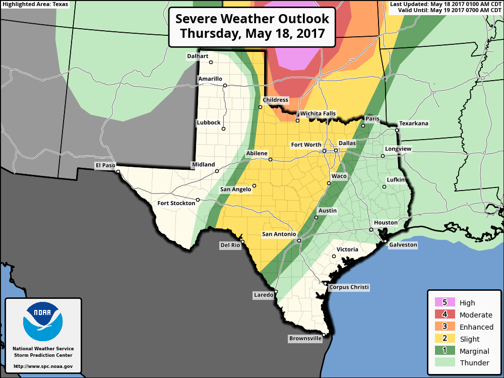
Severe weather is likely to affect Texas today, but not the Houston region. (NOAA)

Thursday and Friday

We’re going to end the week warm and windy. Southerly winds will bring atmospheric moisture into the area, so the region should see partly cloudy days, and there will be the chance for some scattered showers—but most people are unlikely to see any rain. Highs will nudge up into the upper 80s, and overnight lows will be summer-like, in the mid-70s.

(Space City Weather is sponsored this month by Jetco Delivery)
See full post

Feeling like summer with low-end shower chances for now

This weather pattern is one that occurs in Southeast Texas fairly often this time of year, and the best word I’ve found to describe it is “annoying.” You have to mention showers, but most people won’t see much. No exceptions this time, as low-end shower chances will be in the picture the next few days. Higher chances for showers exist this weekend. Let’s get to some details.

Today

A quiet start to the morning across the area. If you’re south or east of Houston, you’ve probably noticed gusty winds though. Onshore flow has cranked up, but winds should ease up some this morning.

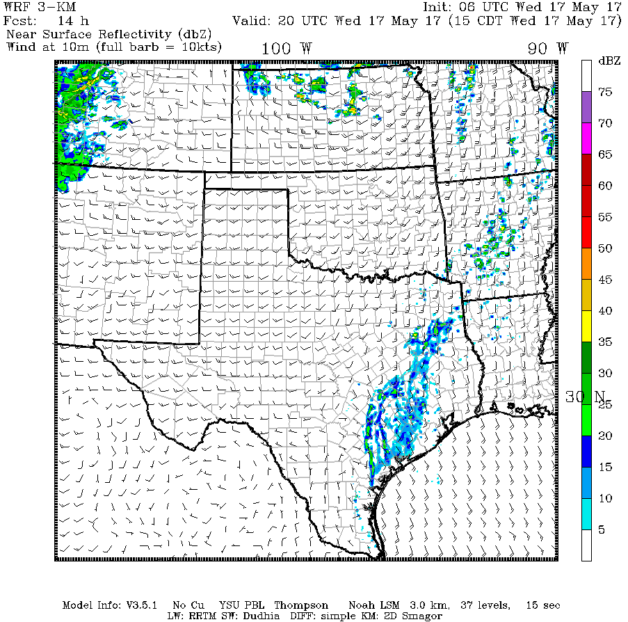
The bulk of the day will feature a mix of sun and clouds. There could be an isolated shower, primarily north and west of Houston, but I don’t see anything too serious from this.

One model’s depiction of rain chances later today shows just a handful of showers north and west of the city. (Texas Tech University)


Expect temperatures to be near to just under where we got yesterday (mid to upper 80s).

(Space City Weather is sponsored this month by Jetco Delivery)
See full post

Houston off to warmest start on record, and weekend rain chances loom

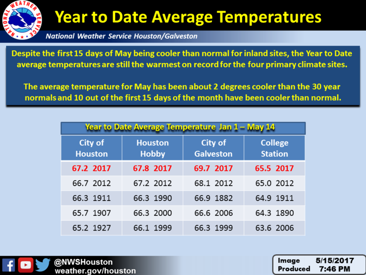
The National Weather posted a pretty astounding graphic this morning. Although temperatures this May have been cooler than normal for most of Houston—except for areas immediately along the coast—the region is still off to a sizzling start for temperatures this year because of warmth during the prior four months. For every major weather location in the area, the average temperature this year is above normal. Galveston remains nearly 2 degrees above normal.

Year-to-date average temperatures through Sunday. (National Weather Service)

Today

After a warm-ish morning, temperatures will reach the mid- to upper-80s today under partly to mostly sunny skies. The most notable feature will be onshore winds returning with feeling, perhaps gusting to 20 mph or above. This moisture will likely set the stage for rain showers later this week.

(Space City Weather is sponsored this month by Jetco Delivery)

See full post

May’s site sponsor: Jetco Delivery

A Houston based transportation firm that serves Houston, Dallas and San Antonio—Jetco Delivery—has agreed to sponsor Space City Weather for the entire month of May.

Here are some reasons to choose them as a provider for your cargo delivery services:

When you need a “best in class” logistics and trucking partner.

No matter the size or security-sensitivity of your cargo, Jetco Delivery is committed to safely delivering your freight every time.

For over 41 years, clients have gained peace of mind because of our experienced, professional team, our newer fleet and  cutting-edge technology.

Together, we are going the extra mile.

Import/Export—Flatbed/Heavy Haul—Freight brokerage—Project management—Warehouse & Storage

Please join me in thanking Jetco Delivery for sponsoring the month of May in Houston. So far we’ve had great weather, but in this month thunderstorms are never far away.