Record-setting heat ends today in Houston, but gray skies will remain

The region’s anomalous warmth continued on Wednesday, as the city set a record high temperature of 82 degrees for February 6, breaking the mark of 81 degrees set in 2017. This also marked the first time Houston recorded a daytime temperature of 80 degrees or warmer this year. Lows this morning have only dropped down to around 70 degrees—more typical of late May or early June than this time of year—but this mid-winter warm spell will finally end today as a cold front sweeps through the area.
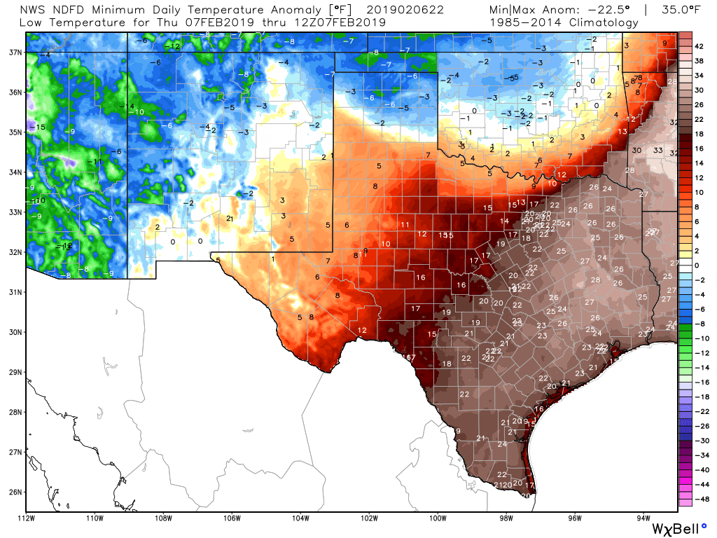
Lows on Thursday morning are about 25 degrees warmer than normal in Houston. (Weather Bell)

Thursday

Patchy fog has developed near the coast this morning, but for the most part coverage is thin inland due to some moderate surface winds mixing things up. The front should reach areas northwest of the region this morning, push through the city itself around noon-ish, and move off the coast this afternoon. In terms of rainfall, we’re still looking 1 to 3 tenths of an inch of rain, with the potential for some thunderstorms near the frontal passage. It’s probably not a bad idea to send your kids to school with a sweater for this afternoon, but temperatures aren’t really going to start falling until around sunset. Winds will gust this evening at or above 20mph, and lows Thursday night will drop into the low 40s, generally.

See full post

Record warmth for one more day in Houston before a front

Houston appears to have set a record for a “high minimum” temperature on Tuesday, February 5th, when the low temperature at Bush Intercontinental Airport only fell to 68 degrees—breaking the mark of 67 degrees set in 1927. This morning temperatures are warmer still at the airport, with lows only bottoming out at 71 degrees as of 6:15am. Another record minimum therefore seems likely, and Wednesday’s high temperature may well threaten the daily high for February 6 (81 degrees, set in 2017). A front on Thursday will abruptly end the anomalous warmth.

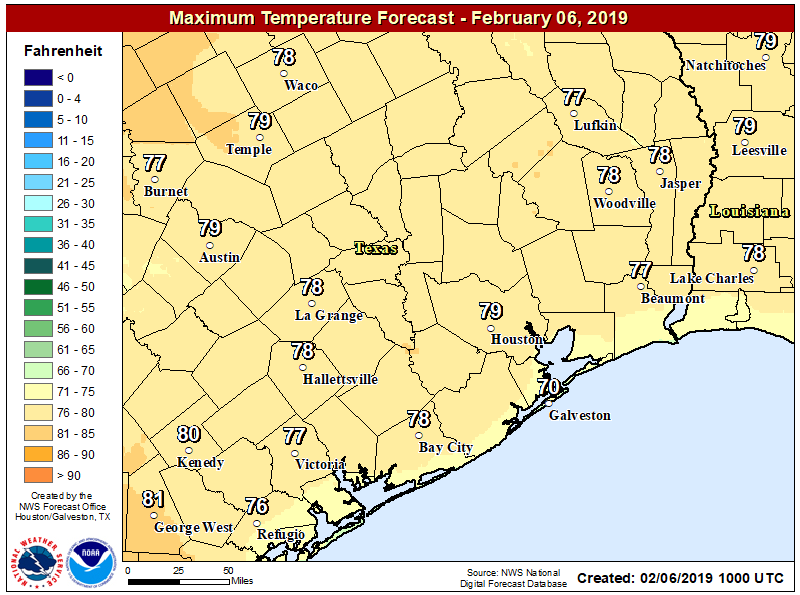
Wednesday highs will depend on whether there are any cloud breaks. (National Weather Service)

Wednesday

We can expect another warm and mostly gray day, much like we’ve already experienced this week in Houston. Highs should reach the upper 70s across the region, although we can’t rule out Houston’s first 80-degree mark if there are enough breaks in the clouds this afternoon. Slight rain chances will linger, but they should be only 10 to 20 percent for most of the area, with very light accumulations. Mostly just gray and warm today therefore, with south winds on the order of 10 to 15mph.

See full post

Soupy, warm weather remains in Houston until Thursday’s front

Dense fog is again the story this morning, as very warm air temperatures in the mid-60s overrun run nearshore sea surface temperatures 10 to 15 degrees cooler. It will take some time for the fog to burn off, perhaps not until late morning for some areas. We can expect foggy mornings (and nights) through Thursday morning before a cold front snaps the region back into more seasonal temperatures.

Tuesday and Wednesday

The next two days should more or less be carbon copies of Monday, with high temperatures in the mid- to upper-70s and lows only falling into the 60s. Some very light, very scattered showers are possible both days, but for the most part we should just see clouds. Perhaps the only notable change will be an increase in southerly winds on Wednesday, as lower pressures over the central United States bring winds up to 15 or 20mph.

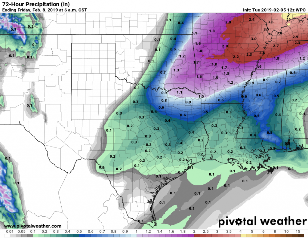
We don’t expect too much rain with this week’s cold front. (Pivotal Weather)

Thursday

A cold front remains on track to push through Houston on Thursday, likely during the middle of the day. Rain chances will increase Wednesday night and Thursday morning ahead of the front, but again, accumulations don’t look too serious, with most parts of the area perhaps picking up two or three tenths of an inch. A few brief-lived thunderstorms will be possible. By Thursday afternoon or evening, rains should end as much colder and drier air blows in, bringing nighttime lows into the low 40s for most of Houston.

See full post

Fog, gray skies, and then more gray skies in the forecast

As Matt noted Friday, we’re in the midst of “fog season” in Houston, when warmer air moves over the somewhat cooler nearshore coastal waters, bays, and inland waterways. Much of the region saw fog this weekend, and it is especially dense this morning, with visibilities down to one-quarter of a mile, less for some areas. The fog should slowly begin to dissipate this morning with the rising sun. We’ll likely see fog of various densities through Thursday of this week before a strong cold front moves through the area.

Monday, Tuesday, and Wednesday

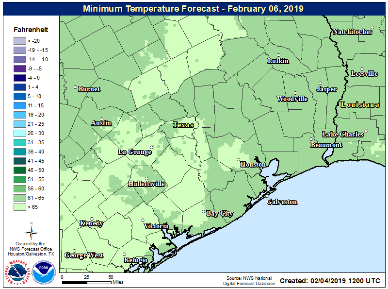
Aside from the fog, there isn’t too much to say about the region’s weather through the middle of the week. Days will be warm, with highs in the mid-70s, under mostly cloudy skies. Nights will be especially warm, with the cloud cover and moderate southerly air keeping lows in the mid-60s. This is about 20 degrees above normal for this time of year.

Lows Wednesday will be in the mid- to even upper-60s for parts of Houston. (National Weather Service)

Rain chances aren’t going to go away completely, but each day will only have about a 10 to 30 percent chance of rain, and any precipitation that falls should be light. Accumulations through Wednesday should be on the order of one-tenth of an inch for most locations.

See full post