Drier, warmer weather for Houston this weekend, but what about next week?

It’s been a somewhat gloomy late week, but we will gradually see some brighter skies roll in late today and especially this weekend.

Today

For most of us, Friday should start similarly, with a low, gray overcast. Clouds should gradually fracture a little, however I don’t think we will completely clear out today. But it won’t be the worst afternoon ever, with at least some sunshine. High temperatures will slowly warm to near or just shy of 60 degrees with a light north wind.

Tonight & weekend

Skies should clear out tonight. We will see low temperatures bottom out in the 40s.
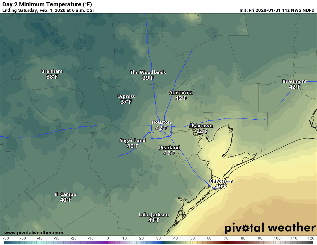
Overnight lows in the 40s for most of us tonight, with even some 30s Saturday morning, mainly north and west of Houston. (Pivotal Weather)

Both Saturday and Sunday look beautiful right now. Some high clouds may spoil the sky by late Sunday afternoon. But that would be all. If you have outdoor plans, you have the green light to go forth and enjoy on either day!

We should warm into the 60s on Saturday, drop back into the 40s Saturday night, and warm back up to near 70° on Sunday.

See full post

It’s been a warm winter, but Thursday bucks that trend

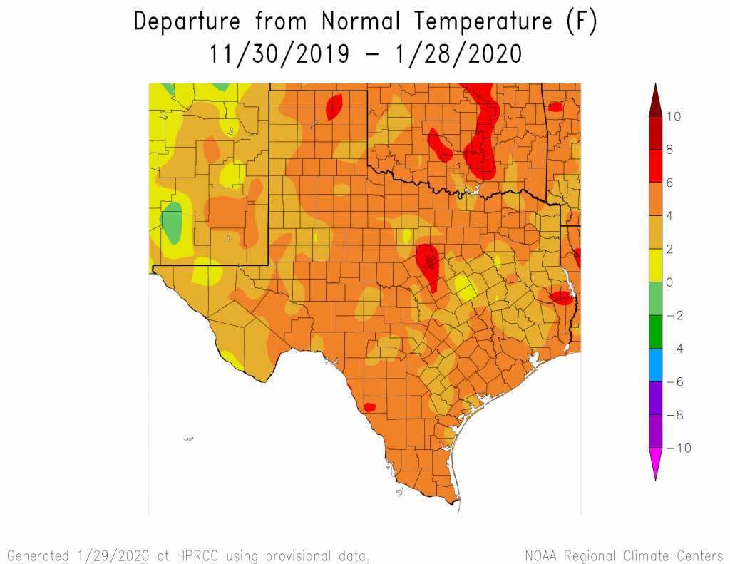
The tale of this Texas winter has yet to be fully told—for the purposes of this site, we’ll define winter as December through February, which is known as meteorological winter. But for the entirety of Texas temperatures have been warmer than normal, with much of the Houston metro area 4 to 6 Fahrenheit degrees above normal. NOAA’s climate outlook calls for about near-normal temperatures in February for the region. The bottom line: If you’ve thought this winter lacked oomph, you’re right. At this point the chance of another freeze in central Houston is probably less than 50-50, but we’re far from being able to say that definitively.

The departure from normal temperatures for Texas, for the last 60 days. (HPRCC)

Thursday

Today will buck the trend of a warmer winter, as clouds and a northwest wind will conspire to keep highs generally in the mid- to upper 50s across the region. Some mostly (very) light and scattered rain showers will be possible today and Thursday night as temperatures drop into the upper 40s. Accumulations for those who receive rain today and tonight should be slight, mostly measuring one-tenth of an inch or less.

Friday

A reinforcing front arrives on Friday morning, which should keep highs in the 50s, and help lead to some clearing of skies during the afternoon hours. Friday night will be chilly, dropping into the upper 30s for northern parts of the metro area, while remaining in the 40s in the city and points south.

See full post

Cool weather until the weekend, which looks quite nice for Houston

It’s a breezy, chilly morning, with temperatures in the 40s and winds gusting above 20mph across most of Houston. We’re really not going to see temperatures much above 60 degrees until the weekend, when conditions look rather pleasant

Wednesday

We had been hoping to see some sunshine today, but there’s enough moisture above the surface to generate some clouds this morning. As a result, we’re likely to see partly to mostly cloudy skies throughout the day. Add to that steady northwesterly winds in the 10-15 mph range, with stronger gusts, and we’ve the makings of a cool day. Highs will probably top out in the upper 50s to 60 degrees. Low temperatures tonight will drop into the 40s under mostly cloudy skies.

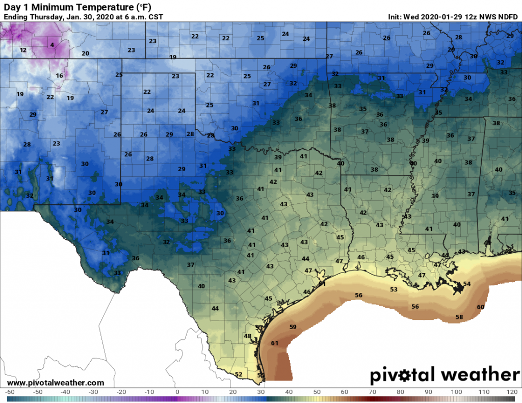
Expect another chilly night Wednesday night. (Pivotal Weather)

Thursday

We may see a little more sunshine on Thursday morning, but pretty quickly the high pressure in the wake of Tuesday evening’s front is going to move off to the east. This will open the region up to a couple of atmospheric disturbances. Highs Thursday should reach about 60 degrees again, with very slight rain chances during the afternoon hours. Chances increase during the overnight hours into Friday morning as a cold front approaches, but the models are keeping the the heavier rain showers offshore. As a result, I’d expect pretty much all of the Houston area to receive a tenth or two of an inch of rain—if that.

See full post

With Houston’s low clouds, Ship Channel shows up on radar

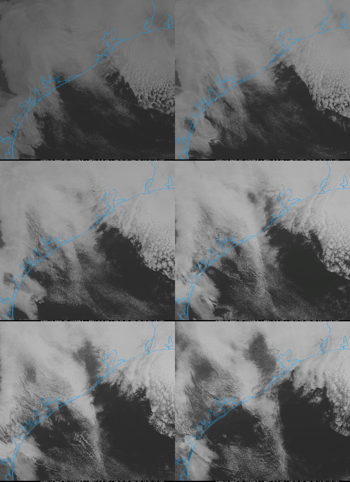
On Monday the state climatologist, John Nielsen-Gammon, called my attention to the visible satellite image page for the upper Texas coast. I’ve attached a snippet below, showing the period roughly from 8am to 1pm on Monday. If you look just northwest of Galveston Bay you can see the cooling stack plumes show up from some of the largest refineries in the Ship Channel. These facilities are leaving bow wakes in the low-stratus cloud layer.

This time lapse from a visible satellite images shows cooling stack plumes on Monday. (COD)

So what is causing this? The cause is weather-related, John speculates it is likely a combination of the following factors:

  • A well-defined temperature inversion at the top of the low cloud deck.
  • Weak stability and strong wind shear above the inversion that would enable waves to be trapped horizontally on the inversion rather than propagating upward and away.
  • A sufficiently shallow stratus layer that a bit of downward motion would be enough to temporarily clear out the clouds.
  • A sufficiently large volume of heated air rising from the plants to produce strong enough wakes to be seen.

In any case, the weather on the Texas coast is rarely dull! Now, on to the forecast.

Tuesday

A diffuse mass of mostly light to moderate rain showers will move slowly from west to east across the Houston area today. The showers, with possibly a few embedded, stronger thunderstorms, will probably persist through most of the daytime hours. Most parts of the region should see between 0.25 and 0.5 inches of rain throughout the day. The combination of clouds and rain will likely limit daytime highs to the upper 60s for most of the region. After sunset, a cold front will sweep through Houston to help dry the region out. Conditions tonight will be breezy and colder, dropping into the 40s.

See full post