An active weather pattern over Texas will slowly increase our shower chances each day this weekend. Generally, the deeper into the holiday weekend you go, the better the rain chances will become. Today and tomorrow probably won’t be too bad. Sunday could see heavier rain west of Houston and Monday could see more widespread coverage of thunderstorms in the Houston area. Specifics beyond “showers and storms are possible” will be hard to come by more than 12 to 18 hours in advance; such is the nature of weather patterns like this. Let’s walk through each day and tell you what we know at this time.
Today
Expect some clouds and some sun today, with sun probably becoming more dominant as we roll toward afternoon. There’s a little more moisture available today, so we will at least mention that a shower or storm is possible. As I am finishing writing this, it’s evident that some showers have popped up out toward Wharton County and up through Columbus, well west of Houston but somewhat sudden and unexpected this morning. We think most activity should be spotty (call it like 10 to 20 percent or so), and storms should be very much the exception, not the rule today but hopefully these morning showers are not a harbinger of a busted forecast to come. We will see!
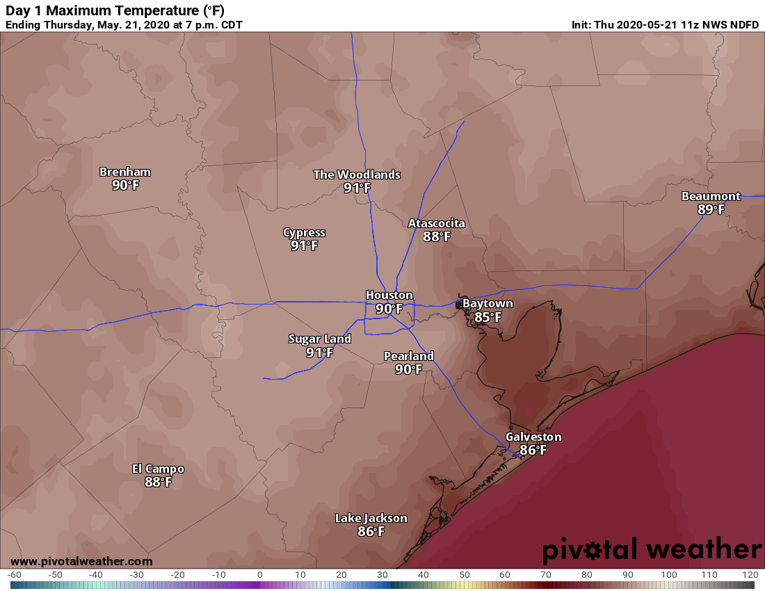
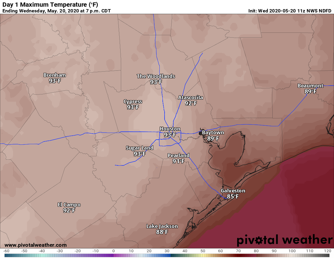
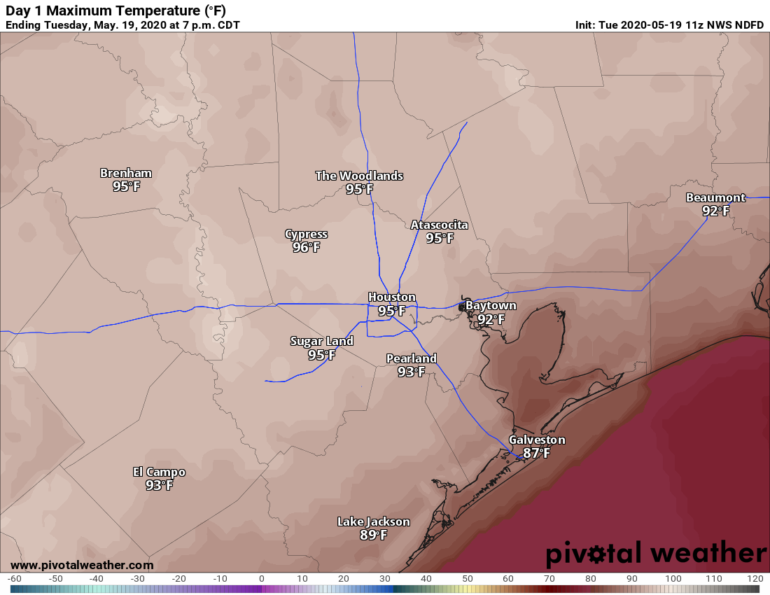
It’ll be hot and humid with highs around 90° or so for the fifth day in a row.
Tonight
Another round of showers and storms in North Texas may just have enough “oomph” to hold together as it drops south and east late tonight. We could see a shower or a thunderstorm, mainly north of Houston after 3 AM or so. For most of us? Just mostly cloudy with a slight shower chance or some mist. Lows will be in the 70s.
Saturday
On Saturday, the best ingredients for thunderstorms remain mostly inland or to our west, which means Hill Country may be the favored area for more numerous showers. We’ll call it a spotty day once again for Houston with a few showers or storms possible, once more being the exception rather than the rule. Odds of storms may go up a bit as you go to the north and west of Houston.
Look for another hot day with highs likely staying in the upper-80s or low-90s under partly to mostly cloudy skies.
Sunday
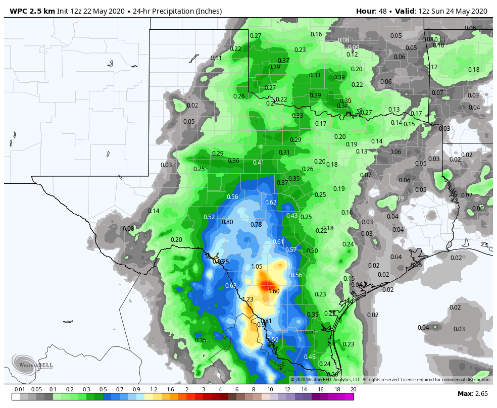
So on Sunday, the best ingredients for storms drift a little closer to Houston. While we think the coverage of storms will still be highest to the west of Houston, there should be slightly better odds for much of the area to see storms. I would say storm chances jump up close to 50 percent on average for Sunday afternoon, higher west of I-45, lower east of I-45.
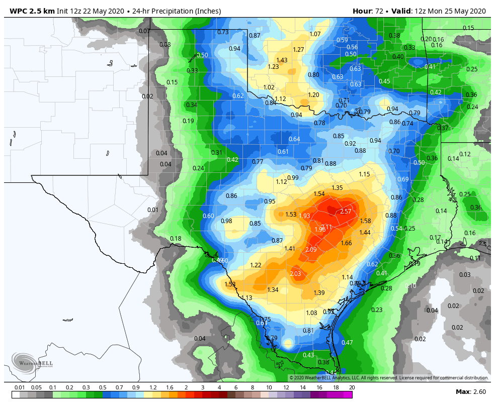
Sunday’s storms could also be better organized than what we see Saturday in Texas, so heavier rain is possible. We would say that areas west of Grand Parkway up through Conroe stand the best chance of heavier rains impinging on plans Sunday afternoon. But again, specific details are tough to pin down, so most of the area has at least a chance at some storms Sunday.
A muggy Sunday morning in the 70s will give way to highs only in the mid-80s, maybe upper-80s with clouds.