Here’s the latest on Houston’s winter storm and exceptional cold

Good morning. Before jumping in to the forecast, I wanted to spend just a moment discussing why some areas of the region will see snow on Sunday night and Monday, and others sleet or freezing rain. It has to do with the temperature in the column of air above the surface, through which precipitation falls.

Snowflakes form high in the atmosphere, and if the temperature remains below 32 degrees as they fall thousands of feet to the surface, they remain snow. However, if there are pockets of warmer air and then sub-freezing temperatures again, sleet will form as snowflakes, melt, and then re-freeze as small ice pellets. And finally, if there is warmer air near the surface, but not at the surface, we’ll get freezing rain. The graphic below helps depict these processes.

How different types of winter precipitation form. (National Weather Service)

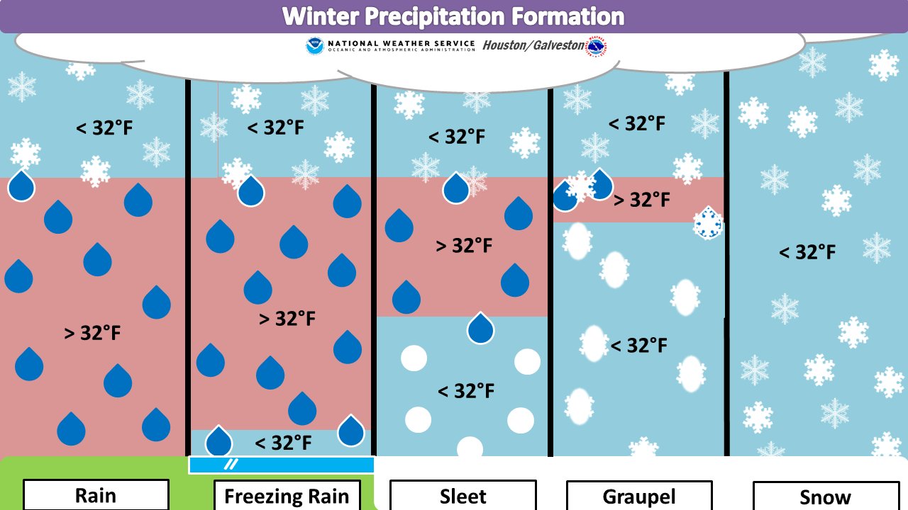
This is the primary reason we think freezing rain is most likely near the coast—where the Arctic air mass will be most modified by the warmer Gulf of Mexico near the surface—and snow most likely over areas well inland. In terms of roads and potentially power lines, freezing rain is most problematic because it only takes a little to stick to roads and make them icy, and not that much more to accrue on power lines and weigh them down, or become more susceptible to blowing winds.

We’re starting to get closer to Monday, so higher resolution models are beginning to come into our forecasts, and as they do so confidence in which types of winter precipitation, and how much will fall, will increase.

Saturday

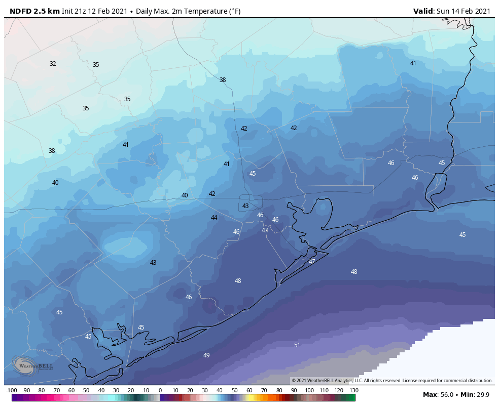
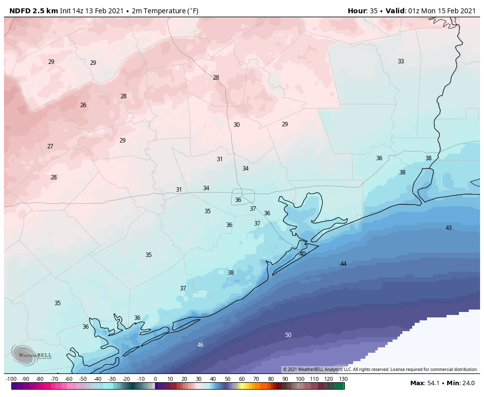
Temperatures are above freezing across the Houston area this morning, but only barely. They won’t rise a whole lot today, likely only reaching the upper 30s in Houston, and near 40 degrees along the coast. Buy hey, that’s better than freezing, right? In terms of wintry precipitation, our concerns now begin tonight for parts of the metro area northwest of a line from Katy to Tomball to Conroe. This is because lows for those areas are now expected to fall to about 30 degrees. This, in concert with light precipitation, could lead to some icing on elevated roads and bridges.

Sunday

Highs on Sunday should get into the mid-30s for even these inland areas, and warmer in Houston itself, so traveling across the metro area after mid-morning on Sunday should be fine. But the further west and north you go, you’re still going to run into freezing conditions.

Conditions begin to deteriorate by around sunset on Sunday in Houston. This is when we expect widespread precipitation to move into the area, and temperatures to begin to fall below 32 degrees. Some inland areas won’t see above freezing temperatures again until Wednesday.

Freezing temperatures begin to reach northern and western Houston by sunset on Sunday. (Weather Bell)

Sunday night and Monday

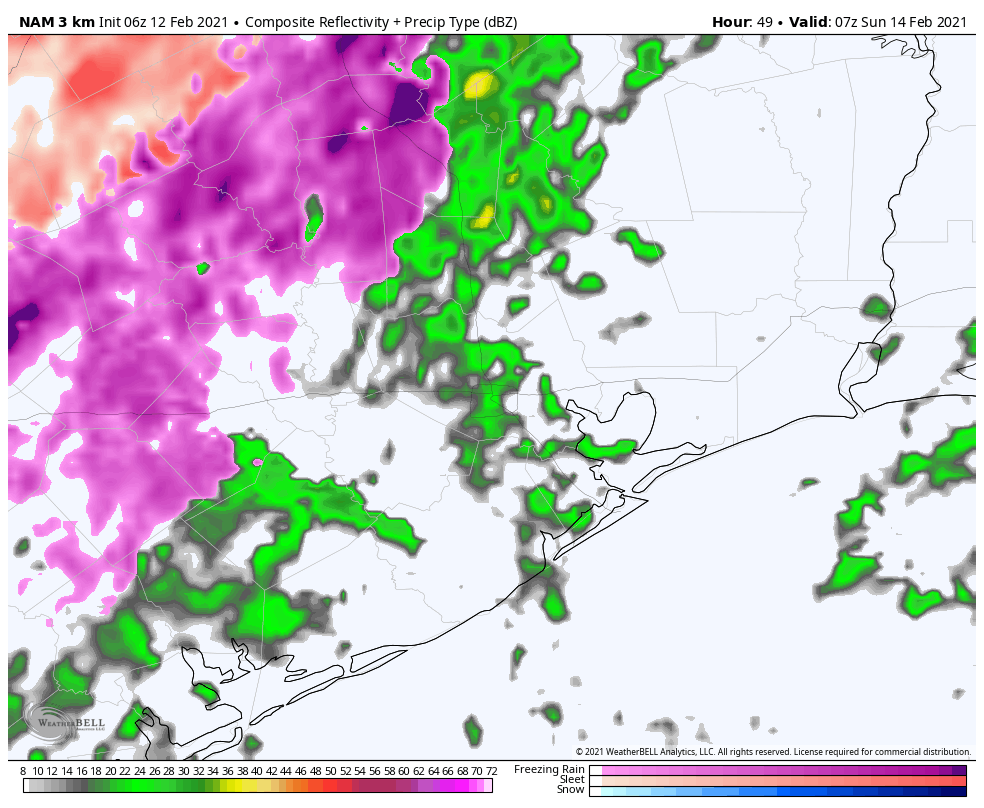
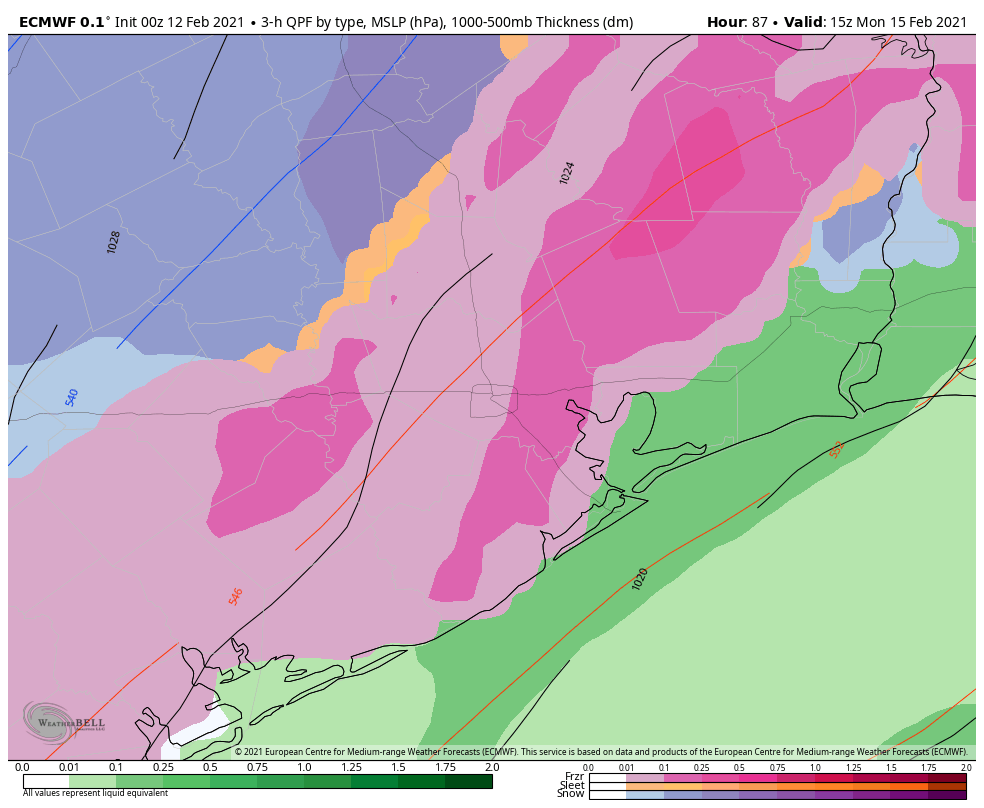
This is when conditions on area roadways will become treacherous. As noted above, we expect snow to fall across inland areas where temperatures are the coldest, but we don’t know where snow will switch to sleet, only that this line will likely be somewhat north of Interstate 10. In terms of accumulations, here is our best forecast at this time, but it remains highly subject to change as additional high-resolution forecast models enter the picture.

Snowfall: For areas that receive it, about 1 inch, with 2 or more inches possible for Conroe and areas north of there.

Sleet: About 1 inch for central parts of the Houston metro area, with less north (where there will be more snow) and south (where freezing rain is more likely).

Freezing rain: About one-quarter inch for areas along and south of Interstate 10.

It now appears likely that precipitation will wrap up by around Noon on Monday, if not shortly before. Unfortunately, because temperatures at that time will probably only be in the low 20s for most of the area, whatever falls on the roads is not going anywhere. Moreover, with winds gusting out of the north above 30 mph, especially along the coast, it will feel like 10 degrees or below. Finally, these winds could play havoc with iced over power lines. So yeah, Monday is a day to stay home and hunker down.

Tuesday

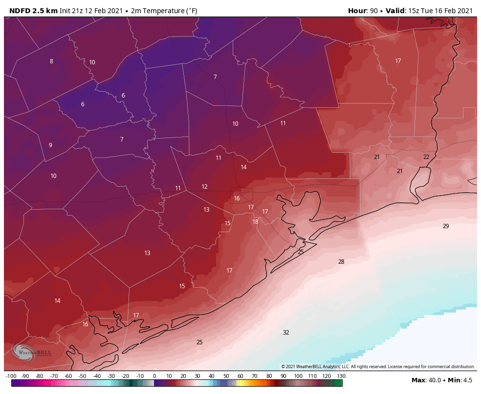
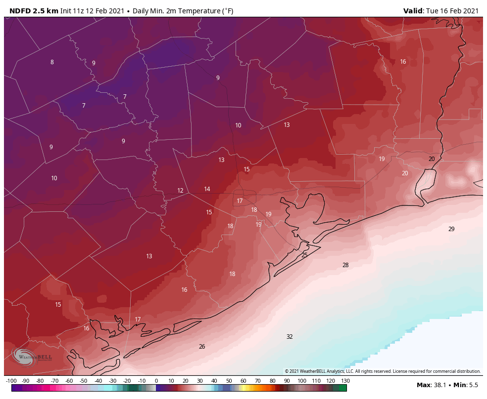
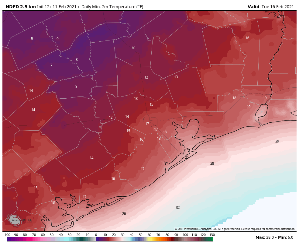
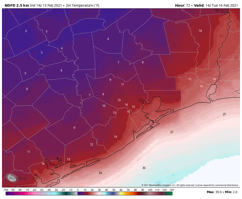
After the precipitation ends, skies may begin to clear overnight. With extremely cold air in place, this will allow for ideal cooling conditions heading into Tuesday morning. And it will be exceptionally cold for Houston. Areas where there is snow on the ground, well west and north of Houston, may see temperatures of 5 to 10 degrees, and the coast will only be marginally warmer, in the low 20s. (The all-time record low for Houston is 5 degrees, set in 1930.)

Forecast temperatures for 6am CT Tuesday. (Weather Bell)

Temperatures should reach above freezing, if barely, for areas south of Interstate 10 on Tuesday. But areas north of that line may continue to see freezing temperatures throughout Tuesday and Tuesday night. Lows will not fall much Tuesday night.

What this all means for roadways in the Houston for Tuesday morning and beyond is unclear. It will depend on how much precipitation falls Monday, in what form, and whether efforts to de-ice roadways are effective. I can offer no good predictions here, sorry.

Wednesday, Thursday, and Friday

Unfortunately, another round of precipitation is likely on Wednesday, as moisture moves inland from the Gulf of Mexico, and another front approaches. This will fall as rain on Wednesday, but for inland areas at least it could turn into sleet or freezing rain on Wednesday night—at least for areas along and north of Interstate 10.

The details of this are still very much in flux, but there’s a chance for more icy roads on Wednesday night and Thursday morning. At this time we do anticipate less impact than we’re likely to experience on Monday. Lows drop into the 20s on Thursday night, probably, before finally warming well above freezing on Friday.

And that’s the end. Saturday should get into the 50s or so, and by Sunday we’re back to highs in the 60s. Until then, it’s going to be absolutely frigid. Stay safe, y’all.

Matt will have a brief update on the forecast later today, and also take a first stab at historical significance of this kind of winter event for Houston.


Some Friday evening thoughts on Houston’s looming winter storm

Good evening. The overall forecast picture has not changed much today. We still expect a winter storm on Monday, with widespread problems on area roadways, followed by an extremely cold night and frigid Tuesday. Matt’s post from this morning still holds up well, but I just wanted to add a few more things that are becoming clearer as we get closer to the hard freeze.

There is still time to prepare

Conditions have fallen below freezing across much of the state, but most of the Houston metro area should remain above freezing until Sunday evening. That’s not to say it will be pleasant this weekend—highs are unlikely to rise above the low 40s, and there will be a chance of drizzle or light rain, especially Saturday night.

High temperatures on Sunday, which is your last day to prepare. (Weather Bell)

However, that means you still have the weekend to prepare for the winter storm, from wrapping your pipes or covering your garden for a hard freeze, to running to the grocery store. However, it now seems likely that by as early as Sunday evening light rain could turn to freezing precipitation. This means you should plan to be home, or wherever you’re going to hunker down, by around sunset on Sunday.

Monday looks pretty bad

Temperatures will fall below freezing Sunday night, and stay there for all of Monday, with the possible exception of Galveston and other beach locations. By tomorrow the higher resolution models should provide us more clarity on exactly what type of freezing precipitation will fall in Houston. But for the most part, we expect a mix of freezing rain and sleet in the city, with a greater likelihood of snow north of Houston.

Freezing rain would be the worst outcome, because as little as one-tenth of an inch will be enough to glaze over roadways. As more falls, it starts to accumulate on power lines, and that could eventually lead to power outages. Some recent models are leaning more toward sleet (ice pellets) than freezing rain, which would be good. We expect precipitation to end by early Monday afternoon, but with temperatures below freezing the ice isn’t going anywhere.

The bottom line: many if not all roads will be a mess either way, and you should stay home. If you’re an employer, you should at the very least tell employees to come in late on Monday, pending a final call. By early Monday morning we should have a better sense of just how bad things will get.

Models have trended slightly colder

If anything, the major models have trended slightly colder with lows on Monday night and into Tuesday morning. It now seems possible that areas of west Houston (i.e. Katy or Sugar Land) could see temperatures drop to around 10 degrees, with central Houston at about 15 degrees.

This is extraordinary cold. The all-time record low temperature for Houston is 5 degrees, set in 1930.

Current forecast for low temperatures on Tuesday morning. (Weather Bell)

I would caution that there is still some wiggle room in the temperature forecast. There are a couple of factors that will ultimately determine lows on Tuesday: extent of snow cover, if any; whether clouds clear out before sunrise, and how calm winds become. But we are highly confident in a very hard freeze for the entire area.

When does this end?

Something else we’re trying to track is when this mess ends. It now seems pretty clear that any roads iced over will remain so through Tuesday night given the cold temperatures. The big question is whether temperatures will warm up enough on Tuesday to melt any icy or snowy roads.

There is not much agreement on this in the forecast models, but for now I think at the very least areas along Interstate 69, and closer to the coast, will warm to above freezing levels. I’m less certain about west and northwest parts of the metro area. Wednesday should bring above-freezing temperatures back to the area.

However, yet another front will bring more Arctic air into the region toward the end of the work week. We think there is a chance of yet another hard freeze on Thursday or Friday morning, and we can’t preclude more of a wintry mix on Wednesday or Thursday. We are reasonably confident that temperatures will recover by next weekend. So if you’re looking for an end to the winter madness, it’s likely coming about seven days from right now.

We’ll have a full update on the forecast on Saturday morning.

A major winter storm followed by brutal cold will impact the region on Monday & Tuesday

Bonafide winter has arrived in Texas, and we’re just getting started. This may be Texas’s most severe and damaging cold snap since the 1980s, and it’s going to come with a significant mess on Monday, so do read on.

Today

After yesterday’s fireworks via quite a few thunderstorms in the area, we expect today to be a bit quieter. There should still be some showers, and there may be some drizzle as well. But we aren’t expecting much more than a few hundredths to tenths of an inch of rain today, and some areas will stay completely dry. The best coverage of showers should be south and east of the city. With plenty of clouds, temperatures won’t go far today. Look for highs maybe getting to 40 degrees or so, low-40s if you’re lucky.

Note to those traveling north or west of Houston, as we get a lot of questions: There may be some patchy freezing drizzle well off to our north, especially this morning. So if you’re headed to Austin, Waco, or Dallas, be hyperaware of road conditions. Bookmark drivetexas.org for updates for the state and the Houston TranStar site for additional local conditions.

Saturday & Saturday night

Tomorrow will likely be a similar sort of day to today. Expect clouds, some showers, some light rain or drizzle, and cold temperatures struggling to get to 40 degrees or so. There could be a slightly more vigorous disturbance that pivots through very late in the day Saturday or Saturday night and brings more numerous showers. If that happens, there is the chance that areas north of I-10 get close to the freezing mark and freezing rain (ice) could become an issue.

Forecast radar from the NAM model for 1 AM Sunday morning, showing rain in the Houston area (green) and freezing rain or drizzle north and west of Houston (pink). Just one model’s depiction, so we’ll need to watch this period closely. (Weather Bell)

This would likely be mainly focused on the nighttime hours. The Houston area should just see a cold rain, but if you have to make your way north of Houston for any reason after 6 PM Saturday, you will want to pay particularly close attention to any forecast updates this weekend. Lows bottom out in the low- to mid-30s.

Sunday

That Saturday night disturbance should exit stage right on Sunday morning, and the majority of Sunday looks dry but cloudy. Because of the generally drier conditions, we may be able to sneak into the low or even mid-40s on Sunday afternoon.

Sunday night through Monday afternoon

So, here’s where the troubling part of our forecast begins to emerge. As we’ve been discussing for days now, a strong disturbance and storm system are going to pass through the region on Monday morning. We are growing highly confident in wintry precipitation impacting almost the entire region, including the coast on Monday now. There is a good chance that travel may become close to impossible anywhere in the Houston area beginning early Monday morning.

Here’s what we know right now:

  • Rain, or a wintry mix will develop on Sunday night.
  • It will likely quickly transition to all freezing rain and/or sleet, except maybe at the immediate coast before sunrise Monday.
  • Precip may be heavy at times Monday morning.
  • Frozen precip will likely end as some sleet or snow flurries by early Monday afternoon.
  • Ice and/or sleet accumulation is likely across much of the area.
  • Temperatures will likely remain below freezing all day Monday, dropping into the lower 20s by afternoon.
  • Winds will gust to 20-25 mph most of the day Monday.

Now, for what we really don’t know:

  • Whether sleet or freezing rain will be the dominant precipitation type (snow seems mostly unlikely except well north and west of Houston or at the very end of the event).
  • How much sleet and/or freezing rain falls.
  • If there will be snow accumulation at the end.
  • The exact timing of the storm. (still some 3+ hour differences among various weather models)
  • How many power outages will occur.

Those first two points are very important, as there is a monumental difference in impacts between an all-sleet storm, an all-ice storm, and an ice storm followed by sleet. A couple inches of sleet is a nuisance, but it’s not severely problematic. A tenth to quarter-inch of ice with gusty winds and bitter cold could be extremely problematic. And a layer of ice caked over by sleet or wet snow is even more problematic. Unfortunately, we really aren’t good enough to predict winter storm precipitation totals to that specificity this far in advance. I can tell you that having looked at model data, they are loudly implying that a large portion of the area will be at risk for icing on Monday. This event will likely be problematic.

Forecast precipitation types from the ECMWF (European) model on Monday morning. Freezing rain (pink) would extend from the Houston metro to about the coast, with sleet (orange) and snow (blue) off to the northwest of Houston. This is, again, just one model’s depiction of the weather, however other models we use aren’t terribly different. (Weather Bell)

Much like flooding events, models struggle mightily when it comes to exact placement of the bullseye of a winter storm. But even putting that aside, any amount of ice on the roads here will make travel close to impossible, and that seems to be the direction we are heading for Monday.

So to summarize: A winter storm will impact the majority of the region late Sunday night through Monday afternoon with a sleet or ice storm being the most plausible outcome right now. We would strongly encourage folks to prepare to remain wherever you are from Sunday night through Tuesday morning. This forecast will change between now and then, and Eric and I plan to keep you posted all weekend long.

Monday night & Tuesday

The temperatures will be the big story once our storm exits Monday afternoon. We will likely see highs on Monday near freezing very early, dropping into the low-20s by afternoon. Those temperatures will continue steadily downward Monday night. The current forecast from the National Weather Service for Tuesday morning is shown below.

Forecast low temperatures for Tuesday morning. We likely haven’t seen a map like this since December 1989. (NWS via Weather Bell)

Yeah, that’s cold. We are expecting the city of Houston to bottom out at 15 to 20 degrees. The western and northern suburbs will likely fall to 10 to 15 degrees. Bay Area and coastal locations will be around 20 degrees, give or take. If we were to somehow see accumulating snow on Monday, you could probably subtract another 1 to 3 degrees from these values at least. The last time Houston officially hit 15 degrees? December 1989.

Tuesday will see sunshine at least! We should break out above freezing by late morning. The combination of the sun and temps in the mid-30s should allow us to melt most of Monday’s ice. We hope.

It’s worth noting that this won’t be just an extreme cold event in terms of temperature. It will also be so in terms of duration. Temperatures will likely drop below freezing in Houston on Monday before sunrise and not make it above freezing til mid or late Tuesday morning. This will easily be a 24 to 36 hour stretch of subfreezing temperatures for Houston, with a longer-duration north of the city. It has been over 30 years since Houston has seen this kind of cold weather. You absolutely need to prepare your home for the impacts. Reliant has provided some very useful advice below. You can also read more cold weather prep tips here, here, or here.

Later next week

I’ll be honest with you: I don’t even want to think about later next week right now, but the reality is, more headaches are likely. Another storm system is likely to impact the region on Wednesday into Thursday. This will also potentially carry a potpourri of precipitation types. Whether we see snow, more ice, or just plain rain remains to be seen. More cold will follow, and although we are unlikely to see the teens again, there is some chance we have another hard freeze (mid-20s?) by Thursday or Friday mornings. We’ll get more into that Sunday or Monday.

Note from Our Sponsor:

As Houstonians are prepping their attire, gardens, pets and plans for the freeze, Reliant wanted to share some tips on prepping your home to stay warm during the expected winter weather.

Stay Warm Tips:

Here are a few things you can do immediately to reduce energy consumption and still stay comfortable. Best of all, they’re simple and free.

  • Let the sun in. Open blinds and shades during the day and remove any solar screens so the sun can warm your home.
  • Check your thermostat settings. For every degree above 68°, you can expect a 3-5% increase in your heating costs.
  • On vs. auto. Ensure the fan on your thermostat is set to “auto” not “on” to prevent it from running 24/7.
  • Close heat escape routes. Be mindful of how often you’re using bathroom or utility room ventilation fans and ensure the damper on your fireplace is closed when not in use, as heat can escape from your home through these outlets.
  • Set your ceiling fan to rotate clockwise. This helps force warm air down from the ceiling into the room to create a more comfortable environment in colder seasons.

Home Prep Tips:

A few home improvement projects can help keep your heating system from working harder than it needs to.

  • Consider installing a Nest programmable thermostat. This can help you reduce energy usage by up to 15% without lifting a finger.
  • Eliminate cold air leaks by weatherstripping exterior doors and windows. This is a relatively quick and inexpensive way to help save up to 10% on total energy costs. A few additional places to check are pull-down attic stairs, dryer vents and exterior wall outlets.
    • Try the paper test: Open an exterior door, insert a piece of paper and close the door. If the paper comes out easily, the gap is too large and can contribute to cold air leaks.
  • Get an annual heater tune-up. Make sure your furnace or heat pump is clean and in good working order, so that it can run as efficiently as it should.
  • Check your insulation. Ultimately, a home without proper insulation and weatherization can lose up to 40% of heated or cooled air.

Check out more on winter weather prep and common causes of high winter electricity bills here.

The latest on extremely cold weather coming to Houston, and snowfall potential

The Arctic front has pushed all the way off the coast and temperatures this morning are in the 30s and 40s. Welcome to your new reality, Houston. It’s possible the region won’t see temperatures in the 60s again for a week to 10 days, and there will be plenty of freezing weather in between. Our biggest concerns remain focused on next Monday—when roads could turn icy across much of the region—and Tuesday morning when lows could drop into the teens.

Thursday

Today will be rather grim, in terms of weather, with widespread showers and highs only reaching into the mid-40s. Most areas will likely see on the order of 0.5 to 1.0 inch of rain or so today and tonight, with higher amounts definitely possible underneath heavier showers. Lows tonight will get into the upper 30s, but stay above freezing and therefore keep roadways wet rather than slick in the metro area.

Friday

I think we’ll continue to see the potential for light rain on Friday, although the showers will not be as widespread as on Thursday. When it’s not raining, skies will be gray, and temperatures should again peak in the low 40s.

NOAA rain accumulation forecast for now through Friday. (Weather Bell)

Saturday

The region should see a break in precipitation from Friday night into Saturday. Perhaps we’ll even get a peek at the Sun? Anyway, it won’t matter much as highs should remain confined to the mid- to upper 40s. Some slight rain chances may return later in the day or during the evening as an upper-level system approaches from the west. For now, low temperatures Saturday night will probably remain just above freezing in most of Houston, but inland areas may well see their first (of several) freezes during the coming stretch.

Sunday

Sunday will be another cold, gray day for the region. The models seem a little more bullish on some light rain falling, so lets call it 30 percent during the daytime. (It’s possible that some areas north of Conroe may see this falling as snow or freezing rain). Highs will be in the 40s, and as additional cold air starts moving into the region temperatures on Sunday night should drop into the 20s—mid- to upper-20s, maybe?—in the city of Houston, with colder conditions inland. The immediate coast may still avoid a freeze. We’ll see.

This colorful map shows the probability of an area receiving 1 inch, or more, of snow next week. For most of Houston, this value is 20 to 40 percent. (Weather Bell)

Monday

The outlook for Monday, which surely will change further so please bear that in mind, now looks to bring widespread, mostly light precipitation into the region from around sunrise to sunset. Because temperatures will be in the vicinity of freezing for much of the day, this raises the important question of whether this falls as cold rain, freezing rain, sleet, snow, or all of the above. At this point I’m reasonably confident that areas north of Interstate 10 will be cold enough on Monday, during the day time, to see some sort of wintry precipitation. I think the jury is still out on areas closer to the coast. But again, this day has the potential to be a real mess for traveling through the region, so be preparing for that possibility now.

Tuesday

We now think the precipitation will end sometime on Monday evening, or so, and this may allow for some clearing skies overnight and into Tuesday morning. (Will this allow roads to dry by Tuesday morning? It’s difficult to say). Regardless, the absence of insulating clouds will create ideal conditions for cooling with this very cold air mass. The region is virtually certain to see a hard freeze on Monday night and Tuesday morning, with lows potentially from 10 to 25 degrees in the city of Houston. This will wreak havoc with exposed exterior pipes and vegetation, and animals must not be left unprotected in these kinds of conditions. Check on neighbors to make sure their heat is working. Sunshine should allow temperatures to recover into the mid- to upper-30s on Tuesday. Lows Tuesday night will again flirt with freezing levels.

Current forecast for low temperatures on Tuesday, February 16. (Weather Bell)

Wednesday and beyond

Forecast models indicate yet another reinforcing front moving into Houston on next Thursday or so that may again lead to a widespread freeze and raises the potential for some more wintry precipitation. I have zero confidence in trying to forecast that period. By next weekend we should finally be headed back toward days in the 60s and nights in the 40s, and this will all behind us. Spring, after all, isn’t too far away. But it’s not coming today!

Matt and I will, of course, be with you for the duration of this event.