With the persistence of heat and drought, wildfire risks are on the rise

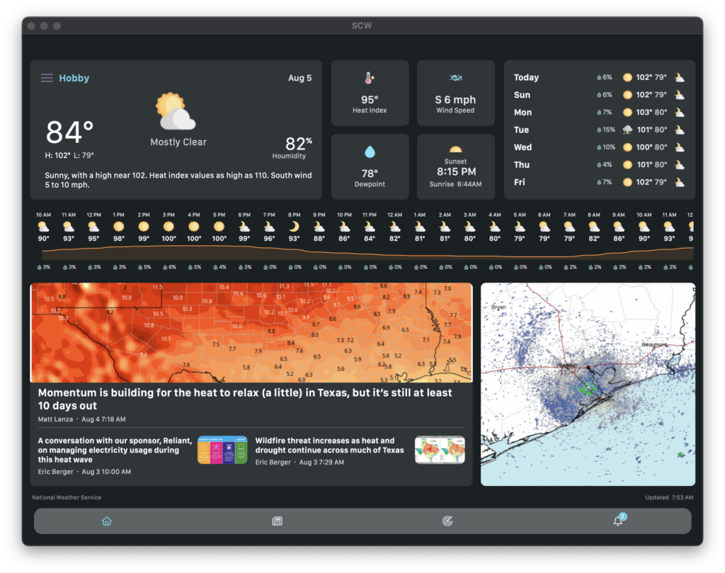
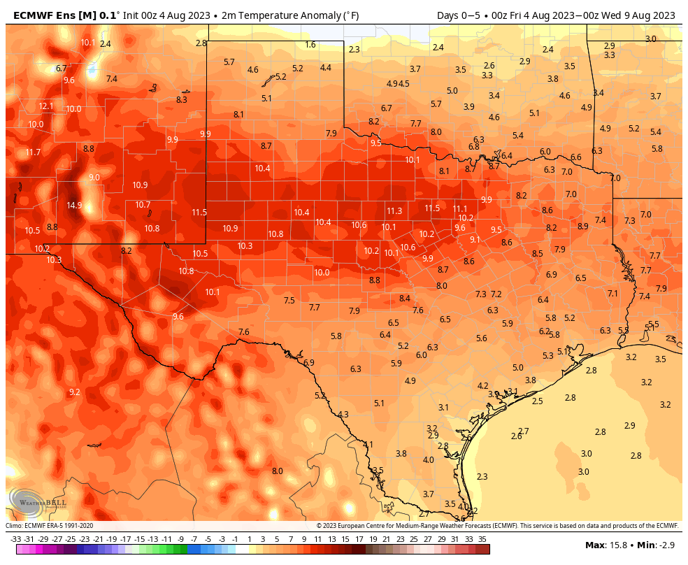
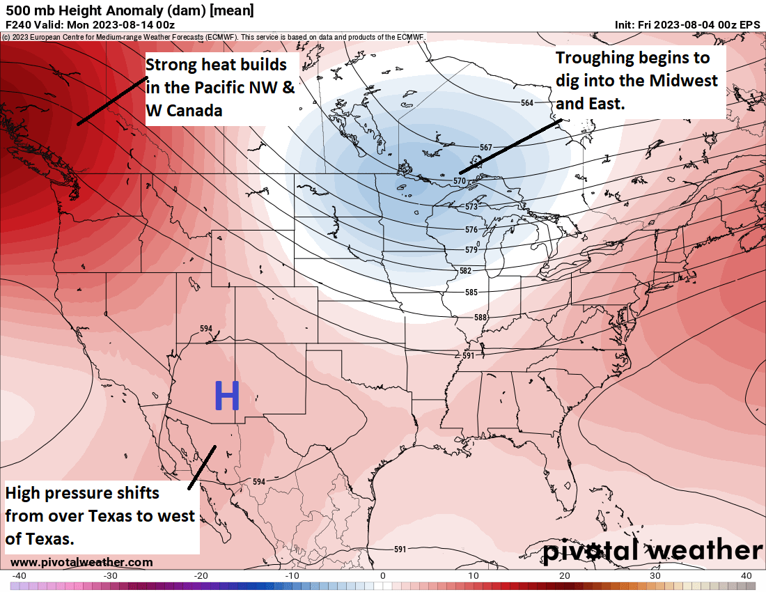
Good morning. Alas, our forecast remains largely unchanged. High pressure is dominant today. High pressure will be dominant tomorrow. And that persistent ridge is going to remain into place at least through early next week and very likely beyond. This means a couple of things:

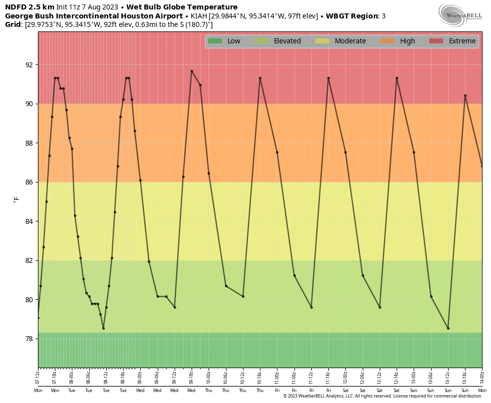
  • First of all, please continue to practice heat safety. It is hot, hot, hot during the midday hours and you should know the signs of heat related illnesses.
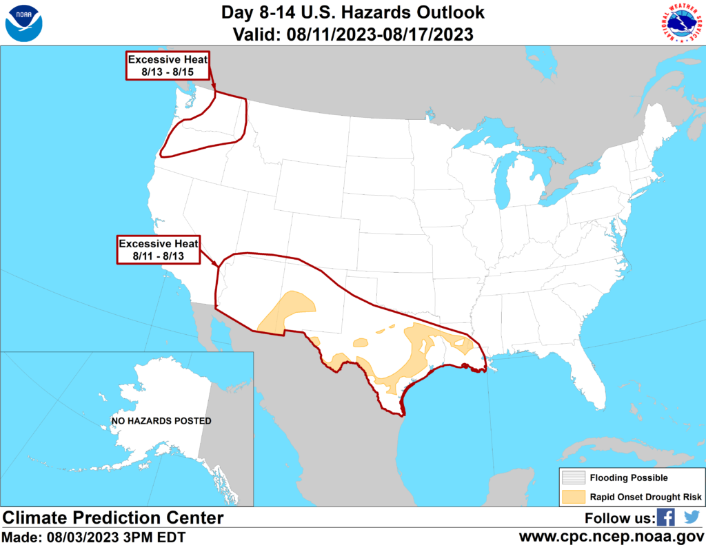
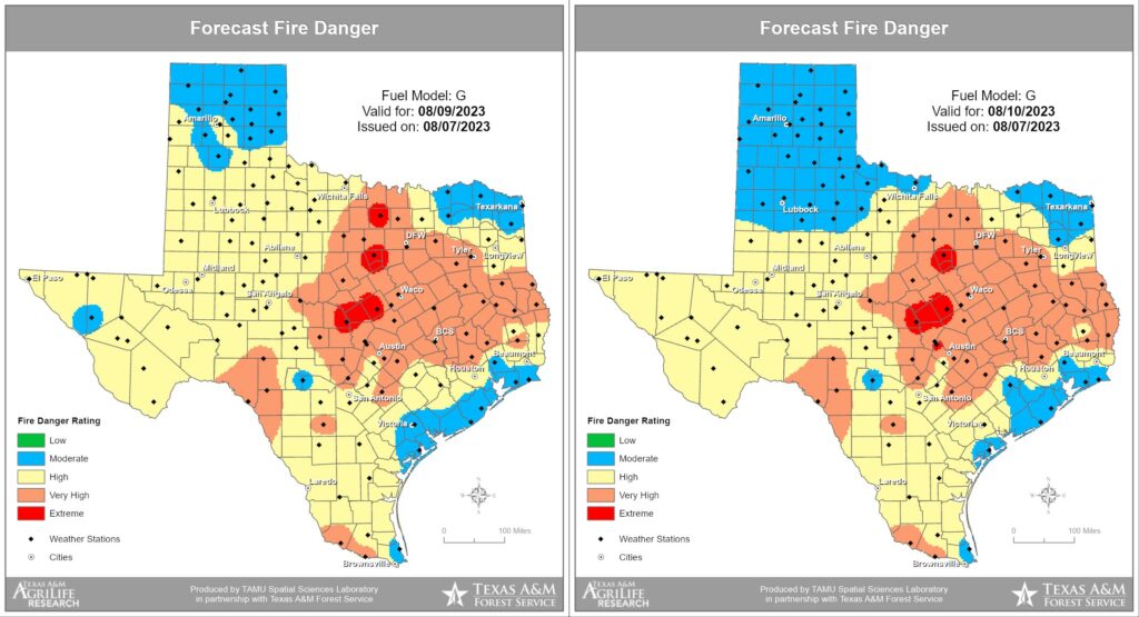
  • Secondly, we’re continuing to see high to very high fire danger conditions across much of the Houston region, especially for Montgomery County and areas further inland. The state has seen dozens of wildfires recently, and the number is on the uptick.

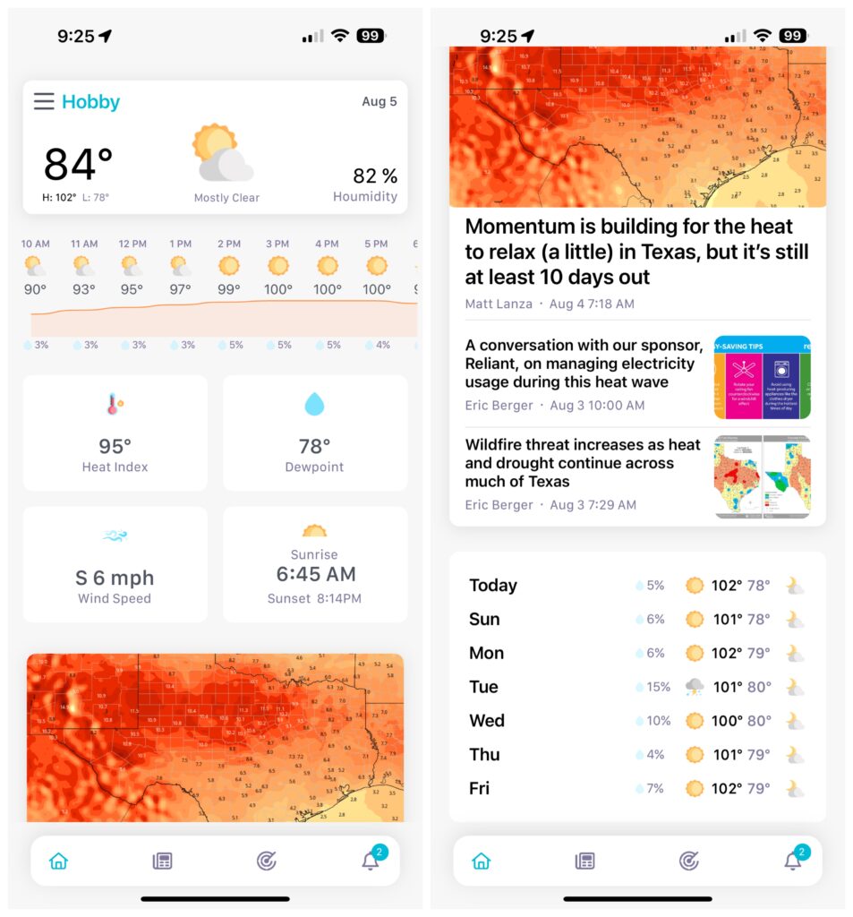
Also, I want to mention again that we’ve released an updated version of the Space City Weather app for mobile phones and tablets, and it is one we’re really proud of because it brings a lot of the features you’ve requested. It’s also the one way to ensure that you never miss a post during inclement weather. Which, presumably, we’ll have one day again in the future. You can find the app in both Apple’s App Store and the Google Play Store

Fire danger forecast for Wednesday and Thursday of this week. (Texas A&M Forest Service)

Tuesday

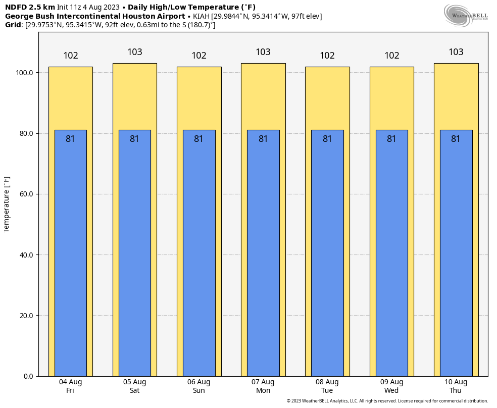
At this point, do I really need to write it out? It feels like we’re in the movie Groundhog Day. Highs today will be around 100 degrees, or slightly above. Skies will be mostly sunny. Winds will be out of the south, at about 10 mph, picking up a bit during the evening and overnight hours. Rain chances are 5 to 10 percent. Low temperatures tonight will drop into the low 80s.

Wednesday through Friday

Absolutely no change.

Saturday and Sunday

It’s still difficult to discern a meaningful change in the sensible weather.

High heat continues next week. (Pivotal Weather)

Next week

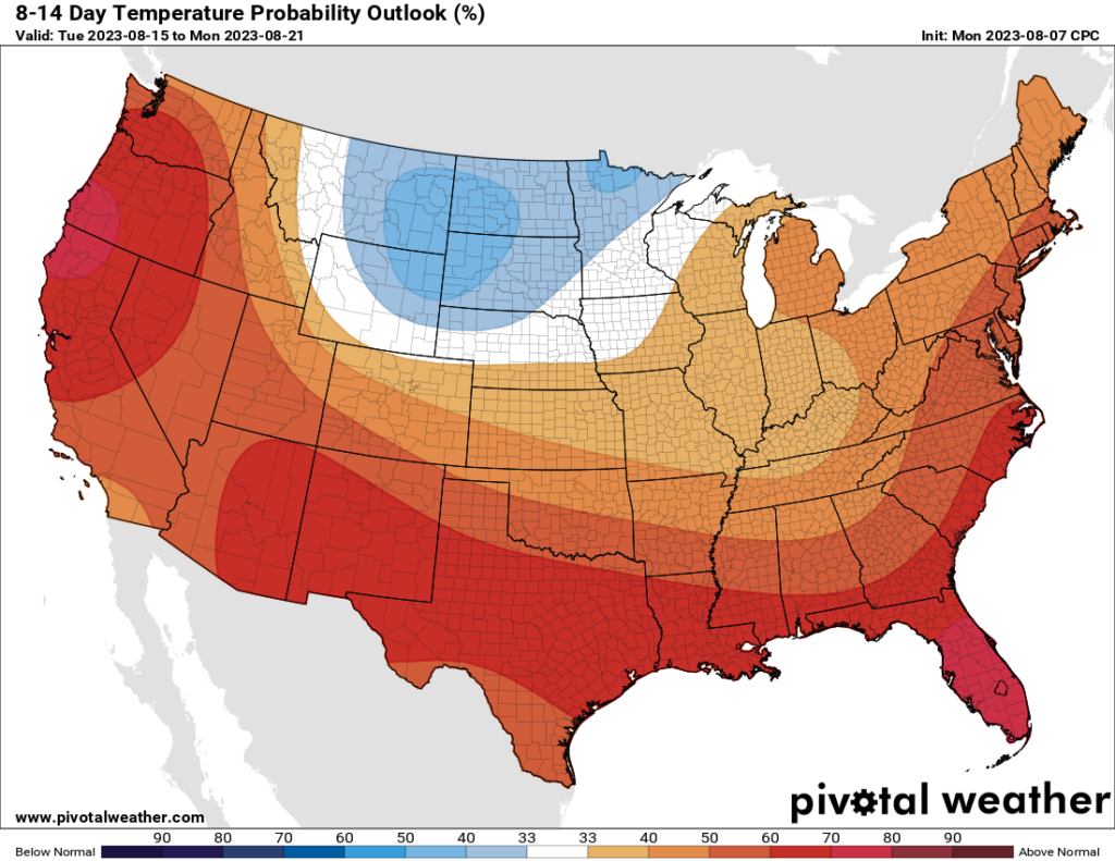
I’ve saved the bad news for last. Whereas a couple of days ago we had some hope that this persistent high-pressure pattern may break down somewhat as we got toward the middle of August, at this point I’m just not seeing it. Sure, we might see some rain chances return by Tuesday or Wednesday of next week. But the odds of meaningful rainfall at this point remain low. And temperatures still look blazing hot for the foreseeable future.

Darker and wider: Introducing the Space City Weather app 2.0

Editors note: We’re thrilled to release the latest and greatest version of our app today. As always it’s free, and we can offer this because of your generous contributions to our annual fundraiser in November. I want to thank Dwight Silverman for shepherding these changes, and Hussain Abbasi for his fine programming work. Here’s Dwight with more information.

When we first introduced the Space City Weather mobile app for iOS and Android devices two years ago, we sought to make it useful, simple and Houston-focused. The design was clean, the information clear, and the approach non-intrusive. There were no ads, and unlike most mobile apps, it did not track you.

We gave it some tweaks last year, adding more area cities, rain percentage chances, a live National Weather Service radar page, a Fahrenheit/Celsius toggle and more. Most of these new features were by request—we really consider y’all to be partners in our development of the app, and we thank you for your continued input.

But there were two high-demand features that we had yet to add—dark mode and tablet view. Well, you asked—and asked and asked and asked again—and this year, we have delivered.

The new Space City Weather app features both a tablet orientation and dark mode – and you can even have both at the same time!

Version 2.0 of the Space City Weather app is now live in both Apple’s App Store and the Google Play Store. As always, it’s free—and still ad-free and tracker-free.

Here’s what’s new:

  • Dark mode. We know that fans of a dark display are passionate about it, so we took our time to do it right, complete with ADA-compliant colors. For now, it’s triggered based on your system settings. When your device is set to dark mode, the SCW app goes dark as well. At the moment there’s no manual toggle, but that’s coming in a future update.
  • Tablet mode. When you install the SCW app on an iPad or Android tablet, it expands to fit the space, with a different layout for horizontal and vertical orientations. If you have a newer Mac with an Apple Silicon processor in it, you can install and run the iOS version of the app in tablet mode. You can click and hold on the lower right corner of the window and drag it to adjust the orientation. It also is designed to display as a tablet on horizontally folding phones, such as the Samsung Galaxy Z Fold family. You can launch it in traditional smartphone view from the narrow, external cover screen, and when you open the phone, the app appears in tablet mode. Nifty!
  • Design. Our stellar developer Hussain Abbasi has done a fantastic job polishing up the visuals. The layout for stories now puts the photo to the right of the headline on the main page, making it easier to read at a glance, and the current story now has a heavier typeface. A gradation line has been added between hourly temps and rain changes, to visually indicate how quickly temperatures are changing. The whole app has gotten many visual improvements, and we think it looks great.

If your device is set to automatically download updates, you will have version 2.0 soon, or you may already have. If not, head to your respective app store and grab it.

The traditional smartphone view also gets some design tweaks, including new cards for current conditions and readability improvements.

We’re particularly excited about this release, because we feel we’ve now got a mature, truly useful app that will help Houstonians keep up with local weather in style, and on whatever platform they choose. We think you’ll love it, too.

Of course, because it’s a big update, there are going to be bugs. If something doesn’t seem to work right, please let us know by sending an email to [email protected]. Please include as many details as you can, including what device you’re using and the version of its operating system.

Again, thanks for your ideas, and please keep them coming. We appreciate your support!

It’s going to be very, very hot again this week—but here’s why things will eventually change

Good morning. I hope you had a wonderful weekend. While I would love to say that this is the week that Houston’s heat finally breaks, I cannot. We are actually amidst the climatologically warmest part of the year in Houston. From the period of July 29 through August 12, the average high peaks at 96 degrees, and the average low at 76 degrees.

However, after this week, we really will start to slowly slide toward fall. That is largely driven by shorter days and the Sun rising lower in the sky. Houston’s day length is already nearly 40 minutes shorter than it was at the peak of summer, and the Sun lower in the sky. By the end of this month, the day will be an hour and 17 minutes shorter, and instead of the Sun reaching a zenith of 84 degrees at midday, it will max out at 69 degrees. So fall is coming, if slowly.

But not this week. High pressure will more or less hold sway, and there’s not much else to say. Highs will be around 100 degrees each day, and if we consult the wet bulb globe temperature forecast, which factors in humidity, winds, and other variables, we can see that daily heat will reach extreme levels. Sorry, it’s going to be pretty miserable. Please practice heat safety.

Anything of 90 degrees represents extreme heat. (Weather Bell)

Monday

High temperatures today will reach 100 degrees, or above, for pretty much the entire metro area. Skies will be mostly sunny. Rain chances are less than 10 percent, and winds will blow at just 5 to 10 mph. Lows tonight will only drop to around 80 degrees.

Tuesday through Friday

Our forecast is the same—bleak, barren, and hot.

Saturday and Sunday

If you were looking for a major pattern change by this weekend, unfortunately, I don’t see it happening. Forecast highs will be on the order of 100 degrees, or hotter for inland areas, with mostly sunny skies.

NOAA rainfall accumulation forecast for now through Sunday. Yeah, not great. (Weather Bell)

Next week

But what about next week? Is there hope? Careful readers will recall Matt writing on Friday that the heat may relax a bit by the second half of August. Global models do start to trend temperatures down a bit in seven to nine days from now, but only slightly. Rain chances also look to be on the upswing. However, these trends are far from definitive. I’m hopeful that this will be the last really, really hot week. But I’m not ready to firmly predict that yet.

Momentum is building for the heat to relax (a little) in Texas, but it’s still at least 10 days out

I want to start my Friday post on a positive note. For weeks it feels like, Eric or myself have been writing these posts saying “we honestly don’t know when this excessive heat is going to meaningfully end.” We all know it will still be hot; it’s August after all, but it would be nice to tone it down just a little and maybe bring some rain back into the picture.

Temperatures over the next 5 days are certainly going to be a good deal above average, even for August across all of Texas. (Weather Bell)

Eric has alluded to some potential change at the end of posts the last day or two, and I think we’re starting to build some legitimate momentum for this to occur. As we move beyond days 7 to 10, we begin to see a bit of a shift in the pattern showing up in modeling. High pressure in the Southwest & Texas shifts just a little more to the west. Heat is established now in the northwestern corner of the country and parts of Canada.

Some changes evolve late and beyond day 10, which include big heat in the Pacific Northwest and western Canada, a cooler trough digging into the eastern half of the country, and high pressure just drifting a little to the west from Texas into Arizona and New Mexico. (Pivotal Weather)

What this may do is help carve out a trough in the eastern half of the U.S. This is helpful for us in Texas because if this happens, it sort of puts us in the middle. Meaning, yes, it will still be fairly hot here, but not at record levels (think upper-90s instead of low-100s). It would also probably allow for the door to the Gulf to swing back open again and bring back at least some rain chances.

This is good news because drought continues to gradually worsen in Texas. The Climate Prediction Center hazards map for August 11-17 shows that many areas in Texas are at risk for “rapid onset drought.”

The Climate Prediction Center has noted continued excessive heat risk for Texas on August 11-13, but they also have highlighted much of East & South Texas for being at risk for “rapid onset drought.” (NOAA CPC)

What exactly are they talking about? Essentially “flash drought,” which is what happened in the Central Plains in 2012. Drought quickly goes from kind of bad to very bad very fast. This can have implications on agriculture, water supply, lake levels, etc. We really don’t want to be dealing with a flash drought here, but given the recent issues with wildfire flare-ups, as Eric noted yesterday, we may already be descending that path.

This is why we are really, really hoping that what we see beyond day 10 can hold. Fingers crossed.

Today and the weekend

Meanwhile, yes, it’s more of the same. More heat. More advisories or excessive heat warnings. More humidity. Drink more water and try to limit outdoor exposure when possible. Please also check on your neighbors. There have been a couple instances of showers popping up in recent days in central part of the Houston area. That could happen again today or tomorrow, but consider yourself extremely lucky if it does.

Summer to date, we’ve just tied 2009 for the 3rd hottest on record in Houston. We are only a couple tenths of a degree behind 2011 for 2nd hottest, and over the next 7 to 10 days, we’re likely to go neck and neck with that summer. I suspect 2011 will pull away in the end, assuming our pattern does change some later in the month.

“Hey Siri, show me what stability looks like in a weather forecast.” (Weather Bell)

Next week

Copy and paste. More heat and more sun. Look for a slight rain chance Tuesday afternoon and then maybe again by Friday. Any changes that take place in the weather pattern would not materialize before next weekend. So buckle in.