Houston to experience amazing fall weather for awhile

Two of my very favorite words in Houston weather are “reinforcing front.” Often, during fall, we will see a cold front move into the region, push into the Gulf of Mexico, and then return onshore a couple of days later as a warm front. But when additional shots of cooler and drier air reinforce the initial front, we can get a run of cool, mostly dry weather for a week or longer. And that’s just what we have ahead of us now.

Monday

It’s a chilly morning up north, with lows in the mid-40s for inland areas near Conroe and The Woodlands, and about 10 degrees warmer in the city of Houston and closer to the coast. With dry air and sunny skies, highs today should warm to about 80 degrees. But wait, there’s more! A reinforcing shot of cooler, drier air should move into Houston tonight.

GFS model 10-day forecast for Houston’s Hobby Airport. (Weather Bell)

Tuesday and Wednesday

With the additional, cooler air we should see some splendid fall weather both days, with highs probably around 70 degrees, give or take, beneath sunny skies. Overnight lows will range from the 40s inland to upper 50s closer to the coast. If you’ve been waiting for truly fall like weather, it has arrived.

See full post

Front moves through Sunday morning, with rains then winds

Good Sunday morning. As of 7:15am CT a cold front is moving through the northern parts of the Houston metro area, and should push through the city by 9am and off the coast by noon.

Residents can expect some rain showers and a few strong thunderstorms with the front’s passage, but the main line is storms is moving fairly rapidly to the south-southeast, so the strongest storms won’t last too long. Light rain is possible for an hour or two after the front’s passage later this morning before we dry out this afternoon.

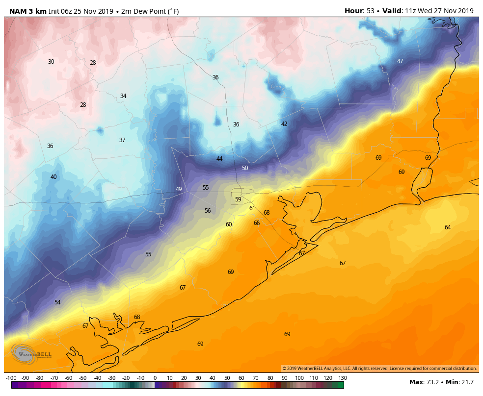
High resolution modeling indicates storms should be moving away from Houston by noon Sunday. (Weather Bell)

After the storms move through northerly winds will persist through the afternoon hours as skies clear out. We can expect gusts in the 20s through the early evening hours as high temperatures perhaps hang around the upper 70s. Temperatures will cool fairly quickly this evening.

Most of the rest of the week looks clear, cool, and spectacular. We’ll have our full forecast on Monday morning.

A wet, possibly stormy, weekend on tap for Houston

The Houston region will enjoy one more sunny day before a three-day period in which we should see rain return to Houston, including the possibility of some intermittent thunderstorms before a cold front clears us out for next week.

Thursday

A pleasant, partly sunny day with highs in the mid-80s. We can’t rule out some scattered showers to the west and southwest of Houston, but I expect most all of the region to remain dry. After several cool nights, lows Thursday night probably won’t reach below 70 for most of the metro area.

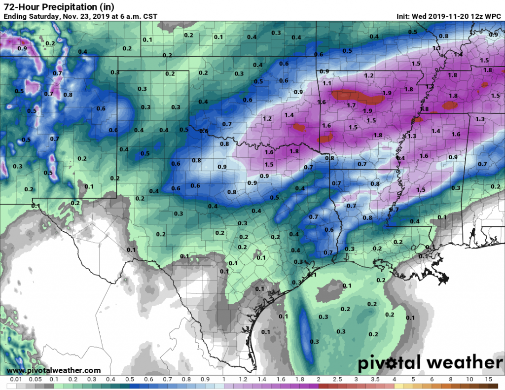
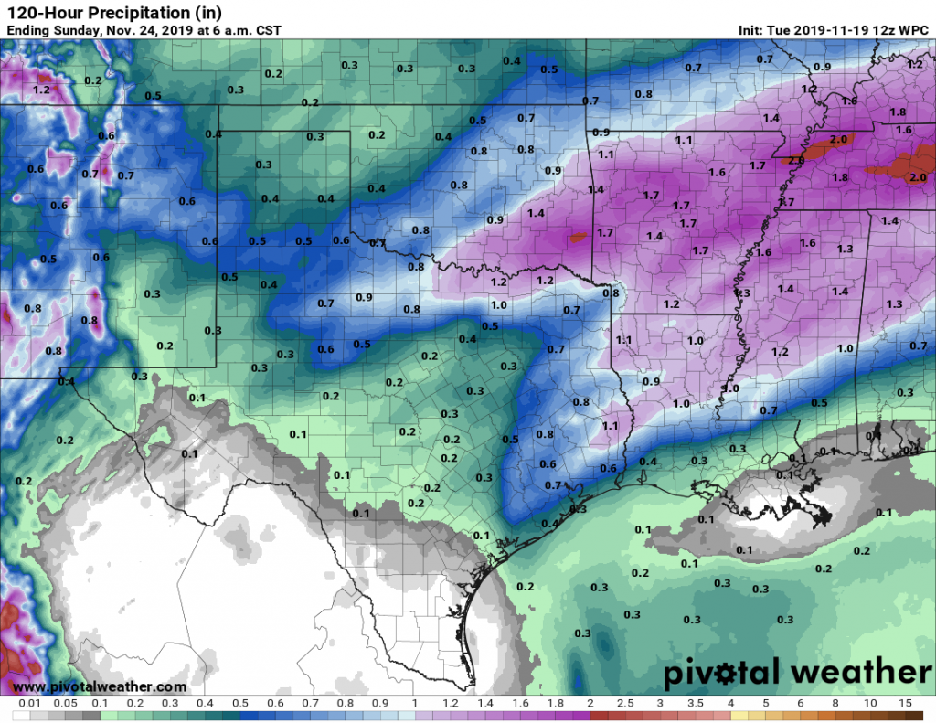
Rain accumulation forecast for Friday, Saturday, and Sunday. (NOAA/Weather Bell)

Friday

The combination of rising moisture levels and lower pressure in the upper level atmosphere will create favorable conditions for rainfall on Friday. We’re certainly not looking at anything extreme, as I think most of the region will see between 0.25 and 1 inch of rainfall on Friday. However, some of the showers could briefly pulse up to some heavy rainfall, so if you’re caught out in one of these take care. Clouds should limit highs to the low 80s.

See full post

Watching for thunderstorms to end the week in Houston

After this morning, the cold front is gone. It was nice while it lasted—and more is on the way. But first, some disturbed weather.

Wednesday and Thursday

It’s pleasantly cool this morning, with most of the region falling into the 50s except for areas immediately along the coast. Sunny skies will allow for warmer temperatures today, in the mid-80s, and the real change will come later this afternoon as winds shift to the southeast. This will allow for humidity levels to rise, and overnight temperatures to jump into the upper 60s. Thursday should be another mostly sunny day, with highs in the mid-80s.

Friday

Moisture levels will be rising with the onshore flow, and by Friday an upper-level disturbance will bring a healthy chance of rain to the forecast. We could see some intermittent downpours during the afternoon, but we expect the storms to move rather than stall, so we’re not too concerned about the potential for localized flooding. Some parts of town may see 1 inch of rain, or so, while others get only very light showers, or no rain at all. Highs in the low 80s.

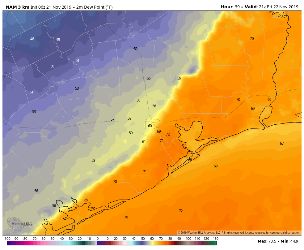
A comparison of precipitable water levels on Wednesday morning (top), and Friday night. (Weather Bell)

Saturday

Rain chances will remain, but there doesn’t appear to be quite as strong of a trigger for showers and thunderstorms on Saturday. Look for partly to mostly cloudy skies, with scattered showers, but right now accumulations do not look too significant. If you’re planning outdoor activities this weekend, the chance of pulling them off on Saturday is higher than Sunday. Highs in the mid-80s.

See full post