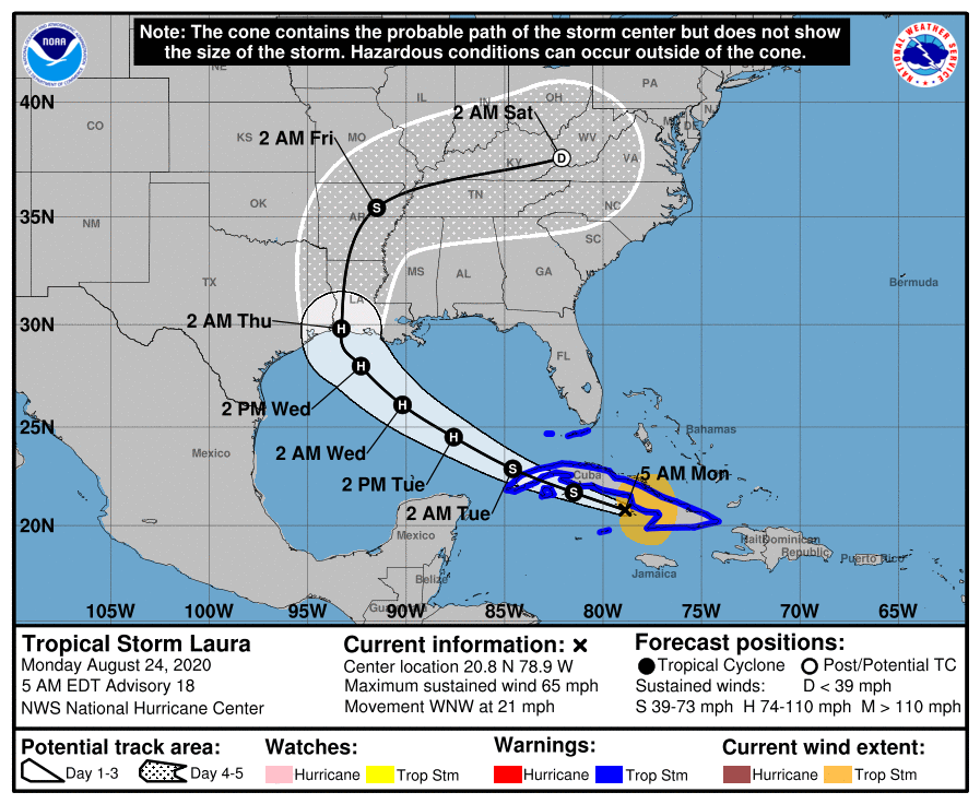
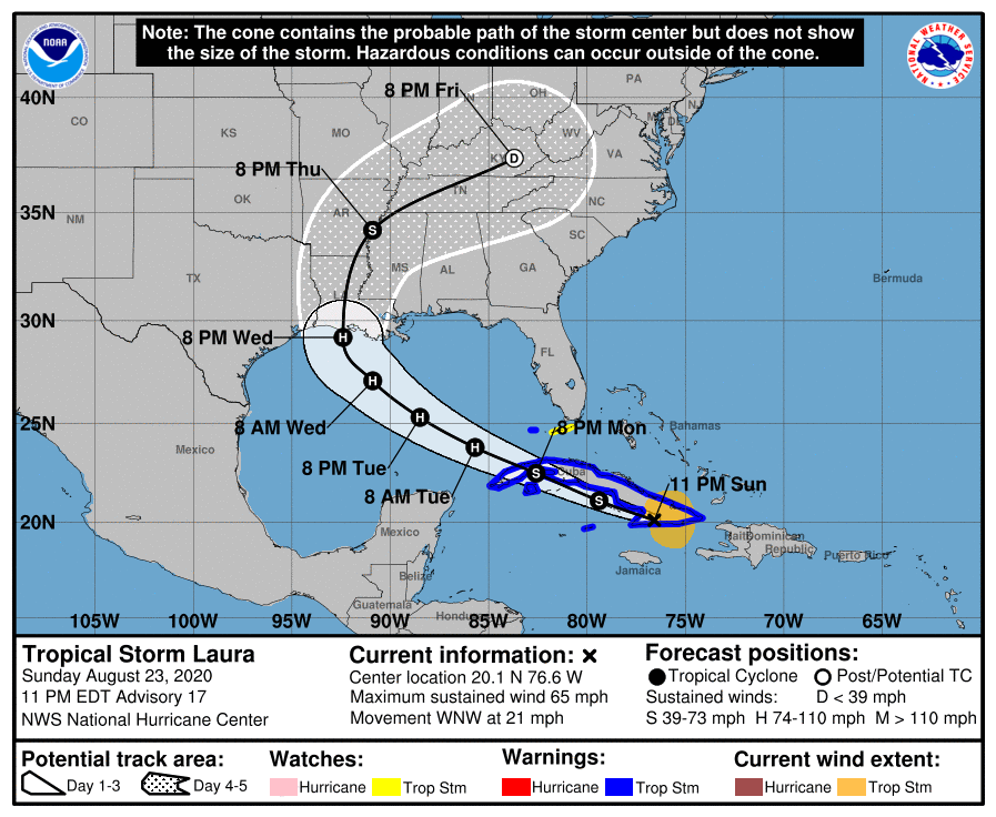
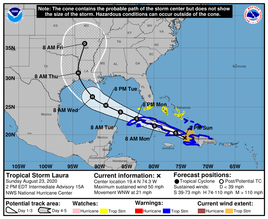
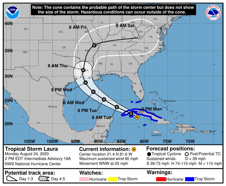
I will not lie. (We never do, and that’s a promise you can bank on). When the National Hurricane Center issued its updated track forecast at 10 am CT this morning I had my doubts. Forecasters there seemed too conservative in not moving the track of Laura closer to Houston, as that is where a lot of the model data indicated it would go. However, in going over all of the just released data from 12z models, their track forecast (shown below) now looks pretty good. So, kudos to the pros in Miami.
What does the 12z data show? Several models have made slight adjustments eastward today, but the most significant movement has come from the UKMET model, produced by the United Kingdom. This is not the world’s best global forecast model, but it is competitive, and something we often look at. In the case of Laura, it has had some of the best performance to date since tracking began a few days. This meant we have weighted it a little bit higher for this storm.
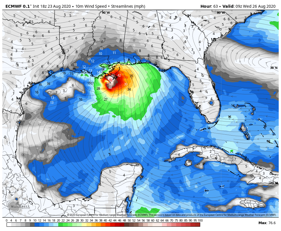
One of the things that has concerned us is that the UKMET, although an outlier, had been frequently bringing Laura to the central or upper Texas coast. This would have placed Houston, Galveston, and the upper Texas coast on the powerful right side of the storm. However, in a just released run of the model, the storm’s landfall location has made a sizable jump east, from near Corpus Christi to the Texas-Louisiana border:
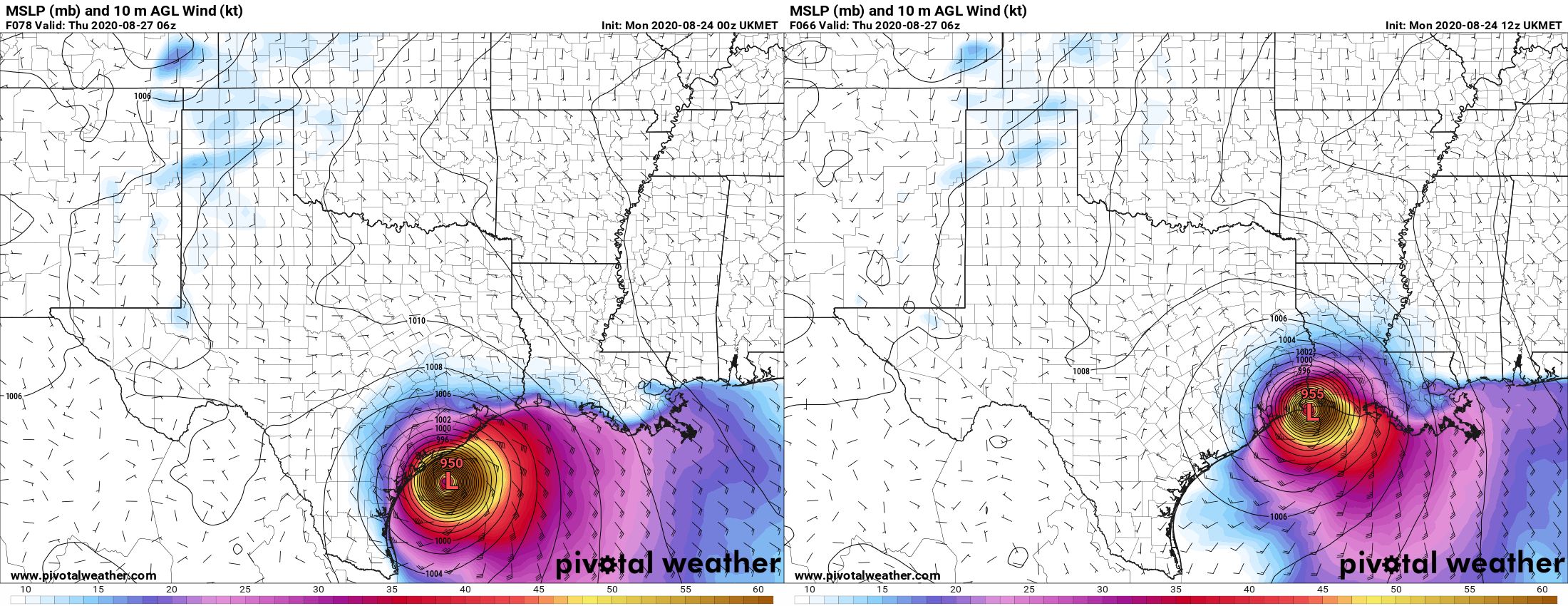
This brings the UKMET more in line with other global models in predicting a landfall near the Texas-Louisiana border, or slightly east of there. This gives us more confidence in a solution that brings Laura onshore just far enough east of Houston to keep the worst of its winds, waves, and rains away from the area. But this does not mean the track forecast is locked down—we still have a fair amount of uncertainty there. There are some very fine details in the positioning of several features in the upper atmosphere, and these could easily move a bit in the next day or so. That would be enough to nudge the forecast back toward Houston. So please, do not let your guard down and keep making preparations. But maybe, breathe slightly easier if you live in Houston. If you live in Beaumont or points east, the threat remains very high.
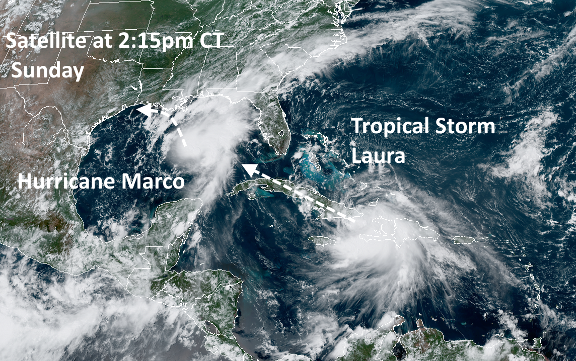
One thing I think we can answer is when we should have clarity on what Laura is really going to do. I am reasonably confident that the track will be dialed in by this time tomorrow, after Laura has come across the western edge of Cuba and emerged into the Gulf of Mexico. By this time it should be forming a more well defined center of circulation, and the models will have ingested better initial conditions. So our long, uncertain wait for some answers should finally come to an end within 12 to 24 hours. As ever, thank you for your patience.
To update the percentages I’ve been using for various scenarios, this is what I would now go with:
Scenario One: Near or direct impact on Houston by a powerful hurricane. (30 percent)
Scenario Two: Powerful hurricane near or east of Texas-Louisiana border (70 percent)
Scenario Three: Weaker storm, central or southeastern Louisiana (~0 percent)
I will be conducting a Facebook Live video at 2pm CT that you can find on our page there. Matt will provide our next update no later than 9pm CT tonight.