Dreary today and Thursday, but the weekend looks festive for Houston

Winter has come to Houston, and along with it we’re seeing widespread light rainfall for a couple of days before sunny and cool weather.

Wednesday

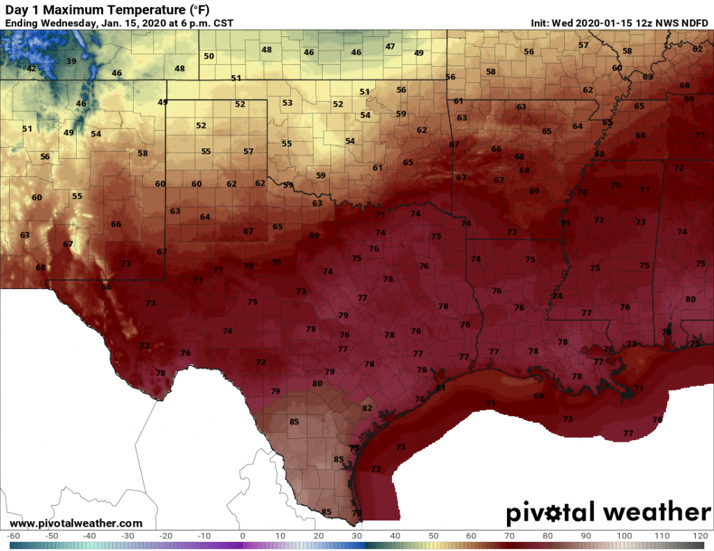
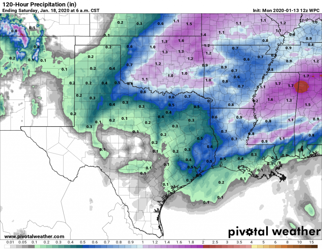
Today is definitely winter coat weather—even if you’re one of those hardy souls from the north who mocks those of us accustomed to Houston weather. High temperatures will probably top out in the mid- to upper-40s today, and a 10 to 15-mph northerly breeze will keep things brisk, with higher gusts along the coast. Clouds are likely all day as well, with intermittent light rain showers adding to the fun. I’m not worried about accumulations, as most areas should see less than 1 inch of rain. But my, this will be a dreary day.

Thursday

Some northern areas have a slight chance of sleet (tiny, clear pellets of ice) on Wednesday night—I’m thinking of areas like Washington, Grimes, and Walker counties, and points north of there. However, the ground is warm enough still that any such wintry mix should melt on contact. In Houston, we’ll just see cold rain. This day should be a lot like Wednesday, albeit with slightly warmer temperatures and diminishing rain coverage later in the day.

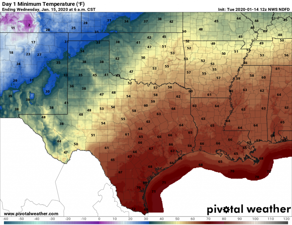
Low temperatures for Thursday night into Friday morning will be quite cold. (National Weather Service)

Some clearing skies (generally from the northwest to the southeast) should allow temperatures on Thursday night to get a bit colder, perhaps in the upper 30s for the Houston area, but a freeze seems unlikely in the city.

(Space City Weather is brought to you this month by the Law Office of Murray Newman)

See full post

Dare we say it? You’ll need your winter coats this week

Temperatures this morning, just before sunrise, were about 70 degrees in the greater Houston area with essentially 100 percent humidity. This soupy weather is considerably warmer than normal for Houston, but it will now come to an end with the passage of a strong cold front Tuesday, and several reinforcing fronts over the next week. In short, winter has come to Texas.

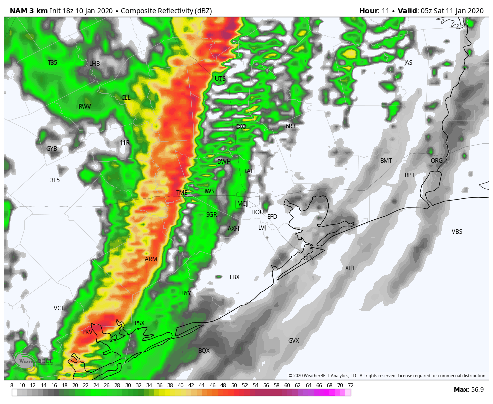
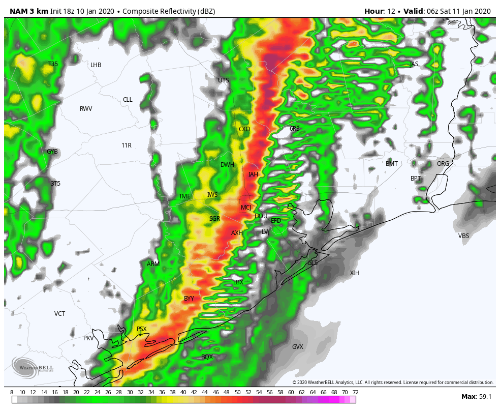
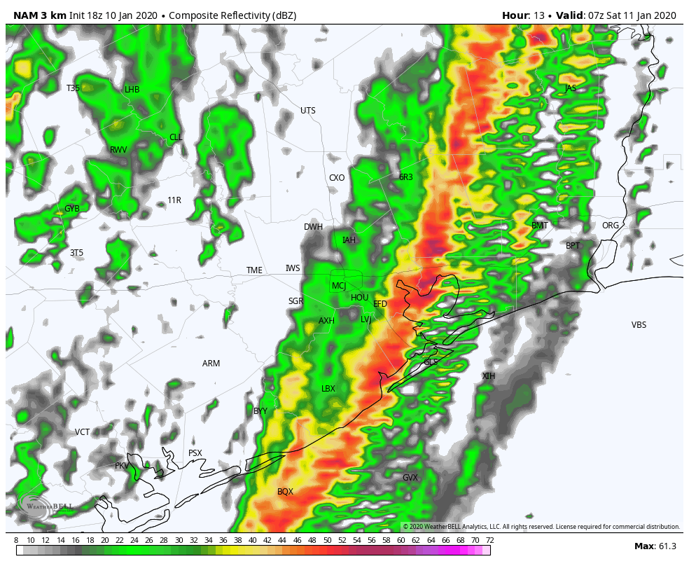
A big change is coming to Houston’s weather on Tuesday. (Weather Bell)

Tuesday

The cold front is on track to move through Houston later this morning, likely reaching the coast by around noon, give or take an hour or two. The radar shows a broken band of light to moderate showers, with a few thunderstorms, accompanying the front as it sweeps down through Texas. I expect this pattern to more or less hold, and accumulations will be relatively low given the fairly rapid movement of the front to the southeast. Our weather will cool quickly with strong northerly winds blowing in behind the front.

Rain chances will return later this afternoon and evening, however, The dry air at the surface moving in with the cold front won’t extend very far up into the atmosphere, and due to the moisture aloft we are likely to see some continued light rain showers Tuesday night and on Wednesday.

(Space City Weather is brought to you this month by the Law Office of Murray Newman)

See full post

Post-Harvey week in review: December 4, 2017

We’re back with another Monday wrap-up of the last week’s stories about Houston’s recovery from Harvey and flooding issues in our region. Feel free to share any that we missed in the comments. If you missed the last two weeks of recaps, you can find them here:

Post-Harvey week in review: November 27, 2017
Post-Harvey week in review: November 20, 2017

Reads of the week

Early results of federal rainfall study show dramatic growth in 100-year storm (Houston Chronicle): An initial study from NOAA (currently in the peer review process) suggests that the rainfall of a 100-year storm in Harris County (a storm that has a 1% chance of occurring in any given year) has increased by 3-5″ since 2001. If that holds up, that has enormous implications on development and how we define floodplains in the Houston area.

Furthering the point that all this is very preliminary, Jeff Lindner of Harris County Flood Control points out that there are still some questions about the gage data and methodology that was used.

This will be an important story to follow in the months ahead.

Developers Said Their Homes Were Out of a Flood Zone. Then Harvey Came. (New York Times): At least 6,000 properties in locations that were redesignated after previously being classified as in flood zones ended up with damage from flooding during Harvey. Map changes are legal and come via raised lots, levees, drainage systems, water-detention ponds, etc. But the margin for error is small, and not all property owners realized this. A provocative story with a focus on The Woodlands.

(Space City Weather is brought to you this month by the Law Office of Murray Newman)

See full post

Winter begins in Houston on Tuesday

The region received more rainfall than expected on Sunday evening, as a warm front moving in from the coast met with moist air, helping to drive rain showers across the area. Rain amounts were greatest near the coast, where some areas of Brazoria and Galveston saw 4 inches of rainfall, and most of Harris county received 0.5 to 2 inches of rain.

Rainfall accumulation on Sunday and Sunday night. (NOAA)

Monday

After what should be a mostly dry morning, much of the region should see more rain today, although it does not appear as though rain showers will be quite so intense. Mostly, I’d expect light to moderate showers under gray skies, with muggy high temperatures near 80 degrees. Rain coverage will probably lessen during the evening hours, but that should change later, overnight, as a strong cold front approaches.

(Space City Weather is brought to you this month by the Law Office of Murray Newman)

See full post