Good morning. We’re going to have a seasonable end of the work week, with a healthy chance of rain this weekend—the timing is most likely Saturday night, so don’t cancel those outdoor plans just yet—and then much warmer weather next week. It’s not June yet, but with high pressure moving in temperatures will go up and rain chances will go down.
Wednesday
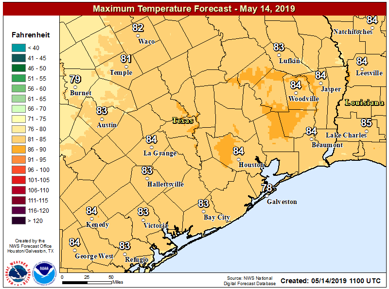
Today’s forecast will feature partly to mostly sunny skies. We may see a very few scattered showers over the region, especially to the southwest of Houston, but mostly we’re going to see sunshine. Highs will be in the mid-80s and overnight lows will drop down to around 70 degrees. In short, this is pretty standard weather for May. And while it’s fairly warm, this is nothing like what’s coming.
Thursday and Friday
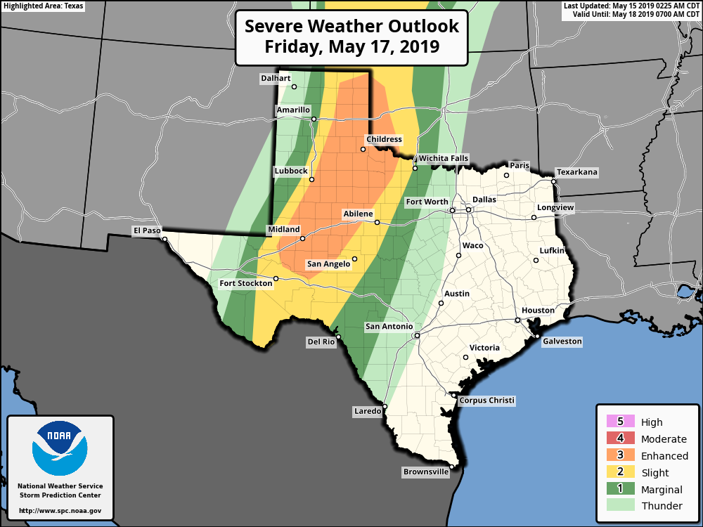
High pressure should keep a lid on all but scattered showers to end the work week, and allow partly to mostly sunny skies across Houston. Highs will likely reach into the mid- to upper-80s with southerly, humid winds. A reminder, if you’re traveling to West Texas or the Panhandle on Friday, check your travel plans closely, as a storm system will likely be moving across that part of the country with the potential to produce severe weather, including tornadoes.