A front moves into Houston later today, and then it will die

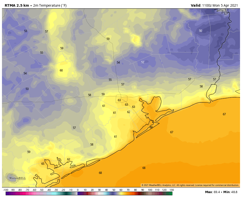
Good morning. It’s rather warm across the region, with much of the city experiencing lows only in the 70s. Our weather over the next several days will remain mostly warm and mostly humid, with a few decent chances for rain. In case you’re wondering, the temperatures we’ve experienced this week are about 10 degrees above normal for early April, when we’re typically in the upper 70s during the daytime, and 50s at night.
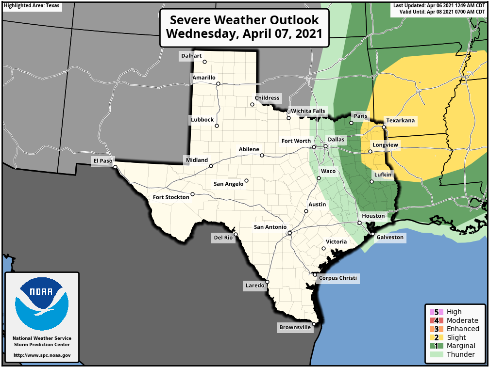
Wednesday

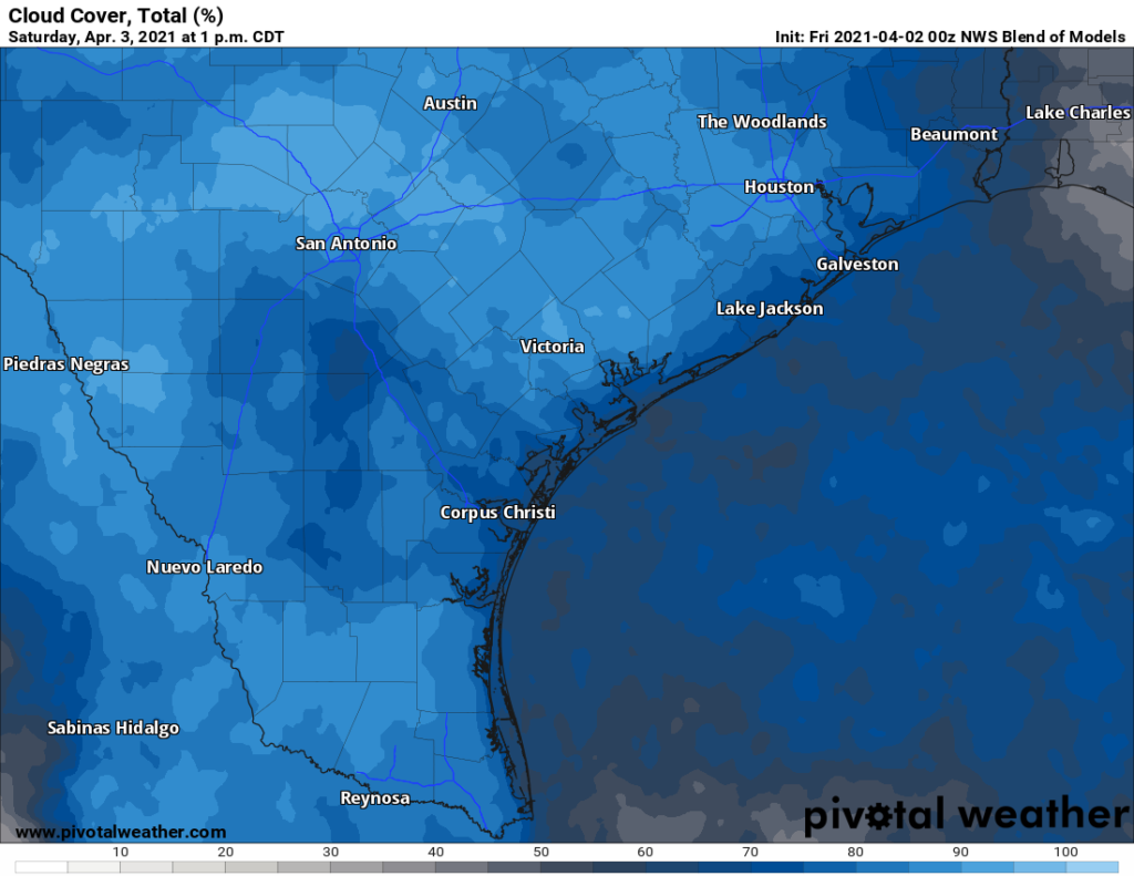
Partly to mostly cloudy skies today will limit high temperatures today to the low 80s. The “excitement” will come later in the day as a dying front sags into Houston, and peters out over the region. Instability associated with this front may provide the impetus for some showers, especially north and northeast of Houston. The extent of rainfall, however, will depend on the strength of a capping inversion. For now I think this cap will limit rising air, and showers fairly scattered this evening as a result. Lows Wednesday night should range from the low 60s for areas far inland the low 70s along the coast.
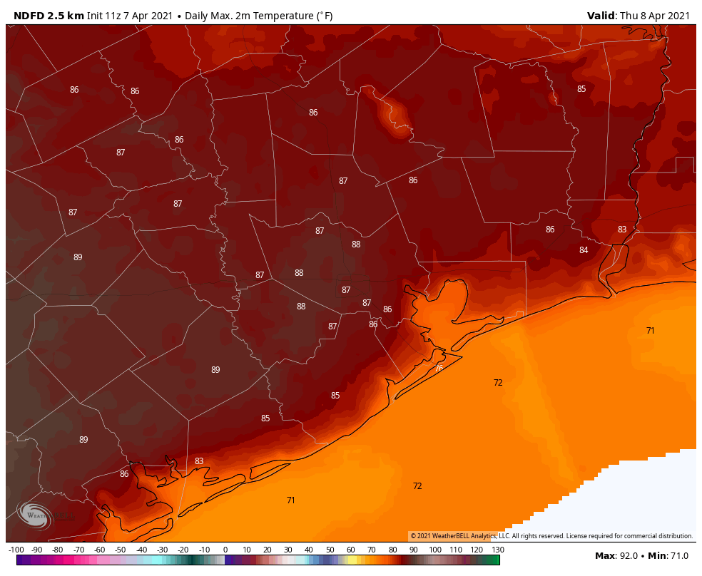
High temperatures for Thursday. (Weather Bell)

Thursday

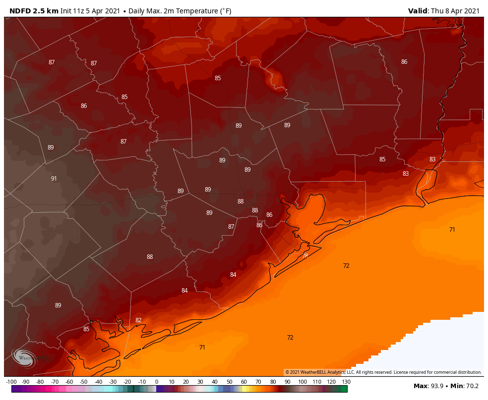
Skies should be sunnier on Thursday, and with a more southwesterly flow we can expect an influx of warmer air that should allow high temperatures to rise into the upper-80s for much of the region away from the coast, with highs of around 90 degrees possible for Sugar Land, Katy, and other areas southwest and west of Houston. Lows Thursday night will drop to around 70 degrees.
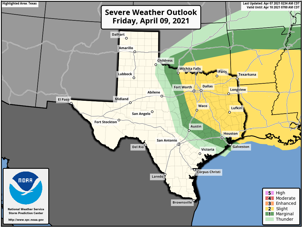
Friday

Another warm day, with highs again approaching 90 degrees, despite the presence of more clouds. The region’s next chance for rain showers or storms will come Friday afternoon into the overnight hours. This will again be a battle between instability and other factors favoring rain showers, and a capping inversion. Areas north of Interstate 10 have a decent chance of picking up 0.25 to 0.5 inch of rain, along with some thunderstorms, with lesser totals likely near the coast. A front will drag into the area Friday night, but the drier air will lag behind.
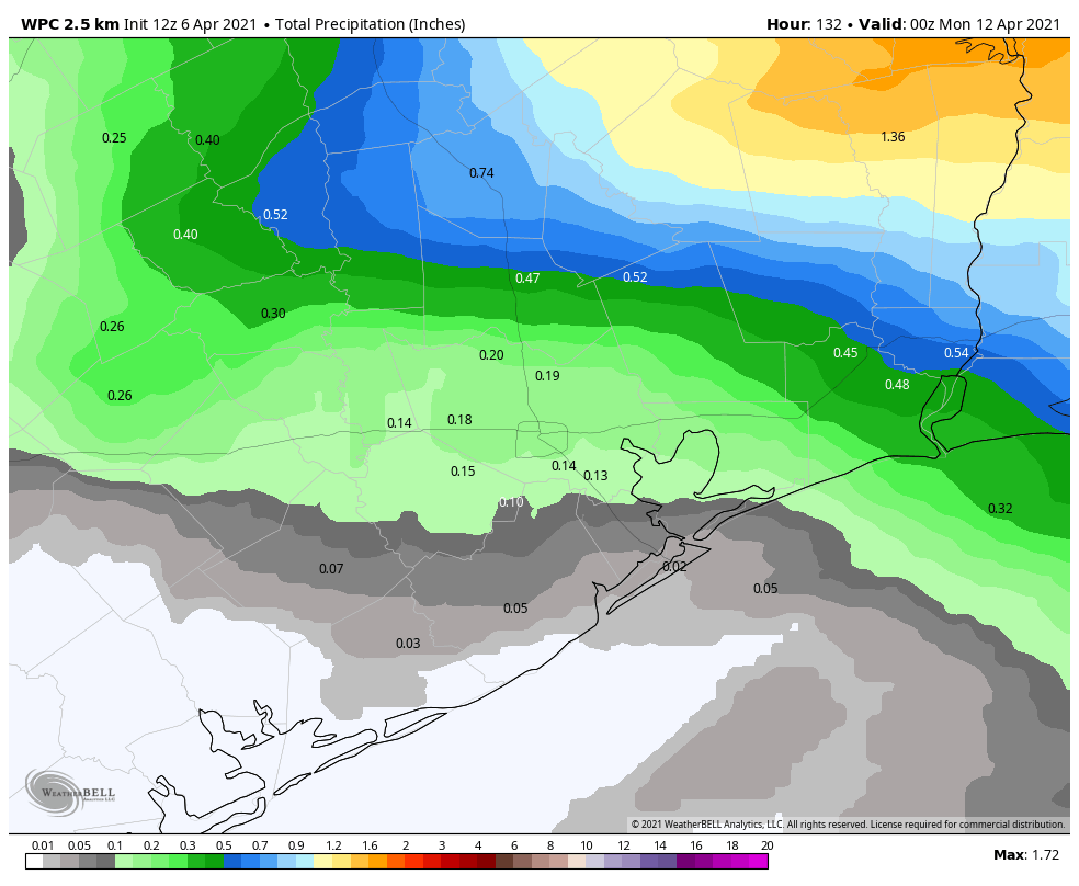
Severe weather outlook for Friday and Friday night. (NOAA)

Saturday and Sunday

As drier air moves into the region on Saturday, I’m cautiously optimistic about the weekend forecast, with the most probable outcome partly sunny skies and highs in the low- to mid-80s. Overnight lows may drop into the 60s, but it’s not going to be particularly chilly. Still, the lower dewpoints will be nice.

Next week

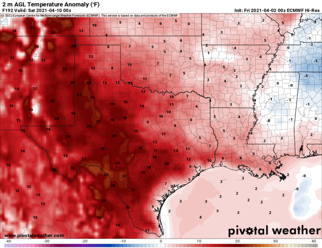
Another front, possibly a stronger one, will arrive by Monday or Tuesday, and this has a chance of bringing us a sustained stretch of slightly cooler days and nights.

Houston this week: Days in the 80s, a few chances for scattered storms

Good morning, Houston! We’ve got a couple of chances for showers and few storms this week, but mostly we’re going to see warm days and moderate nights. The weekend forecast remains somewhat in flux.

Tuesday

Temperatures are fairly warm this morning, about 70 degrees for much of the area, as a southerly flow has established itself over the area. With a mix of sunshine and clouds today, highs will climb to around 80 degrees, and winds will become more pronounced out of the south, with gusts up to about 25 mph. With daytime heating we may see a few brief, very scattered showers during the afternoon hours. Conditions will remain breezy tonight, with lows only dropping to the upper 60s or 70 degrees again.

Wednesday

This day will start out a lot like Tuesday, but it now appears likely that a cool front will in fact make it most of the way through Houston, if not all the way to the coast. High temperatures on Wednesday should still make it into the low 80s, but rain chances will increase during the late afternoon and evening hours as the front approaches the area. Perhaps about 40 percent of the region will see anything from a sprinkle to a brief thunderstorm. Conditions for storms are slightly better for areas east of Interstate 45, as can be seen on NOAA’s severe weather outlook for Wednesday and Wednesday night. A brief influx of drier air should drop lows on Wednesday night into the mid-60s.

NOAA severe weather outlook for Wednesday.

Thursday

The drier air will begin to recede on Thursday, but enough of it should remain to allow for warmer temperatures inland, with highs in the mid- to upper-80s possible for areas west of downtown Houston. Skies will be partly sunny and rain chances nil. Lows Thursday night will probably only fall to around 70 for most as dewpoints rise.

Friday

During the daytime, Friday will be a lot like Thursday. However, at some point during the afternoon or evening hours, a front will push into the area. There are hints within the models of more inclement weather with this front, including the possibility of stronger thunderstorms or hail. But it’s not clear to me all of the ingredients necessary for this will come together, so we’ll have to wait and see with this forecast.

Saturday and Sunday

We still have questions about the weekend, as well, with the potential for another front on Sunday. But for now the best guess is highs somewhere in the low 80s, with partly sunny skies, and nights somewhere in the 60s. Rain chances are low, but not zero. Details very, very much to come.

Overall, rain chances will be better just north of the metro area this week. (Weather Bell)

Next week

Our weather next week will depend upon whether a somewhat stronger front makes it through Houston by Monday or so. If this is the case much of next week may feel more spring-like, with highs in the 70s and 80s, and lows in the 50s and low 60s.

Houston to warm steadily this week, but rain showers will remain scarce

Good morning. After what turned out to be a rather pleasant Easter Sunday, Houston will now begin a warming trend that will culminate with temperatures at least in the upper 80s toward the end of this week. We have unresolved questions about when the next cold front will push all of the way through Houston, and when the region might see a meaningful amount of rainfall—something we need after a dry late winter and early spring have led to an emerging drought.

Low temperatures on Monday morning range from the low 50s to upper 60s. (Weather Bell)

Monday

Winds are very light out of the southeast this morning, and will only slowly pick up to around 5 to 10 mph later today. After a cool start for some, temperatures will rise into the upper 70s, with partly sunny skies. Like on Sunday, a slightly disturbed atmosphere will do battle with a drier upper atmosphere, with the result likely producing some very scattered, light showers later this afternoon. Low temperatures tonight will again drop into the low- to mid-60s.

Tuesday

This will be another day a lot like Monday, albeit with daytime highs a few degrees warmer, and overnight lows in the upper 60s to low 70s. We’ll again see a chance of light, scattered showers to go along with our partly sunny skies.

Wednesday

More clouds will build overhead on Wednesday, and a cold front will approach the region. However, it’s likely to stall around the College Station area, rather than pushing into Houston, or all the way down to the coast. As a result, we’ll likely see highs in the low- to mid-80s, with a slight chance of showers and thunderstorms in the city and surrounding areas. Lows will be sticky, in the upper 60s.

Thursday and Friday

Houston’s warm pattern will intensify toward the end of the week, with highs likely ranging from 85 to 90 degrees for most areas to go along with partly to mostly sunny skies. Nights will be quite warm, not dropping below the 70s for much of the region.

High temperatures on Thursday will near 90 degrees. (Weather Bell)

Saturday and Sunday

The weekend forecast is a bit of a mess. The most likely scenario is that a weak cold front pushes into Houston on Friday night, bringing with it a decent chance of rain (a few tenths of an inch for most). This would knock back temperatures into the mid-80s, with a smidge of drier air and sunny skies, for the weekend. But it’s nearly as likely that the front won’t make it, and we’ll stay in a more humid, warmer pattern without much of any rain. Feel free to flip a coin on this one.

Cool but just a little gray at times for Easter weekend

Easter weekend is upon us, and with many folks planning to take their gatherings outdoors this year, we want to try and pin this forecast down as precisely as possible for you to plan around. In a nutshell: We don’t expect any significant weather at all this weekend, and you should go forth with your plans unaltered due to weather. But there will be just enough of an annoying chance of some light showers later on Sunday.

Today

Skies will start off mainly clear today with ample sunshine. Look for that to continue with just a few high clouds passing through at times later today. It will be another very pleasant, temperate day, with highs in the 60s to perhaps near 70 degrees.

Saturday

Tomorrow won’t be the worst day ever, nor the best day. Look for a good deal of clouds sprinkled with breaks of sunshine. A weak disturbance could squeeze a little virga (rain that evaporates before reaching the ground) out in the afternoon, but for the most part I think Saturday will be fine for all our outdoor plans.

The forecast from the National Weather Service National Blend of Models shows about 80 to 90 percent coverage of clouds Saturday afternoon, meaning at times it will be mainly cloudy. (Pivotal Weather)

Temperatures will warm from the 40s or 50s in the morning to 60s in the afternoon, held down a couple degrees due to clouds. A few spots could break into the 70s with enough sunshine.

Easter Sunday

We will once again see a good deal of clouds and breaks of sun for Sunday. The forecast has become relatively tricky here, with another disturbance pivoting through and a little more moisture available than on Saturday. The odds of any one location seeing rain is fairly low. But I do believe some locations will see a shower on Sunday. So, the best advice we can offer right now is to go forth with your plans as scheduled, but you may feel some “spritzes” out there Sunday afternoon. By no means will it be enough to wash you out for the day, but it may be enough to be annoying in a few locations.

Temperatures on Sunday should start in the 50s and work their way to about 70 degrees or so. If it does rain in your neighborhood, temps could drop back into the 60s for a few hours.

Next week

We begin to turn the corner back toward warmer, more humid weather on Monday. Highs should top off in the 70s, with morning lows in the 50s once more. A shower is possible with a mix of sun and clouds.

By Tuesday, we’re starting the morning in the 60s and reaching well into the 70s, if not low-80s. Wednesday looks even warmer, with morning lows in the mid to upper-60s and highs in the mid-80s. We should see a typical spring pattern of morning clouds giving way to afternoon sunshine and a token 10 to 20 percent chance of a shower.

Even warmer weather looks possible later in the week, with maybe a weak front in there at some point between late week or early the following week.

Can we hit 90 degrees next week?

Last year, we hit 90 degrees for the first time on March 25th. In 2019, we did it on April 9th. Typically, we don’t reach 90 for the first time until May 7th (though since 1990, that date has moved up to May 1st). Yes, we could hit 90 degrees next week or weekend. As of right now, the European ensemble is projecting that the air mass over Texas by late next week or next weekend (Friday shown here) will be about 10 degrees or more warmer than normal.

The forecast of temperature anomalies over Texas next week is expected to be about 10 degrees or more above normal on Friday. Upper air temperatures are similarly warm, which means 90° could be attainable by late week (Pivotal Weather)

We start to see average high temperatures get close to 80 degrees next week, so it becomes simple math at that point. Given the dry soils and growing drought over most of Texas, this will not be a Herculean task. There are still some question marks Depending on your point of view, that’s wonderful or the worst news ever. Either way, it is what it is, and we’ll update you on things Monday!