Houston enjoyed a sunny day on Tuesday, and we’ve got a couple of more to go before some rain chances return this weekend. But don’t worry, we’re not expecting anything too extreme.
Wednesday
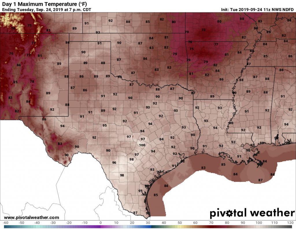
With high pressure in place, we anticipate another partly to mostly sunny day today, with highs touching 90 degrees for many parts of the region. Some areas west and northwest of Houston may even reach highs in the mid-90s, which is pretty extreme for late September, even in Texas. Normal highs for late September are the upper 80s. Rain chances are near zero.
Thursday
This should be a day similar to Wednesday, with hot conditions and rain chances likely 10 percent or less. Summer marches onward, it seems.
Friday, Saturday, and Sunday
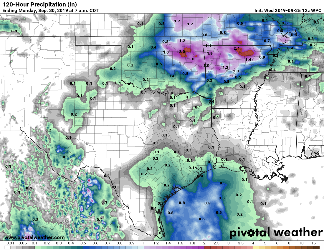
The pattern changes, subtly at least, this weekend. High pressure will retreat eastward, opening up Texas to more of a southerly flow of moisture. This will increase rain chances, and introduce the possibility of thunderstorms. But for the most part, we expect these storms to pop up, die out, and move on. Overall accumulations for almost everyone should be one-half inch or rain, or less, although a few storms may become fairly intense for a time. Rain chances on any individual day should be less than 50 percent. And skies, for the most part, should be sunny. Highs will be around 90 degrees.
