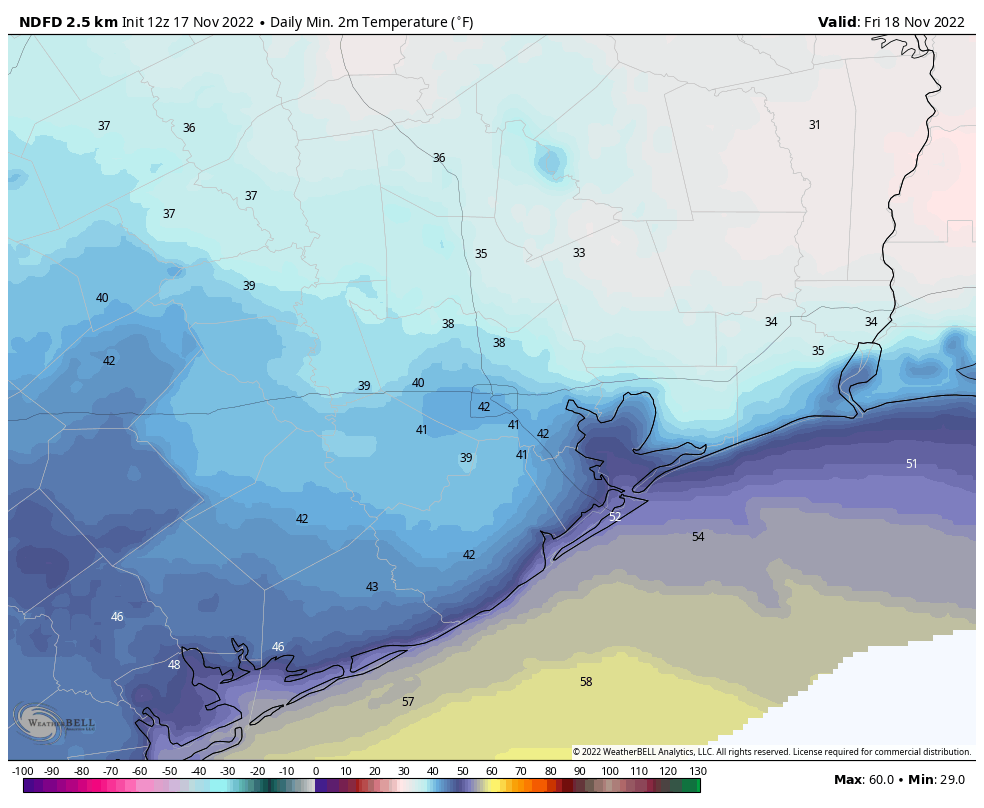
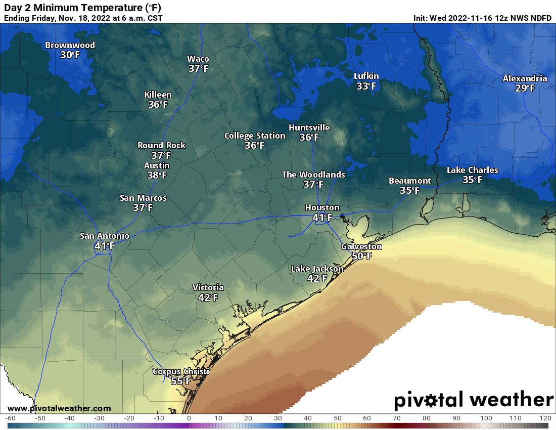
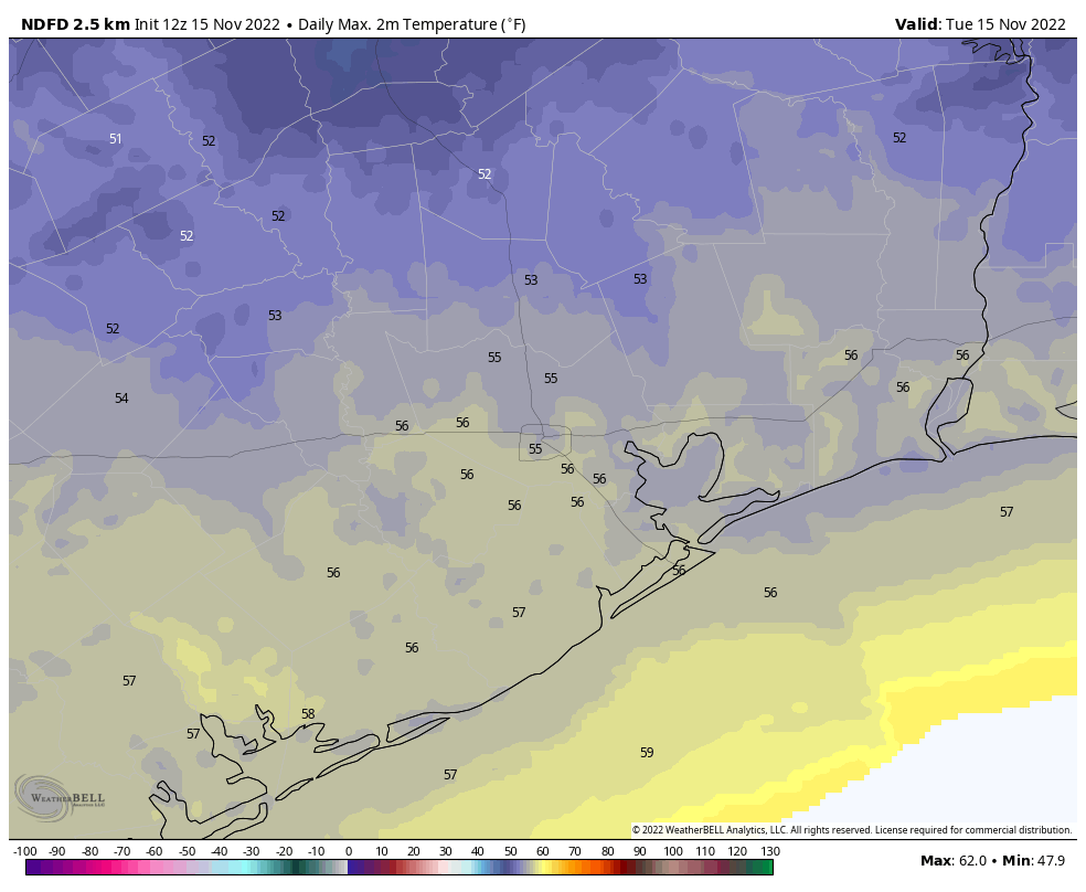
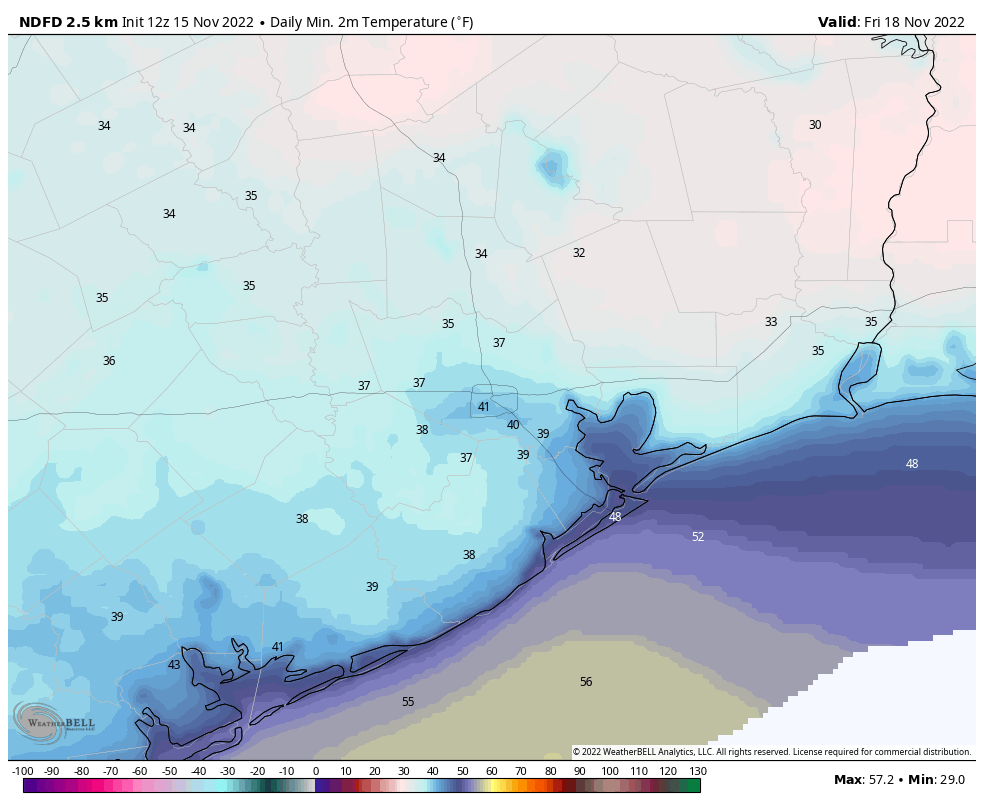
An abnormally cool stretch of mid-November weather continues. We’ve already had more sub-60 degree days this week than all of last November and December combined. Of course, given how warm last year was, that isn’t saying much. But still. We have at least a few more days of sub-60 weather before things change somewhat.
Fundraiser
Thank you again to all who have contributed to our annual fundraiser! We are truly grateful, especially in what has been a pretty uneventful year (thank goodness). You can click here to buy items. And if you don’t wish to purchase merchandise and just want make a contribution, click here and check the box that says “I’d like to make a donation only.” Your support literally helps keep the site running, so thank you so much!
Today
Look for clouds to thicken up as the day progresses. We should begin to see sprinkles or light showers break out from southwest to northeast across the region. Initially, these may struggle to reach the ground due to dry air, but as we get closer to evening, I suspect we’ll get more reports of light rain or sprinkles. Temperatures should remain mired in the 50s today.
Saturday
Welp. Tomorrow may be a front-runner for most miserable day of the year.
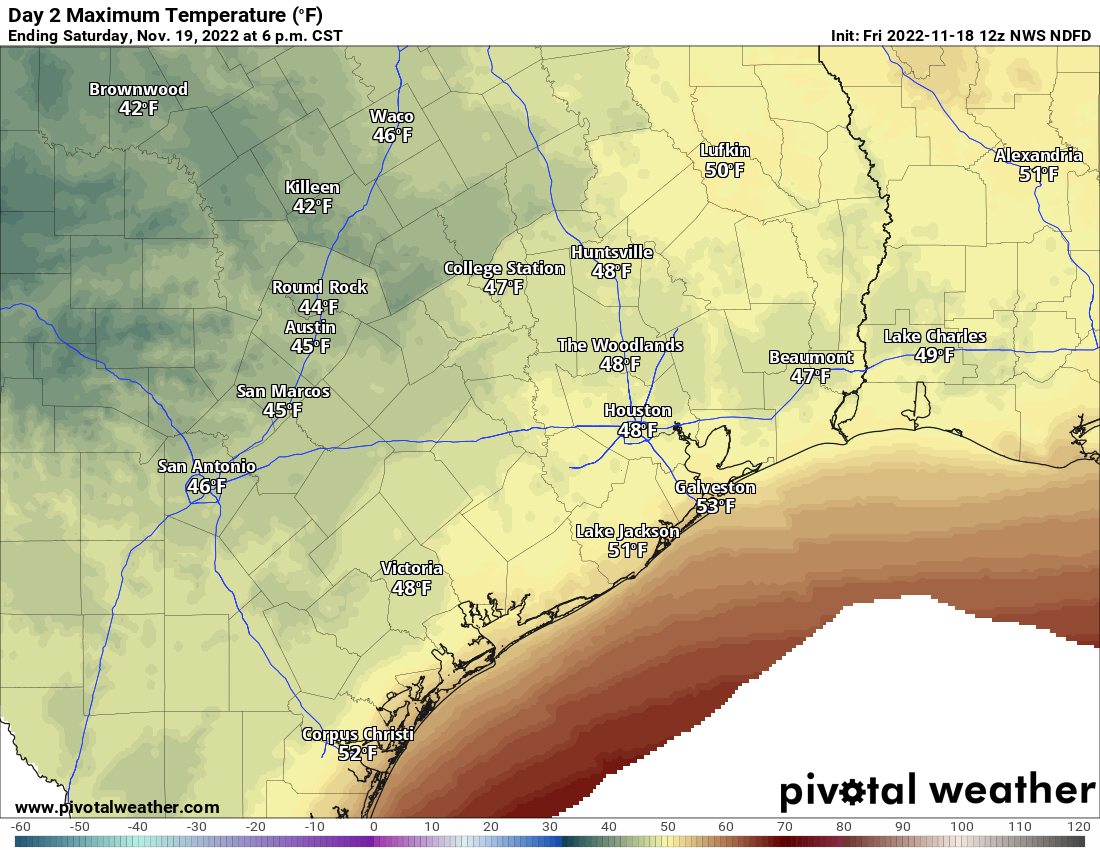
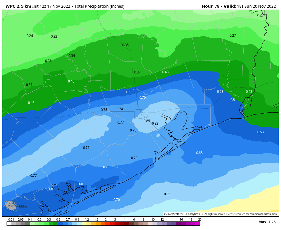
It’s a pretty simple forecast: Periods of rain, steady at times (especially south of Houston). Cloudy. Cold. Breezy. Temperatures will stay stuck in the 40s all day. Look for breezy conditions with winds of 15 to 25 mph at times, stronger over the water or near the coast. Just really raw, cold, and quite nasty for Houston.
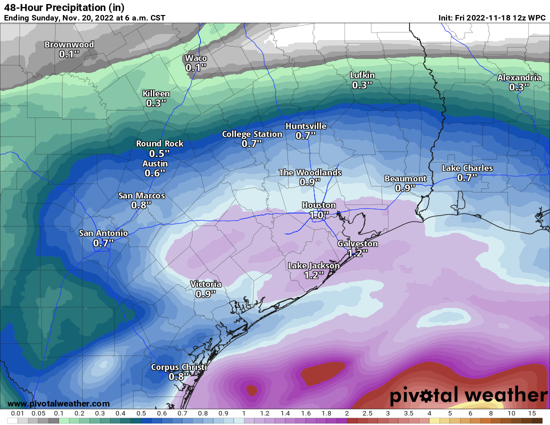
Rain totals will average a half-inch to inch and a half south of Highway-105. Some places may see a bit more, especially nearer to the coast. Others to the north may see a bit less. But everyone sees at least some rain tonight and tomorrow.
Rain should taper off from west to east overnight into very early Sunday morning.
Sunday
Despite Saturday’s gloom, I am optimistic that we should break out into at least a little sunshine on Sunday. It still won’t be a wonderful day, but compared to Saturday it will seem glorious. We should manage lower-50s. A few showers could break out late in the day west of Houston.
Monday
As of now, expect mainly cloudy skies on Monday with scattered showers or some rain. We’ll have to see if this trends more toward a wetter period like Saturday has done. For now, we’ll just call it scattered showers and update you this weekend. One thing we are confident it will be? Chilly. Again. Look for low-50s, maybe mid-50s if were lucky or upper-40s if we’re unlucky.
Tuesday and beyond
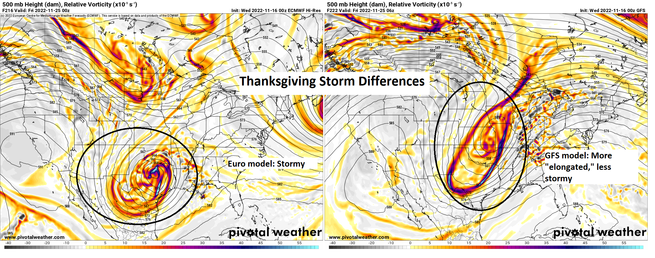
We continue to struggle with details regarding the Thanksgiving period. What we know is that there will likely be quiet weather on Tuesday with building rain chances Wednesday and Thursday. Temperatures should gradually sneak back above 60 degrees by Wednesday and Thursday, with morning lows in the 40s early, warming into the 50s and 60s late.
What we don’t know is exactly when it will rain Wednesday through Friday. Our modeling continues to struggle a lot with what may be a pretty significant storm across the Eastern U.S. One school of thought is for a slower moving, stronger storm that would bring thunderstorms and possible severe weather to Texas and Louisiana. That option seems to be fading some. Another slightly more likely possibility is for a quicker moving, weaker system with just a few showers and storms. Here’s the best thinking right now:
Tuesday: Clouds, some sun, a shower possible. Morning lows 40s, daytime highs near 60.
Wednesday: Clouds, some sun, a few showers or sprinkles, especially south and west. Morning lows 50s, daytime highs mid to upper-60s.
Thanksgiving Day: Clouds with a period of showers and storms possible. Morning lows 50s to 60s, daytime highs upper-60s.
Friday: Sun & clouds. Maybe a shower. Morning lows 50s or 40s, daytime highs low-60s.
That’s what we can give you for now. We will keep you posted this weekend with a daily morning update on the forecast both tomorrow and Sunday!