We’ve been mentioning the possibility of some elevated rain chances beginning on Monday of next week, and now the forecast is coming into slightly better focus.
A surface cold front will move off the northern Gulf coast into the Gulf of Mexico this weekend, and once there it may find favorable conditions for some kind of development. We think it probably will remain a low pressure system, but there is a chance it could become a tropical depression or even less likely, a tropical storm.
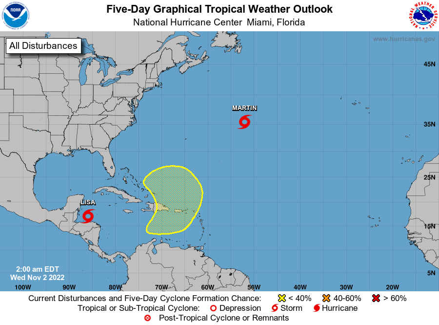
The National Hurricane Center gives the Gulf blob a 20 percent chance of becoming a tropical depression or storm.
Given the steering flow at present in the Gulf of Mexico, and retreating high pressure over Texas, this low-pressure system will most likely track westward across the Gulf. This would bring increasing rain chances to the upper Texas coast, including Houston, beginning later on Monday and through Wednesday. I must stress that at this time these rains look nothing but beneficial for our parched region.
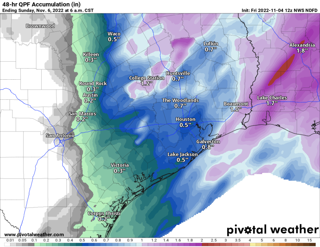
Accumulations are nearly impossible to forecast given the uncertainty at this point, but I’d guess most of the Houston region will receive 0.5 to 3 inches of rain, with a greater likelihood of rain near the coast. By Tuesday the increasing cloud cover should also drive daily temperatures back to around 90 degrees for a couple of days. Eventually this system should move west, clearing our area by later on Wednesday or Thursday.
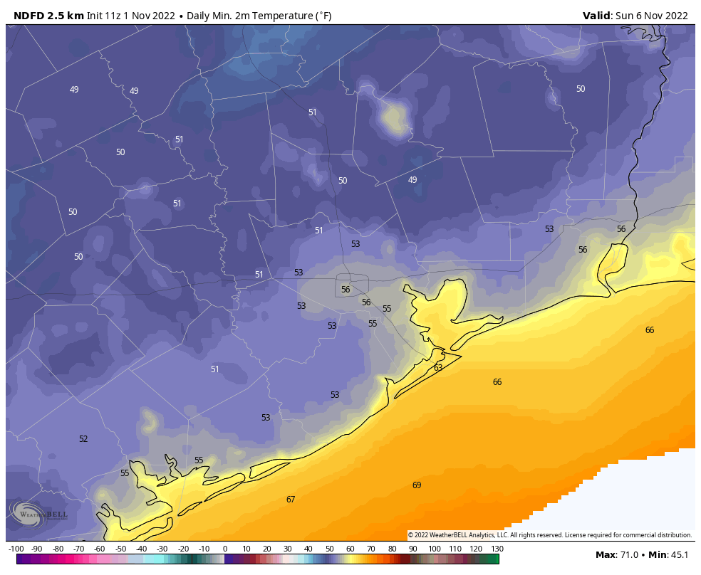
Houston will see two more days of excessive heat before things start to cool off slightly. (Weather Bell)
As ever, tropical systems are dynamic, so we’ll be watching this closely. If the situation changes, we’ll update you on Sunday. If not, look for our regular post on Monday morning.
App note
We’re aware of an issue with the Space City Weather app in which it is not displaying the most current posts on some devices. Our developer has identified the bug and is working to push out an update soon. Please accept our apologies for the issue.
Good morning! The thermometer topped out at 101 degrees yesterday officially in Houston, which tied the record for June 23rd, last set in 2009. It’s hot, it’s going to continue, but we still think next week will be slightly, if not much improved. More on all that in a second.
The most common questions we have been getting of late are two-fold: “How similar is this summer to 2011?” (the epic drought summer), and “Does a hot June portend a hot July and August?” Let’s start with the 2011 comparison.
First off, while the drought is not as severe, 2022 has been hotter than 2011. The May 1-June 23 period checks in at an average (high + low, divided by two) of 83.4°, which smashes the record of 81.8° set in 2011 and again in 2018. The difference between 2011 and 2022 at this point is the extremeness of the heat. We are lagging 2011 in terms of warm temperature records set. But the consistency and persistence of stronger than normal heat is ridiculous. Our last below normal day was June 3rd. Depending on exactly how next week shapes up, we should see our hottest June on record this year.
May and June of 2011 featured some more extreme daytime heat across Texas, but this year is seeing more persistent heat, especially at night. (High Plains Regional Climate Center)
Interestingly, 2011 was hotter during the daytimes, but June 2022 is running almost 2 degrees above 2011 at night. And don’t even get me started on Galveston. The Island has set or tied *33* warm low temperature records just since May 1st. These are signals consistent with climate change, urban sprawl, and a very warm Gulf in our backyard.
The second question about whether we can derive any insights for the rest of summer based on June’s outcome is a little trickier to answer. In general, what occurs in June has very little in common with July and August outcomes here in Houston. We can see this on a scatter plot, which simply compares the June average temperature on the y-axis with the July average temperature on the x-axis.
Since 1950, the correlation between June and July temperatures has been positive (hot Junes tend to favor hot Julys), but it’s pretty weak.
The chart above shows June vs. July in Houston. A June vs. August or July vs. August chart would not look too dissimilar. There’s definitely a loose correlation (hot Junes do favor hot Julys), but it’s pretty weak overall.
Now, what if we just look at some more significant drought summers. Drought would typically imply a stable pattern, much like we’ve seen this year. So I went back and looked at the Texas averaged Palmer Drought Severity Index (PDSI) by month back to 1950. I parsed out the March through May values and extrapolated out an approximate June 2022 value. In other words, I looked at a drought classification for all of Texas between March and June and found the 13 closest matches to 2022. Does that change the outcome? For July it does, significantly so. Remove 2011 from the sample, and there is virtually no correlation whatsoever.
There is very little correlation between June and July temperatures during years with dry March-June periods.
But what of August? That story appears a bit different.
There is some signal suggesting a hot June in a dry year boosts the odds of a hot August, though the sample size is a bit too small to say so definitively.
While there is a very nice correlation showing up here, a sample size of 13 summers feels just a little too small to say anything definitively. In fact, if we again remove the hottest outcome there, 2011, it cuts the R^2 value almost in half, implying a much weaker correlation.
What is the takeaway here? A hot June tells us very little about the subsequent July outcome other than it may also tend to be on the hotter side. A hot June in a drought year may also slightly favor a hot August outcome, but the sample size is too small to say anything with confidence. So, if you are hoping that the rest of summer is not as abnormally hot as June, you do have at least some hope here.
Drought update
With new burn bans and water restrictions being issued daily across the region, a look at the drought map explains why.
Locally, we didn’t see much drought expansion this week, but the state as a whole continues to trend in the wrong direction. (US Drought Monitor)
The coverage of drought changed little across our area with yesterday’s update, and the southern half of the region remains in D3, or extreme drought conditions. But we continue to receive minimal relief. That may change next week, however.
Today through Sunday
Hot, hot, hot. Look for temperatures near 100° or hotter each afternoon with just the slightest chance for a shower or storm. Morning lows should be in the 70s inland and 80s near the bays and Gulf and perhaps in the Inner Loop. Heat index values should flirt with 105° each afternoon, so please use caution outdoors.
Next week: Ch-ch-ch-ch-changes
As the upper level high pressure system responsible for our scorching weekend escapes westward next week, this will open the Gulf up for daily thunderstorm chances. In any other summer, next week would not look overly impressive. Given how little rain we’ve had, however, just the chance at daily showers returning will likely make a big difference, at least temporarily.
Rainfall between Monday and next Friday morning should average around a half-inch or a bit more south and east of Houston. Higher amounts are likely in spots, perhaps up to 1 to 3 inches. (Pivotal Weather)
I think the highest odds for more widespread coverage of showers will be on Tuesday, Wednesday, and perhaps Friday. We’re looking at something like 30 to 40 percent coverage of showers on average each day, with perhaps a couple days seeing 50 or 60 percent coverage. This means that you probably won’t see rain every day, but most of us will see at least some rain on a couple days. Let’s hope for around a half-inch of rain on average next week, with a few more frequently hit spots picking up 1 to 3 inches perhaps. It won’t end the drought, but it will definitely help.
As a result of the showers and clouds, look for high temperatures to back off into the mid-90s or low-90s most days. Lows should remain in the 70s.
Tropics
The National Hurricane Center has increased the odds of development of a disturbance in far eastern Atlantic to 60 percent over the next five days.
The odds of an Atlantic disturbance developing into a depression or tropical storm over the next 5 days have increased to 60 percent today. (NOAA)
This is rather far east for a system to develop at this point in the season, so it’s certainly noteworthy. However, from a Gulf Coast-centric perspective, this has a long, long way to go. Initially, my thought is that after next week’s rainy pattern, a hotter, drier pattern is going to attempt to again re-establish over Texas for the week of July 4th, which would be about the time this disturbance makes it into the vicinity of the Gulf. A stronger system would likely turn north before getting here, while a weaker system would likely be squashed by that ridge and forced into Mexico or Central America. So at this point, I don’t view it as something to worry about, but it’s worth checking back in on after the weekend.
Howdy, folks—I’m Lee, and I do all the server admin stuff for Space City Weather. I don’t post much—the last time was back in 2020—but the site has just gone through a pretty massive architecture change, and I thought it was time for an update. If you’re at all interested in the hardware and software that makes Space City Weather work, then this post is for you!
If that sounds lame and nerdy and you’d rather hear more about this June’s debilitating heat wave, then fear not—Eric and Matt will be back tomorrow morning to tell you all about how much it sucks outside right now. (Spoiler alert: it sucks a whole lot.)
The old setup: physical hosting and complex software
For the past few years, Space City Weather has been running on a physical dedicated server at Liquid Web’s Michigan datacenter. We’ve utilized a web stack made up of three major components: HAProxy for SSL/TLS termination, Varnish for local cache, and Nginx (with php-fpm) for serving up Wordpress, which is the actual application that generates the site’s pages for you to read. (If you’d like a more detailed explanation of what these applications do and how they all fit together, this post from a couple of years ago has you covered.) Then, in between you guys and the server sits a service called Cloudflare, which soaks up most of the load from visitors by serving up cached pages to folks.
It was a resilient and bulletproof setup, and it got us through two massive weather events (Hurricane Harvey in 2017 and Hurricane Laura in 2020) without a single hiccup. But here’s the thing—Cloudflare is particularly excellent at its primary job, which is absorbing network load. In fact, it’s so good at it that during our major weather events, Cloudflare did practically all the heavy lifting.
Screenshot from Space City Weather’s Cloudflare dashboard during Hurricane Laura in 2020. Cached bandwidth, in dark blue, represents the traffic handled by Cloudflare. Uncached bandwidth, in light blue, is traffic directly handled by the SCW web server. Notice how there’s almost no light blue.
With Cloudflare eating almost all of the load, our fancy server spent most of its time idling. On one hand, this was good, because it meant we had a tremendous amount of reserve capacity, and reserve capacity makes the cautious sysadmin within me very happy. On the other hand, excess reserve capacity without a plan to utilize it is just a fancy way of spending hosting dollars without realizing any return, and that’s not great.
Plus, the hard truth is that the SCW web stack, bulletproof though it may be, was probably more complex than it needed to be for our specific use case. Having both an on-box cache (Varnish) and a CDN-type cache (Cloudflare) sometimes made troubleshooting problems a huge pain in the butt, since multiple cache layers means multiple things you need to make sure are properly bypassed before you start digging in on your issue.
Between the cost and the complexity, it was time for a change. So we changed!
Leaping into the clouds, finally
As of Monday, June 6, SCW has been hosted not on a physical box in Michigan, but on AWS. More specifically, we’ve migrated to an EC2 instance, which gives us our own cloud-based virtual server. (Don’t worry if “cloud-based virtual server” sounds like geek buzzword mumbo-jumbo—you don’t have to know or care about any of this in order to get the daily weather forecasts!)
The AWS EC2 console, showing the Space City Weather virtual server. It’s listed as “SCW Web I (20.04)”, because the virtual server runs Ubuntu 20.04.
Making the change from physical to cloud-based virtual buys us a tremendous amount of flexibility, since if we ever need to, I can add more resources to the server by changing the settings rather than by having to call up Liquid Web and arrange for an outage window in which to do a hardware upgrade. More importantly, the virtual setup is considerably cheaper, cutting our yearly hosting bill by something like 80 percent. (For the curious and/or the technically minded, we’re taking advantage of EC2 reserved instance pricing to pre-buy EC2 time at a substantial discount.)
On top of controlling costs, going virtual and cloud-based gives us a much better set of options for how we can do server backups (out with rsnapshot, in with actual-for-real block-based EBS snapshots!). This should make it massively easier for SCW to get back online from backups if anything ever does go wrong.
It’s just not a SCW server unless it’s named after a famous Cardassian. We’ve had Garak and we’ve had Dukat, so our new (virtual) box is named after David Warner’s memorable “How many lights do you see?” interrogator Gul Madred.
The one potential “gotcha” with this minimalist virtual approach is that I’m not taking advantage of the tools AWS provides to do true high availability hosting—primarily because those tools are expensive and would obviate most or all of the savings we’re currently realizing over physical hosting. The only conceivable outage situation we’d need to recover from would be an AWS availability zone outage—which is rare, but definitely happens from time to time. To guard against this possibility, I’ve got a second AWS instance in a second availability zone on cold standby. If there’s a problem with the SCW server, I can spin up the cold standby box within minutes and we’ll be good to go. (This is an oversimplified explanation, but if I sit here and describe our disaster recovery plan in detail, it’ll put everyone to sleep!)
Simplifying the software stack
Along with the hosting switch, we’ve re-architected our web server’s software stack with an eye toward simplifying things while keeping the site responsive and quick. To that end, we’ve jettisoned our old trio of HAProxy, Varnish, and Nginx and settled instead on an all-in-one web server application with built-in cacheing, called OpenLiteSpeed.
OpenLiteSpeed (“OLS” to its friends) is the libre version of LiteSpeed Web Server, an application which has been getting more and more attention as a super-quick and super-friendly alternative to traditional web servers like Apache and Nginx. It’s purported to be quicker than Nginx or Varnish in many performance regimes, and it seemed like a great single-app candidate to replace our complex multi-app stack. After testing it on my personal site, SCW took the plunge.
This is the OpenLiteSpeed web console.
There were a few configuration growing pains (eagle-eyed visitors might have noticed a couple of small server hiccups over the past week or two as I’ve been tweaking settings), but so far the change is proving to be a hugely positive one. OLS has excellent integration with Wordpress via a powerful plugin that exposes a ton of advanced configuration options, which in turn lets us tune the site so that it works exactly the way we want it to work.
This is just one tab from the cache configuration menu in the OLS Wordpress plugin’s settings. There are a lot of knobs and buttons in here!
Looking toward the future
Eric and Matt and Maria put in a lot of time and effort to make sure the forecasting they bring you is as reliable and hype-free as they can make it. In that same spirit, the SCW backend crew (which so far is me and app designer Hussain Abbasi, with Dwight Silverman acting as project manager) try to make smart, responsible tech decisions so that Eric’s and Matt’s and Maria’s words reach you as quickly and reliably as possible, come rain or shine or heatwave or hurricane.
I’ve been living here in Houston for every one of my 43 years on this Earth, and I’ve got the same visceral first-hand knowledge many of you have about what it’s like to stare down a tropical cyclone in the Gulf. When a weather event happens, much of Houston turns to Space City Weather for answers, and that level of responsibility is both frightening and humbling. It’s something we all take very seriously, and so I’m hopeful that the changes we’ve made to the hosting setup will serve visitors well as the summer rolls on into the danger months of August and September.
So cheers, everyone! I wish us all a 2022 filled with nothing but calm winds, pleasant seas, and a total lack of hurricanes. And if Mother Nature does decide to fling one at us, well, Eric and Matt and Maria will talk us all through what to do. If I’ve done my job right, no one will have to think about the servers and applications humming along behind the scenes keeping the site operational—and that’s exactly how I like things to be 🙂
Be brave, my friends. After an exceptionally warm June—there is no question this month will smash Houston’s previous record for hottest June ever—we are approaching the crescendo of this heat wave. The next four days will all bring the possibility of 100-degree temperatures for the metro area, with baking sunshine, before a possible reprieve early next week.
Also, we’ve been asked a lot whether the record heat this June is predictive of abnormally warm conditions for the remainder of the summer. Matt has done some research on this, and will write about it tomorrow. The answer is hopeful.
Thursday
As expected, our region saw some scattered showers on Wednesday, and that likely will be the case today, although coverage should be more isolated. The main reason for less coverage is that high pressure is building again over the region and that will impair some passing atmospheric disturbances from getting too much traction. Rain chances appear best this afternoon along, and north, of Interstate 10. Otherwise expect mostly sunny skies, with highs of around 100 degrees.
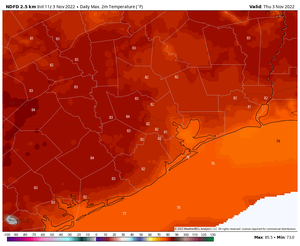
Friday’s high temperatures will not be much fun. (Weather Bell)
Friday, Saturday, and Sunday
These will be three baking hot days, with high temperatures of 100 degrees, or slightly higher, for nearly all of the metro area away from the coast. Skies will be sunny, and rain chances virtually non-existent. A more southwesterly flow, instead of winds directly off the Gulf of Mexico, should help with humidity levels a bit. Even so, there are a number of outdoor activities this weekend, including Pride celebrations in downtown Houston, during the middle of the day. We really urge you to take heat and sunshine precautions during the exceptionally hot weather this weekend.
Next week
We’re not promising any miracles next week, but things should finally change. A front of sorts should push into the region on Monday, helping to open our atmosphere up to a few passing disturbances. By later Monday or Tuesday this should lead to the formation of a few more clouds, and push daily rain chances up to 30 or 40 percent. In addition, high temperatures probably will drop back into the mid-90s, if not even lower. The details on this are still fuzzy, but the end of June will probably, finally, feel like what most of June should have felt like.
Tropics awakening?
Typically, during this time of year, wind shear runs high in a central Atlantic Ocean area called the “main development region” for tropical storms and hurricanes. This is the place where low pressure systems that move off of Africa during the summer can regularly form into tropical storms during the months of August and September. I say August and September, because wind shear is usually hostile to storm formation before then. (This is also why hurricane activity peaks during August and September).
Tropical weather outlook for Thursday morning. (National Hurricane Center)
However, as we’re seeing lower wind shear now in the main development region, it is possible we may start to see these “Cape Verde” storms coming off of Africa and developing earlier this year. To that end, the National Hurricane Center is watching development of a possible tropical wave there five to seven days from now. This is something to watch, but not worry about at this time.