This is our last day with gray, soupy weather before a front clears us out on Wednesday night. But as we’ve been saying, the forthcoming winter interlude will only last a couple of days. Enjoy the sunshine while it lasts!
Wednesday
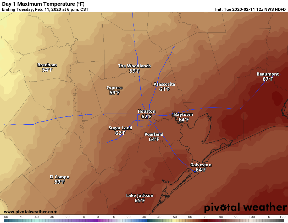
Conditions this morning depend upon where you live, with much warmer conditions in the low 60s right along the coast, where a warm front has pushed back on shore, and lows of around 50 degrees well inland, where the front has not yet reached. Highs today will mostly be in the 60s, with temperatures on the cooler end inland and warmer along the coast. A series of showers—mostly light but possibly with a few heavier thunderstorms—should move through the area this morning and clear by later this afternoon.
For the most part, rainfall totals should be under one-half inch, but we can’t rule out some higher, isolated totals especially north of I-10. A cold front finally pushes through Houston late Wednesday night, dropping lows into the 40s overnight.
Thursday
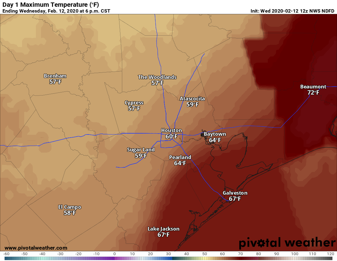
This will be a mostly sunny, cool day with highs likely in the upper 50s. A northerly breeze gusting up to 20 mph will make it feel a bit cooler. Thursday night will be the coldest night of the week, with lows in the mid- to upper-30s possible for inland areas, with temperatures around 40 in the city.