A gradual warm-up for Houston on the way

It’s been a really, really nice start to the week if you like cool and pleasant weather. As we head toward the weekend, we’ll begin to warm things back up, as the weather pattern reverts to more typical spring for Southeast Texas. But for now, the rain chances won’t really follow.

Today

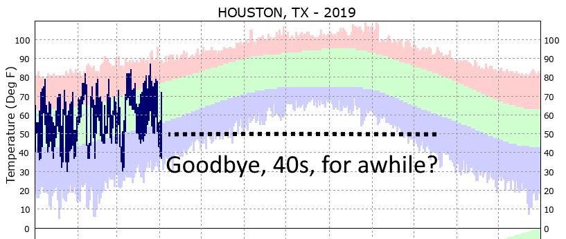
It’s another cool start to the day across the region. We’ve got mostly 40s and some 50s around this morning. We’ll warm things up again this afternoon into the upper 60s or low 70s. We’ll keep it mostly sunny, but I think you’ll notice at least a few higher clouds from time to time today. Wednesday is a bit of a transition day back to onshore flow and typical spring weather.

Tomorrow and Friday

You’ll notice that onshore flow more both visually and by feel on Thursday I think. Some low clouds should build up in spots overnight, especially closer to the coast as humidity begins to tick upward. Thursday morning won’t start nearly as cool as today and will likely be six to ten degrees warmer in spots.

Thursday morning’s temperatures won’t be as chilly as they’ve been much of this week. (Weather Bell)

Thursday afternoon may look a bit murky. Expect clouds and sun, but it will be warm. High temperatures should reach the low to mid 70s. A stray sprinkle or shower is possible also. We’ll be even a bit milder Friday morning, with lows probably in the 60s in most spots. Friday afternoon will again see a good deal of clouds mixed in with some sunshine. There could also be a sprinkle or brief shower, but that would very much be the exception, not the rule. Temperatures will warm up further, reaching the upper 70s to near 80° Friday.

(Space City Weather is sponsored by an anonymous donor this month.)

See full post

Houston’s quiet weather rolls along

Sunday was our coolest day since February 16th. Yesterday was just a little bit milder. Today? Quiet, similar, and not bad at all.

Today and Wednesday

No weather woes the next couple days. We’re starting off quite a bit chilly this morning, with 40s across much of the area and even some 30s north of Conroe.

A chilly start to the morning with lots of 40s in and around Houston. (NWS)


As the day goes on, expect plenty of sunshine and temperatures cresting in the mid or perhaps upper 60s. We’ll have another cool night tonight, but expect Wednesday morning to start about two to four degrees warmer than today. Wednesday looks like another nice day on the whole. We’ll have just a few more clouds than today, but temperatures should try to crack 70 degrees.

(Space City Weather is sponsored by an anonymous donor this month.)

See full post

Super spring break weather

After a chilly, Sunday, we’ll start spring break week for many on a positive note. And spring-like weather should stay with us most of the week.

Today Through Wednesday

There will still be a bit of cloud cover to work through today, but we should see at least breaks of sun, especially this afternoon. It won’t be as cool as Sunday, with temperatures inching their way up to 65 to 70 degrees depending on exactly how much sun we see. Temperatures tonight look a bit chilly, as we should clear skies out. Most areas should see 40s, and some folks may even see some upper 30s. That would be mainly up toward Conroe or in the typically cold spots outside Houston.

Overnight lows tonight into Tuesday morning will be a bit chilly, especially north of the city. (Weather Bell)


Tuesday’s cool start will be brief, and we’ll see temperature push up into the upper 60s to near 70°, with plenty of sunshine on what looks like a near-perfect afternoon. Wednesday shouldn’t be much different. We should have a cool start in the 40s or 50s and a warm finish in the low 70s with sunshine.

(Space City Weather is sponsored by an anonymous donor this month.)

See full post

Friday showers foretell a showery weekend

After a few showers yesterday, we should see a few more around today. An unsettled weather pattern is going to remain in control through Saturday night before some more pleasant weather next week. The details…

Today Through Sunday

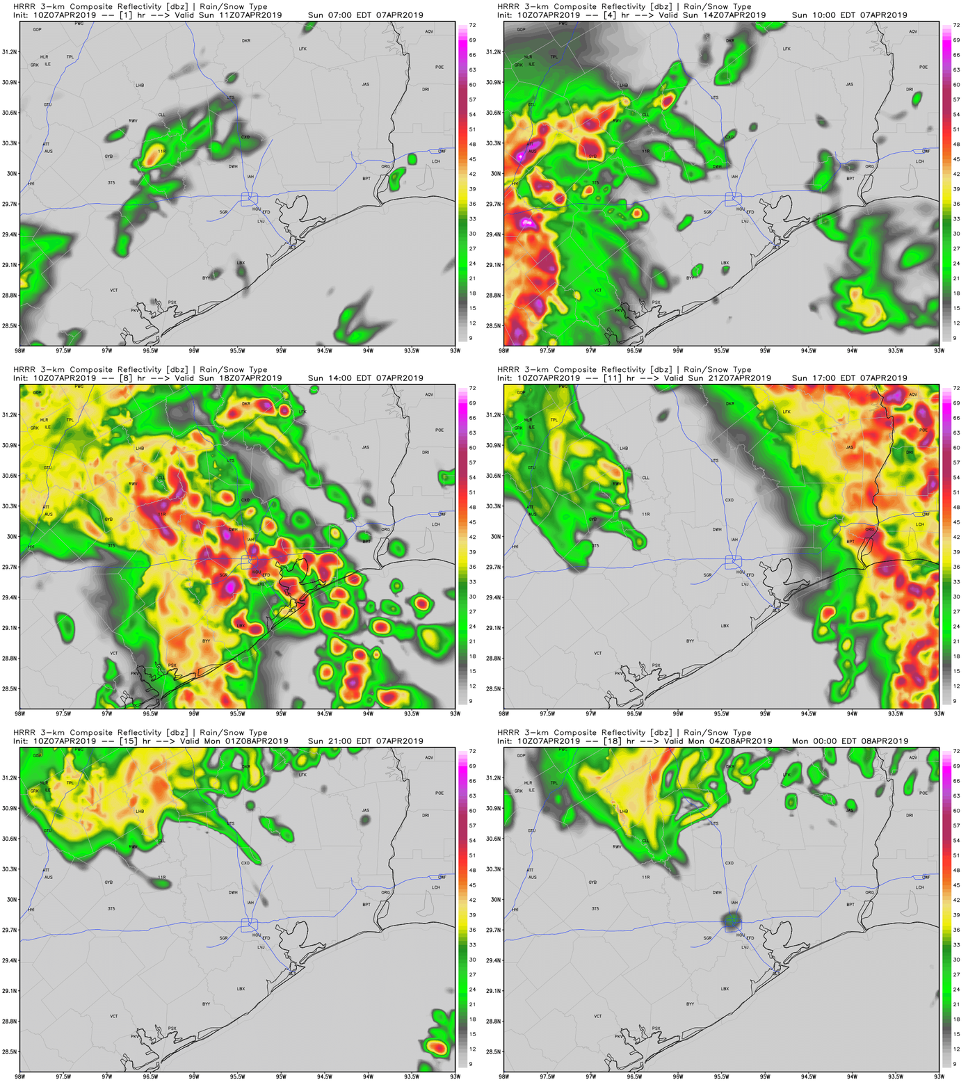
Today will be a bit of a tricky one. There’s going to be a chance of showers anywhere at almost any time today, but exactly how widespread the showers are and where they are will have to be something tackled as the day goes on. A “backdoor” cold front (coming from the northeast) will collide with ample Gulf moisture, some instability, and some upper level energy. The combination will lead to scattered showers and a chance of thunderstorms. The best chances will probably be both northeast and southwest of Houston.

One model solution today shows storms northeast of Houston and scattered showers south of the city. This is a plausible solution. (Weather Bell(


But as you can see, everyone will be at risk for a shower or storm today, so I recommend an umbrella. Severe weather on a widespread scale is unlikely, but there could be a strong storm northeast of the city this afternoon.

Temperatures will be mild, with highs in mid to upper 70s. If you have Friday night plans, the same umbrella advice applies. We should see most activity diminish, but new showers will likely develop in spots. We could also see some steadier rain develop south of Houston toward Saturday morning.

(Space City Weather is sponsored by an anonymous donor this month.)

See full post