Showers and thunderstorms likely from Sunday afternoon through Monday

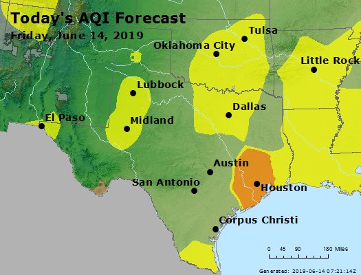
The Houston region appears likely to see an increasingly wet period beginning later this afternoon through at least Tuesday morning as atmospheric moisture levels spike above normal, and the absence of high pressure allows for the formation of showers and thunderstorms. To be clear, we’re not really expecting any significant flooding for most people—at least not beyond some street flooding—just the potential for several rounds of storms. Check the radar later today before embarking on any outdoor plans.

Severe storm outlook for Sunday and Sunday night. (NOAA)

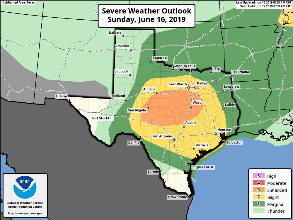
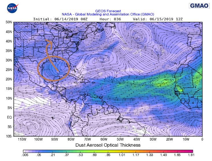
Unfortunately, it is hard to offer too much detail, as there is not great agreement among the high-resolution models about what will take place later today, tonight, and Monday. At a best guess, the potential for heavier rainfall should remain to the west of Harris County, and north of Montgomery County, through the early afternoon hours Sunday, but after that all bets are off.

NOAA forecast for total precipitation for now through Tuesday morning. (Pivotal Weather)

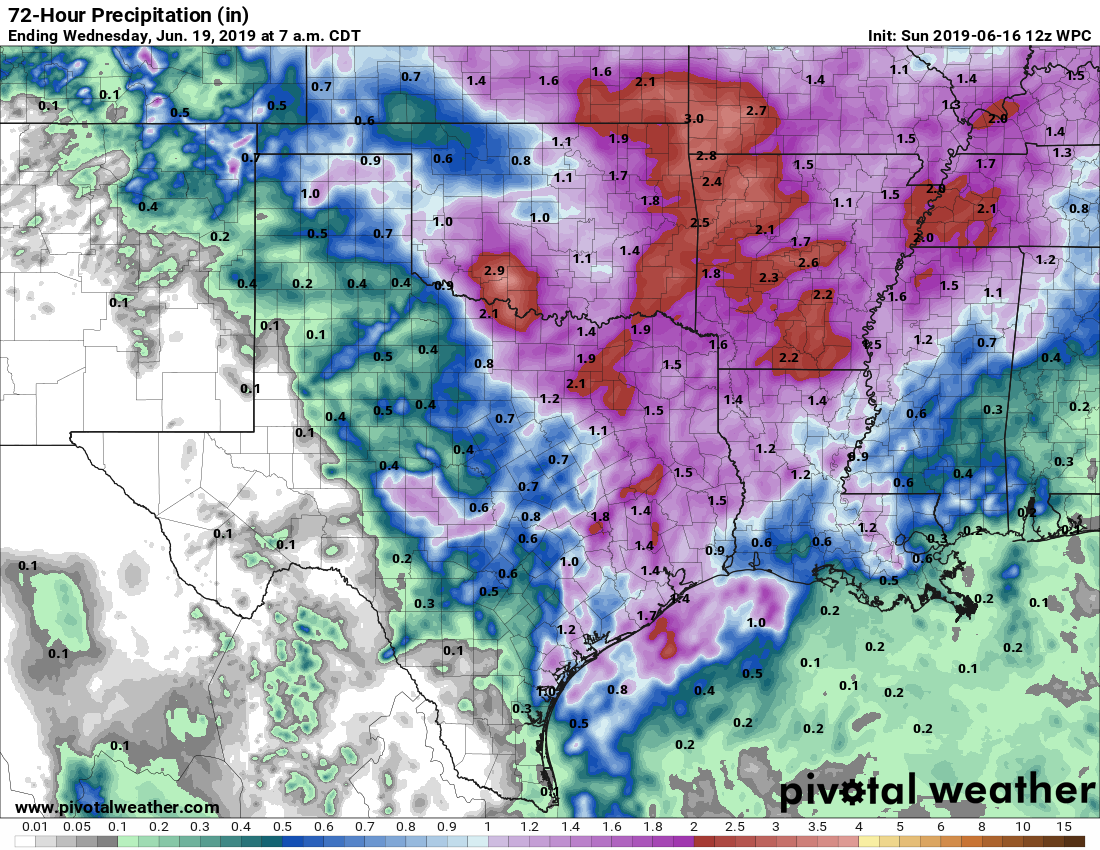
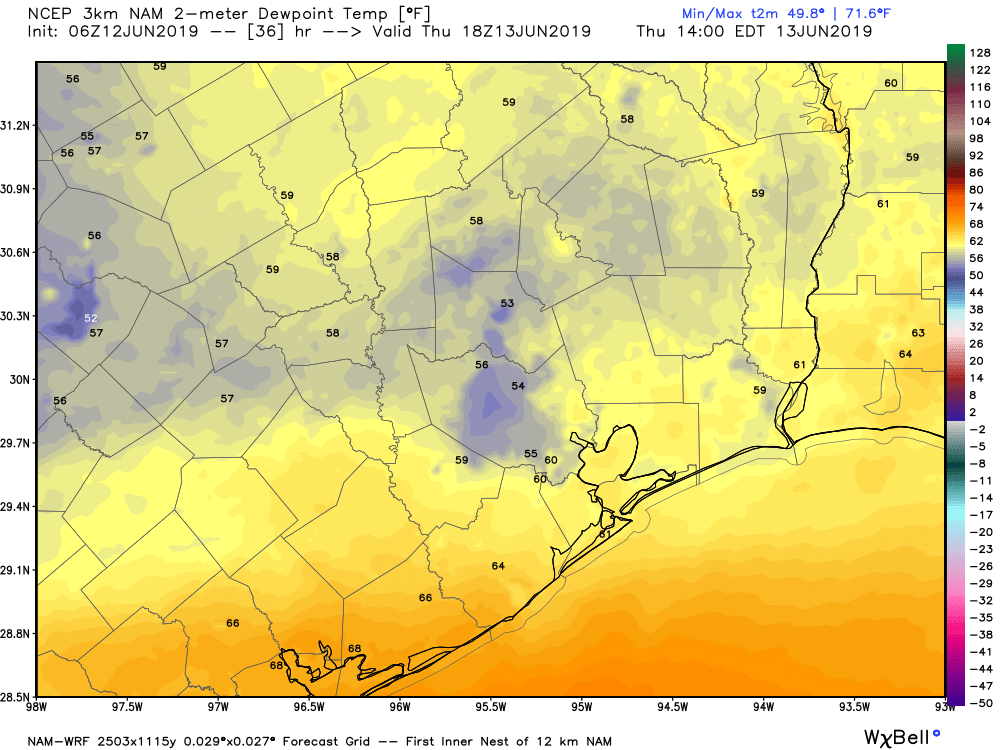
At some point we are likely to see showers and potentially stronger thunderstorms sag into the metro area—moisture levels may peak after midnight tonight for central and coastal areas of Houston—and this will lead to better rain chances. At a best guess, most of the region will see 1 to 2 inches of rainfall through Tuesday morning, but as always there will be the potential for higher isolated totals, and some people are likely to miss out entirely. Most of Houston hasn’t had much, if any measurable rainfall in 11 days so some precipitation will be welcome for most.

We’ll be watching things later today and will update if needed.


High humidity reclaims the throne this weekend

After a week that saw one of the longest June stretches of relatively comfortable humidity in recent memory, we will shift back into the thick of summer today and this weekend.

Today & weekend

Look for sunshine and some clouds today. We’ll top out in the low-90s once again, and humidity, though still relatively low for June, will begin to inch upwards. As of 5 AM, we ended a streak of 71 consecutive hours at Bush Airport with dewpoints of 70° or lower.

We talked a little more about dewpoints earlier this week.

Beginning tomorrow, with the humidity back in force, we can expect clouds, sun, and at least a few showers or a thunderstorm along the sea breeze as it lurches inland in the afternoon. I suspect most of us will be dry Saturday, but you’ll want to have the umbrella nearby to be safe. The morning starts in the mid- to upper-70s, and the afternoon will top out in the low-90s.

Sunday poses a trickier forecast, as the environment looks a bit more favorable for scattered showers and thunderstorms inland. We’ll likely see some activity along the sea breeze again as it moves inland from the Gulf, but we’ll also see a scattering of inland storms, especially north of I-10 and west of I-45. Temperatures will be a little warmer in the morning Sunday, bottoming out in the upper-70s or near 80 degrees. The afternoon should be near 90° where it rains or in the low-90s elsewhere.

Air quality, dust, and wind

I want to briefly focus on some other issues this weekend.

Air quality: Another ozone action day is in effect today, which means air quality is going to be unhealthy for sensitive groups. That said, it should not be quite as high as it was yesterday because winds should be a little stronger today. But those in sensitive groups (particularly elderly, children, or folks with lung or respiratory ailments) should take it easy and try to stay indoors when possible, especially in the afternoon.

Air quality is again forecast to be in the “unhealthy for sensitive groups” criteria int he Houston area due to high ozone levels Friday. (EPA)

Dust: Saharan dust! It’s back! Look for the first real Saharan dust cloud of the season to reach our shores Saturday morning. The dust should dissipate on Monday. This should only be a minor dust event, but it could mean the color of the sky dulls a bit; think more gray than blue, even without clouds. Sunsets and sunrises could be a little bit more interesting looking.

Saharan dust will appear over Houston this weekend, though it should not be a significant event. (NASA)

You may notice more haze than usual or even a little irritation if you have allergies or respiratory ailments. We may get another minor dust event around midweek.

See full post

One more mostly nice day before typical summer returns to Houston

Dry air poured back into Southeast Texas yesterday, and despite high temperatures near 90 degrees, it really didn’t feel bad at all. In fact, dewpoints dropped into the 50s officially at IAH Airport for the first time in June since 2017. We’ve got one more day of this nice stuff today before we return to more standard summer.

Today

Sunshine dominates once again. With dry air in control, we should again see humidity drop to near “comfortable” levels for many parts of the area. Look for high temperatures to pop back to 90 or better for most, however.

Air quality today will be a little better than yesterday, but still unhealthy for sensitive groups due to ozone. (EPA)

Winds will again be on the light side, so expect air quality to be fairly stagnant once again. While not as bad as Wednesday, today will again be an ozone action day, with poor air quality this afternoon. If you’re in a sensitive group or struggle on bad air quality days, take it easy and try to stay indoors later today. If you’re ever curious about the air quality outlook, the Texas Commission on Environmental Quality publishes 4-day forecasts each day. You can bookmark that link here.

Friday

Look for another sunny day tomorrow. The difference will be in the humidity. Dewpoints are expected to slowly rise late tonight and most of the day Friday, and they should end up back around 70, or uncomfortable, by Friday evening. Expect us to start the day pleasant (mid-60s) and finish hot (low-90s). Air quality will improve a bit as onshore winds kick up during the day.

See full post

Hot, but not too humid the rest of this week in Houston

Disappointingly, IAH Airport officially failed to get dewpoints to drop into the 50s yesterday, though Hobby, Ellington Field, Hooks Airport, and Conroe, among others all did for a few hours. Regardless, it was not a bad Tuesday for the middle third of June in Southeast Texas.

Today

We’ll have another shot at fairly comfortable weather today. Showers this morning are pushing offshore of Galveston and Freeport, and the bulk of today should be dry for most of us. An additional pop-up shower is possible near the coast this afternoon. Otherwise, it should be mainly sunny. After failing to hit 90 yesterday, we should be able to manage about that hot today.

Thursday & Friday

Dry air will be reinforced tonight, keeping the offshore winds going for one more day. Mostly sunny skies will greet us Thursday. We have another chance at seeing dewpoints plunge back into the 50s in parts of the area Thursday afternoon. This front will not reinforce any remaining cool air, however. We should easily push past 90 degrees Thursday afternoon, though with the low humidity, it won’t feel much worse than that.

This forecast of NAM model dewpoints around 1 PM Thursday suggests that drier than usual air for June is going to be reinforced for one final day tomorrow. (Weather Bell)

Friday will be our transition day back to summer. Look for the day to start in the lower 70s, and we’ll again reach for the low-90s in the afternoon with sunshine. Humidity will slowly climb on Friday afternoon, and dewpoints should cross back above 70 at some point later in the day, or back into “uncomfortable” territory.

See full post