We’ve discussed the wet start to the month of July in Houston, and this has had the dual effect of keeping our lawns green as well as holding temperatures down a degree or so below normal for most of the area. Most evidence suggests the second half of the month will be considerably warmer and drier, so let’s enjoy the rain chances while they last.
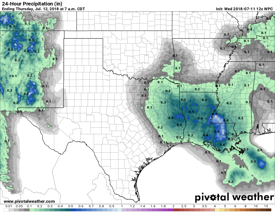
Thursday
With high pressure kept at bay, and moisture levels pretty high, the region will probably see more widespread showers and thunderstorms today than we saw Wednesday. Probably about half of Houston will see rain, with accumulations of a few tenths of an inch. Partly to mostly cloudy skies this afternoon should limit high temperatures in the low 90s.
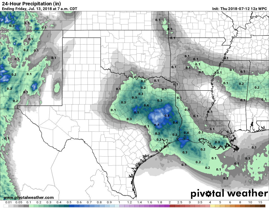
Friday and Saturday
These two days have the potential for more showers, but rain chances are probably only about 30 percent each day, as conditions won’t be quite as favorable for rain. As a result I think we can expect partly sunny skies, with highs in the low- to possibly mid-90s, and a few showers popping up during the day. Any rain is likely to be brief.