Good morning, and happy Father’s Day to those celebrating today. For the most part, the forecast is on track as we’ve been describing it for several days now, but there are a couple things to keep tabs on. And if your travels will take you well south of the area, more toward Corpus Christi, you’ll want to keep a closer eye on the weather. Let’s jump in.
Quick Summary
Here are a few bullet points with the main takeaways that we want to convey today.
- Scattered storms will develop today for much of the area with locally heavy downpours. Probably not a total washout, but you’ll dodge raindrops.
- Heavier rains likely tonight and Monday, particularly southeast of downtown Houston. Areas of street flooding will be possible in heavier downpours.
- Heaviest rain chances should move off to our southwest for midweek, but rain chances stay elevated in and around Houston.
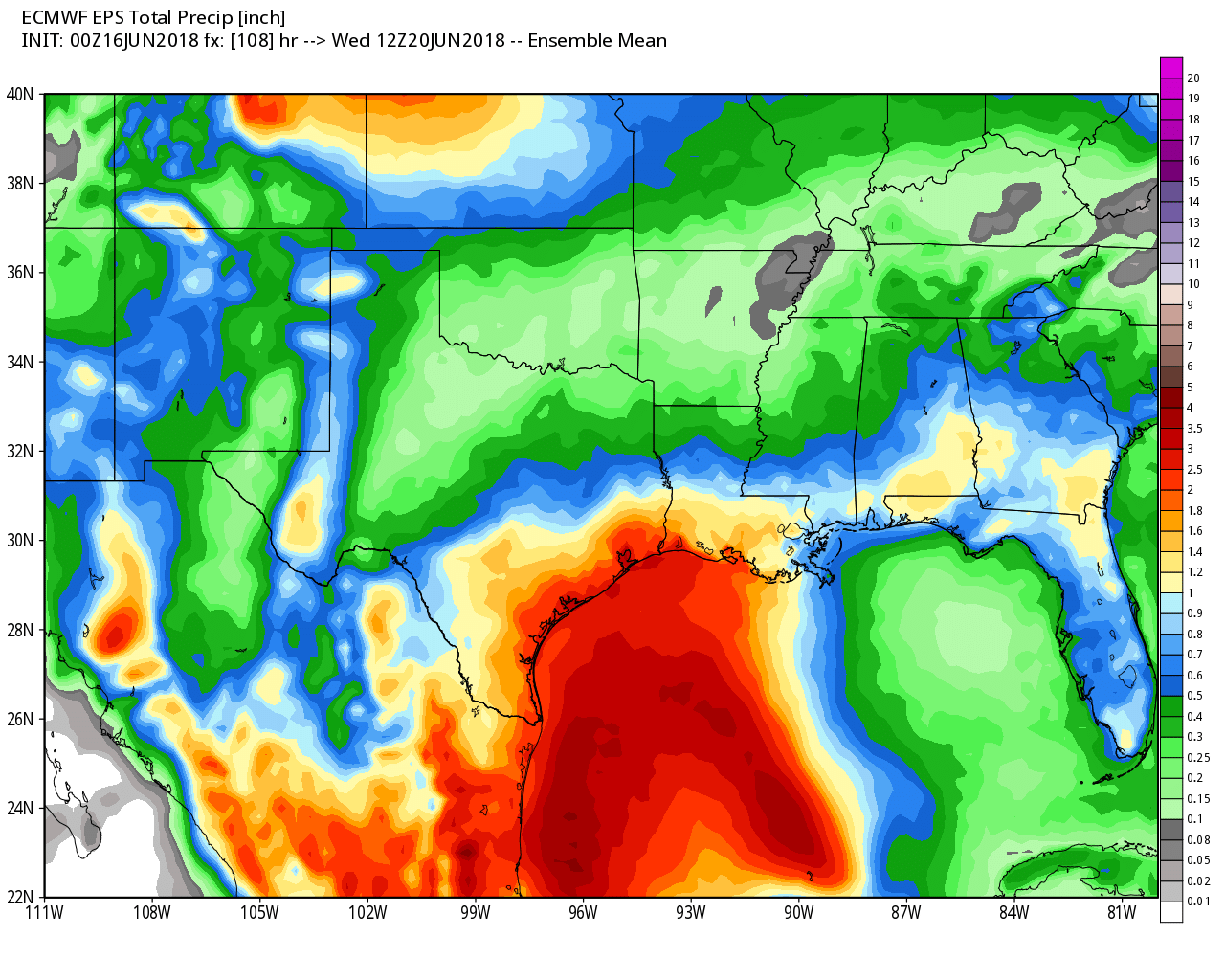
- Total rainfall of two to four or five inches will be the average across the entire area through midweek. There will be smaller, isolated pockets that see higher amounts upwards of seven, eight, or nine inches, most likely closer to the Bay Area or Galveston.
Now
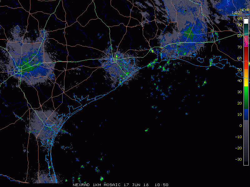
As of about 8-8:30 AM Sunday, the Houston area is all quiet. We have a few isolated showers, mainly south and east of downtown Houston. And for much of this morning, we’ll be fine with just a couple downpours.
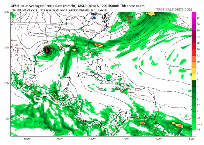
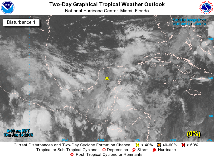
Meanwhile, looking at a bigger picture view of things, satellite this morning shows our disorganized disturbance in the Gulf of Mexico now. Heavier thunderstorms are occurring well offshore. This is what we’re watching for tonight and Monday.
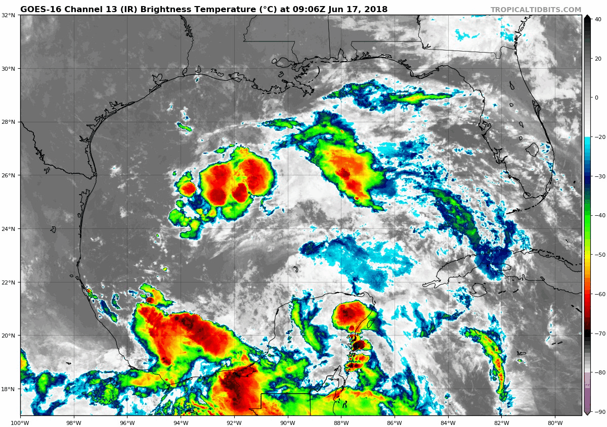
In terms of tropical development, the National Hurricane Center continues to carry a token 20% chance over the next 48+ hours. That’s a fair assessment, and we feel that impacts to our area will be similar regardless of if this thing meets technical definitions or not within the next couple days.
Rest of Sunday
So what can we expect for the rest of today? Well, as this disturbance creeps toward Texas, expect numerous showers and thunderstorms to pop up late this morning and afternoon across most of the area. I’m not going to classify Father’s Day afternoon as a complete washout, but you will likely be dodging raindrops at least once, if not a few times this afternoon. So if you are planning anything outdoors, have a backup plan. Most of the area will see a couple tenths to maybe a half inch of rainfall. Some will see less, and some may see in excess of one or two inches where rains are most persistent. Today’s rainfall will be a nuisance more than anything for most folks.